SeaVectors Marine Navigation
Marine navigation with offline NOAA ENC charts, tides, weather & routes planning
About SeaVectors Marine Navigation
SeaVectors – Marine Navigation with ENC Charts
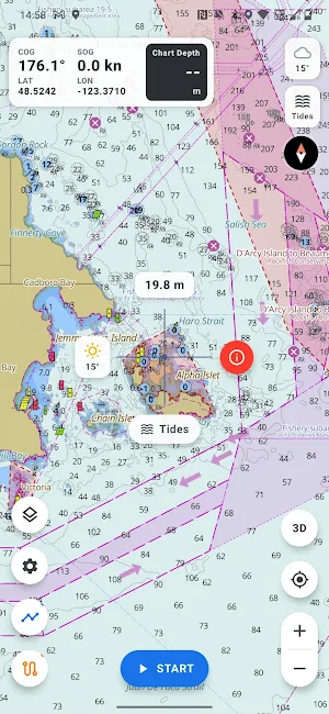
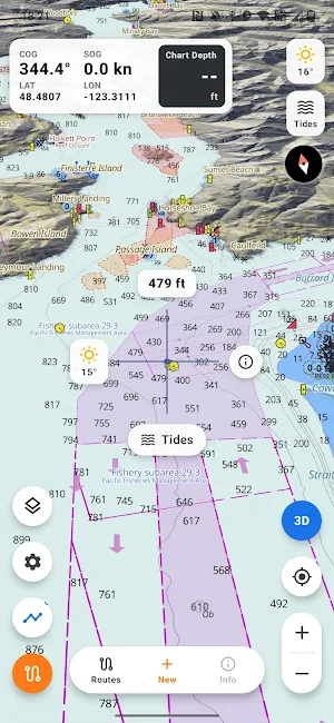
SeaVectors is a marine navigation app for boaters, anglers, and coastal explorers. View NOAA ENC chart coverage across the United States, with additional detailed chart coverage for the Canada West Coast and South China Sea. Combine charts, tides, weather, routes, tracks, and regulatory overlays in one clear navigation workspace.
Official ENC Chart Coverage
Access NOAA Electronic Navigational Chart data across the United States, plus detailed vector chart coverage for supported international regions. SeaVectors presents depth areas, soundings, hazards, aids to navigation, restricted zones, anchorage areas, and other key marine features in a clean, readable chart interface.
Offline Charts
Download chart areas for offline use before leaving coverage. SeaVectors can also cache chart data as you browse, helping keep recently viewed areas available when connectivity is limited. Use the Chart Download Manager to prepare larger regions in advance and manage onboard storage.
Fishing Restricted Areas
On the Canada West Coast, SeaVectors displays DFO regulatory areas directly on the chart, including Rockfish Conservation Areas, reef closures, marine refuges, and strict protection zones where available.
View restricted areas on the map, receive on-screen awareness alerts, and open official source information for more detail. Always review current government regulations before fishing or harvesting.
Tides
View tide predictions from government hydrographic and oceanographic sources. SeaVectors selects a relevant tide station for your area and presents up to 30 days of tide forecasts in a clear visual format.
Weather and Wind
Check marine weather, wind speed, wind direction, waves, currents, and related conditions from supported government and public data providers. Weather layers are designed for quick reading alongside your chart.
Routes
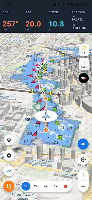
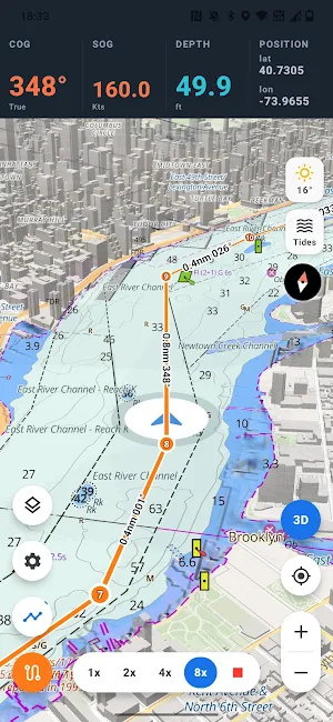
Plan routes, estimate distance and travel time, and review route details before getting underway.
Track Recording
Record your vessel track, speed, and heading for voyage logs, trip review, or later reference.
Markers and Saved Places
Drop custom markers for fishing spots, hazards, anchorages, marinas, or points of interest. Save labels and notes for future trips.
Search
Find places, chart areas, saved routes, tracks, and markers quickly with built-in search.
Secure Account Sync
Sign in with email to sync supported user data across devices.
SeaVectors is designed to support marine planning and situational awareness. It should be used together with official navigation sources, current local regulations, and responsible on-water judgment.
Legal
Terms of Service
https://seavectorsapp.com/terms/
Privacy Policy
https://seavectorsapp.com/privacy/
Similar Apps

Compass & Altimeter
A Compass, with geographic north, true altitude, address, sunset & sunrise times
Guru Maps Pro & GPS Tracker
Get a map before your next journey and navigate with confidence even offline.
Trails Offroad: Offline Maps
Offroad and overland trail guides for offline use.

Pin Traveler: Travel Tracker
Track visited states & countries you've been to, pin places on your trip map

OneSoil Scouting: Farming Tool
Monitor fields and crop growth. Identify problem areas and add notes
Aqua Map Boating
US Charts from NOAA, ACoE Surveys, Marine Forecasts, Anchor Alarm and more...

