
Live 3D Earth Map Viewer
Maps & Navigation Contains ads
Explore cities and terrain in 3D with satellite maps and street view
- Rating
- 1.8
- 268 ratings
- Downloads
- 778K+
- on Google Play
- Price
- Free
- No in-app purchases
- Updated
- Aug 24
- 2026 · v0.0.6.260506
Screenshots


About Live 3D Earth Map Viewer
Live 3D Earth Map Viewer — Explore the planet in 3D, satellite, and street-level views. 🌍🛰️🗺️
Travel planning, route checking, or pure curiosity—Live 3D Earth Map Viewer helps you explore cities, countries, landmarks, and terrain with a mix of 3D earth maps, satellite view, 360° street view, GPS navigation, and smart place search in one app.
Explore terrain & cities in a more realistic view
Get a clearer sense of how places are shaped and connected.
Browse city areas and terrain with interactive map controls
Rotate and zoom to see mountains, rivers, buildings, and streets
Great for previewing destinations before a trip or exploring new areas virtually
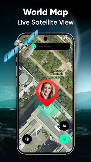
Satellite view for global discovery
Switch perspectives and see locations from above.
View places worldwide in satellite map mode
Helpful for understanding coastlines, landscapes, and city layouts
Satellite imagery availability and detail can vary by region and data provider
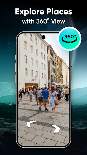
Street View with 360° panorama
Explore real-world streets virtually with full panorama controls.
Walk through neighborhoods, tourist spots, and urban areas
Use 360° camera movement to look around naturally
Useful for trip preparation, scouting landmarks, or revisiting places anytime
GPS navigation & route finder
Navigate with confidence using GPS tools designed for daily use.
Locate your current position with GPS
Get turn-by-turn directions to your destination
Reduce wrong turns and delays with practical route guidance
Route quality and traffic layers depend on supported areas and network/data availability
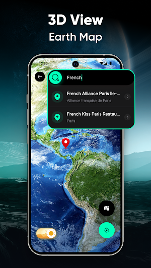
Smart search for places & landmarks
Find what you need fast—near you or across the world.
Search for:
Restaurants, airports, hotels, ATMs
Famous attractions and notable landmarks
Use quick search to save time while traveling or exploring
Clean, fast, and intuitive design
Everything is organized to keep your experience simple.
Easy access to key tools like earth view, satellite view, compass direction, and map options
A modern interface built for smooth exploration and navigation without clutter
Extra tools included
🌍 GPS Earth View & World Map Explorer
🛰️ Satellite view tools
🧭 Compass, speedometer, and altitude display
🗺️ GPS route planner & traffic view (where available)
📍 Real-time location sharing (only when you choose)
How people use it
Plan routes and check surroundings before heading out
Explore landmarks and streets virtually
Learn geography through maps, terrain, and street panoramas
Find nearby essentials while traveling
Important notes (Google Play policy-friendly)
Map, satellite, and street imagery are provided by third-party sources; they may not reflect current real-world conditions and can vary by area.
GPS accuracy depends on device settings, environment, and signal.
Location sharing works only with your permission and actions—please use responsibly and respect privacy and local laws.
Start exploring with Live 3D Earth Map Viewer and see the world from every angle—3D earth, satellite perspective, and street-level panoramas in your pocket.
Alternatives to Live 3D Earth Map Viewer
Looking for apps like Live 3D Earth Map Viewer? Here are 6 similar Android apps on Google Play. The highest rated is Gaggle Paragliding, Ultralight (4.6/5), and 3 of the 6 are free to download.
-
Earth Map App - Live Cam View
-
Guru Maps Pro & GPS Tracker 4.5
-
Gaggle Paragliding, Ultralight 4.6
-
Earth 3D Map-StreetView Camera 4.3
-
Live Weather Forecast : VR 4.6
-
Weenect - GPS 4.5
| App | Rating | Price | Installs | Last updated | Compare |
|---|---|---|---|---|---|
| Live 3D Earth Map Viewer | 1.8 / 5 | Free | 500,000+ | Aug 24, 2026 | |
| Earth Map App - Live Cam View | – | – | 10,000+ | Aug 28, 2026 | Compare |
| Guru Maps Pro & GPS Tracker | 4.5 / 5 | 89.99 USD | 50,000+ | Sep 30, 2026 | Compare |
| Gaggle Paragliding, Ultralight | 4.6 / 5 | Free | 50,000+ | Sep 28, 2026 | Compare |
| Earth 3D Map-StreetView Camera | 4.3 / 5 | Free | 10,000,000+ | – | Compare |
| Live Weather Forecast : VR | 4.6 / 5 | 9.99 USD | 100+ | May 30, 2026 | Compare |
| Weenect - GPS | 4.4 / 5 | Free | 100,000+ | – | Compare |
Similar apps on Google Play
- Earth Map App - Live Cam View
- Guru Maps Pro & GPS Tracker
- Gaggle Paragliding, Ultralight
- Earth 3D Map-StreetView Camera
- Live Weather Forecast : VR
- Weenect - GPS
- My Location - Track GPS & Maps
- AlpineQuest Explorer Lite
- Zoom Earth - Weather Forecast
- GPS Map Camera
- swisstopo
- Mergin Maps: QGIS in pocket
- Gaia GPS: Offline Trail Maps
- Orca: Boat GPS, Charts, Routes
- GPS Photo: With Location & Map
- Save Location GPS
- OsmAnd — Maps & GPS Offline
- Tetra Browser & VPN
- Rainbow Weather: Storm Radar
- Live Earth Map - World Map 3D
- Be Closer: Family location
- Avenza Maps: Offline Mapping
- Photo Background Changer App
- PeakVisor - 3D Maps & Peaks ID
- Magic Earth Navigation & Maps
- Travel Journey Video Animation
- Ventusky: Weather Maps & Radar
- Multi-Stop Route Planner
- Weather Live
- Riser: Motorcycle App & GPS
- Pin Traveler: Travel Tracker
- Voice GPS & Driving Direction
- Weather & Clima - Weather Sky
- calimoto — Motorcycle GPS
- 3D Fish Live Wallpapers 4k HD
- Sunset & Sunrise
- Ruuvi Station
- HERE WeGo: Maps & Navigation
- Geo Tracker - GPS tracker
- Trails Offroad: Offline Maps
- Famio: Connect With Family
- MAPS.ME: Offline maps GPS Nav
- Optibus Driver
- Seably
- FarOut
- iTranslate Translator
- TapSlide
- Compass & Altimeter
- Image to Video AI - NeoScene
- ShipAtlas - Vessel Tracker
- Foreca Weather & Radar
- National World News
- Mapway: Maps & Transit Planner
- Karta Offline GPS Maps Nav
- Navionics® Boating
- Envision
- Local Weather: Live Forecast
- Familo: Find My Phone Locator
- My Track
- Sygic GPS Navigation & Maps
- Local Weather Forecast& Widget
- AlfredCamera Home Security app
- LiveMic: Bluetooth Mic Speaker
- Weather App - Weather Forecast
- TravelAnimator・Journey Route
- Nautide: Tides, Wind, Waves +
- Offline Map Navigation
- 3D Photo: Imager
- PeakFinder
- TomTom - Maps & Traffic
- Identify: Ai Plant Identifier
- Real Weather
- myENV
- Clime: NOAA Weather Radar Live
- Weather XL PRO
- Viidure-Dashcam Viewer
- VUZ: Live 360 VR Videos
- Ferryhopper - The Ferries App
- VicoHome: Smart Home Camera
- Google Earth
- Google Maps Go
- Lookout - Assisted vision
- Google Maps