

Muganhu: Land Boundary
Tools
Pair two phones to measure field boundaries with raw GNSS and closure.
- Price
- Free
- No in-app purchases
- Updated
- Sep 11
- 2026 · v1.0.0
Screenshots


About Muganhu: Land Boundary
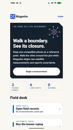
Muganhu is a paired-phone field instrument for measuring a land boundary.
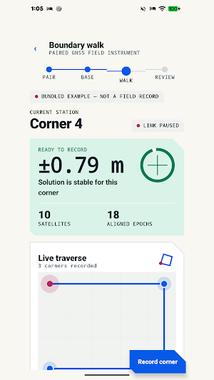
Place one compatible Android phone on a stable reference point. Use the second phone to walk to each corner. Muganhu links the phones over the same local Wi-Fi or hotspot, aligns their raw satellite measurements, and builds a relative traverse as each corner settles.
The app keeps measurement quality visible throughout the work:
- live uncertainty before a corner can be recorded
- satellite sky view and signal quality
- aligned and rejected epoch counts
- pseudorange or float-carrier observation path
- residual error and link timing risk
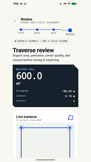
- traverse closure before saving
Review the finished plot with its area, perimeter, interior angles, corner uncertainty, and closure. Area can be read in square metres, hectares, acres, decimals, Bangladesh katha, or Bangladesh bigha. Regional land units vary, so the selected profile is named clearly.
Field records stay on the device until you delete them. Export a record as PDF for reading, CSV for a table, or JSON for a complete machine-readable copy. A SHA-256 epoch chain adds an integrity digest to the record.
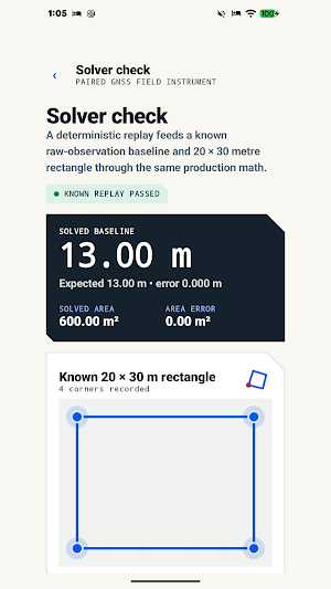
A bundled solver check runs a known 13 metre baseline and 20 × 30 metre rectangle through the same computation path. It is labelled as example data and does not replace a real outdoor device test.
Muganhu needs two Android 7 or newer phones that expose Android raw GNSS measurements. Both phones must be on the same local Wi-Fi network or hotspot. Satellite quality and phone antennas vary.
Muganhu provides practical field evidence. It is not a cadastral survey and does not decide a legal boundary.
Place one compatible Android phone on a stable reference point. Use the second phone to walk to each corner. Muganhu links the phones over the same local Wi-Fi or hotspot, aligns their raw satellite measurements, and builds a relative traverse as each corner settles.
The app keeps measurement quality visible throughout the work:
- live uncertainty before a corner can be recorded
- satellite sky view and signal quality
- aligned and rejected epoch counts
- pseudorange or float-carrier observation path
- residual error and link timing risk
- traverse closure before saving
Review the finished plot with its area, perimeter, interior angles, corner uncertainty, and closure. Area can be read in square metres, hectares, acres, decimals, Bangladesh katha, or Bangladesh bigha. Regional land units vary, so the selected profile is named clearly.
Field records stay on the device until you delete them. Export a record as PDF for reading, CSV for a table, or JSON for a complete machine-readable copy. A SHA-256 epoch chain adds an integrity digest to the record.
A bundled solver check runs a known 13 metre baseline and 20 × 30 metre rectangle through the same computation path. It is labelled as example data and does not replace a real outdoor device test.
Muganhu needs two Android 7 or newer phones that expose Android raw GNSS measurements. Both phones must be on the same local Wi-Fi network or hotspot. Satellite quality and phone antennas vary.
Muganhu provides practical field evidence. It is not a cadastral survey and does not decide a legal boundary.
What’s new
Version 1.0.0 · Updated September 11, 2026
Measure a boundary with a paired raw-GNSS base and rover, review uncertainty and closure, save local records, and export PDF, CSV, or JSON evidence.
Alternatives to Muganhu: Land Boundary
Looking for apps like Muganhu: Land Boundary? Here are 6 similar Android apps on Google Play. All of them are free to download.
-
RawiLoom: Hadith Study
-
Pwyso: Livestock Weight
-
Punutis: Herd Kinship
-
Punctra: Transit Reliability
-
Opashka: Queue Wait Times
-
Muyara: Live Class Sessions
| App | Rating | Price | Installs | Last updated | Compare |
|---|---|---|---|---|---|
| Muganhu: Land Boundary | – | Free | 0+ | Sep 11, 2026 | |
| RawiLoom: Hadith Study | – | Free | 1+ | Sep 12, 2026 | Compare |
| Pwyso: Livestock Weight | – | Free | 5+ | Sep 12, 2026 | Compare |
| Punutis: Herd Kinship | – | Free | 1+ | Sep 12, 2026 | Compare |
| Punctra: Transit Reliability | – | Free | 0+ | Sep 11, 2026 | Compare |
| Opashka: Queue Wait Times | – | Free | 0+ | Sep 11, 2026 | Compare |
| Muyara: Live Class Sessions | – | Free | 0+ | – | Compare |