Msewu: Local Bus Route Map
Find rider-mapped minibus routes, stops, fares and travel ranges, even offline.
About Msewu: Local Bus Route Map
Msewu helps you find local bus and minibus routes that have no published map or timetable. Its network is built from journeys contributed by the people who already ride those roads.
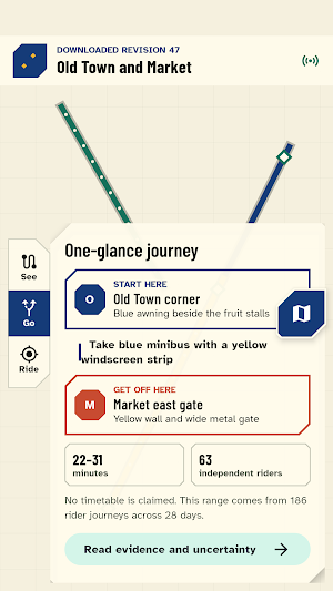
Download a region, choose where you are going, and get a one-glance route answer: the corner to stand at, landmark clues for the vehicle or stop, where to change, where to get off, and a realistic travel-time range. Downloaded maps and journey planning continue to work when your connection does not.
Rider-made route maps:
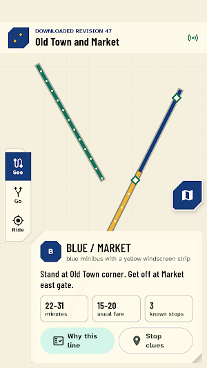
• See routes inferred from many overlapping rider journeys
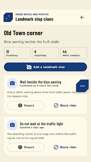
• Recognise stops through landmark notes and photographs
• Compare fare and travel-time ranges instead of false exact promises
• Identify short-turn, branch and seasonal route variants
• Read evidence age and contribution counts for every route
• Distinguish solid, dashed and dotted lines without relying on colour alone
Two-tap contributions:
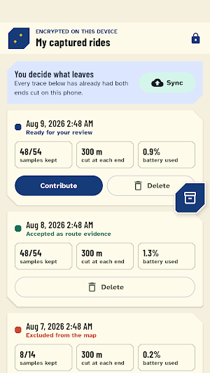
• Tap when you board and tap again when you leave
• Capture keeps working through brief signal loss and marks inferred gaps
• Review or delete every captured journey before it is queued
• The first and last 300 metres are removed on the phone before upload
• Journey uploads carry a one-use blind-signed token, not an account or device identifier
• Routes require independent evidence from several contributors and days
Honest planning:
Msewu does not invent a timetable. It plans across walking, routes and transfers using the evidence that exists, then tells you when a line has few journeys or has not been seen recently. Implausible or replayed traces are excluded rather than silently shaping the map.
Landmark clues are community posts. Every post can be reported, contributors can be blocked on your device, and child-safety rules are available inside the app. Notes and photos go through safety checks and reported content is hidden pending review.
Msewu is made for informal transport such as minibuses, matatus, jeepneys, share autos, tempos and chapas. It is not an official transport authority, ticketing service, live vehicle tracker or ride-hailing app. Route coverage grows only where independent riders contribute enough recent journey evidence.
