
About PeakPing
PeakPing - Real-Time GPS Elevation for Android
Know exactly how high you are. PeakPing gives you precise, real-time GPS elevation data directly from your device's GPS hardware. No internet required, no accounts, no ads.
Whether you're hiking a mountain trail, cycling through the hills, or simply curious about your altitude, PeakPing delivers accurate readings you can trust.
WHAT PEAKPING SHOWS YOU
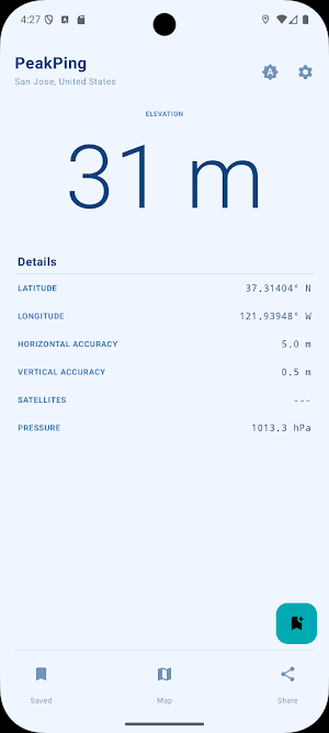
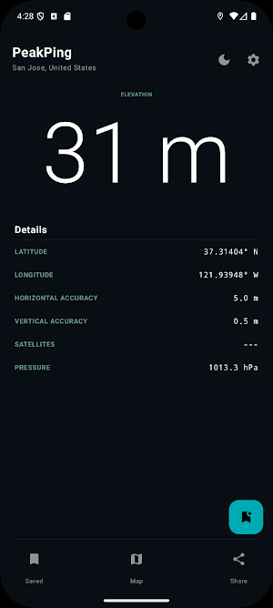
• Elevation above sea level, updated every second (adjustable in the settings)
• Horizontal and vertical GPS accuracy
• Number of GPS satellites currently in use
• Atmospheric pressure (on devices with a barometer)
• Your current city and country, looked up automatically when online
ACCURATE ALTITUDE, EVEN BETWEEN GPS FIXES
PeakPing uses your device's barometer (if available) to provide smooth, continuous altitude readings between GPS updates. The barometer is automatically calibrated against each GPS fix for maximum accuracy.
FLOATING ELEVATION WINDOW
Keep your altitude in view no matter what app you're using. Enable the floating window from Settings and a small, draggable overlay shows your current elevation on top of any screen. Perfect for checking your altitude mid-hike without switching apps. A persistent notification lets you close it with one tap.
SAVE YOUR LOCATIONS
Found a spot worth remembering? Tap the quick-save button to instantly pin your current location with its coordinates, elevation, and place name. You can rename any saved pin to something meaningful, and if you accidentally delete one, a brief undo option lets you bring it back. Back up your saved locations by exporting them to a JSON file, and restore or merge them on any device with the import option. Your saved locations are stored locally on your device and can be deleted at any time.
BUILT FOR PRIVACY
PeakPing does not collect, transmit, or share any personal data. No analytics. No crash reporting. No advertising networks. Everything stays on your device.
OPEN SOURCE
PeakPing is free and open source, licensed under GPLv3. You can inspect the source code, contribute, or build
REQUIREMENTS
• Android 13 or higher
• GPS hardware required
• Barometer optional, used automatically if your device has one
• "Draw over other apps" permission required only if you enable the floating elevation window
Similar Apps

HiiKER: The Offline Hiking app
Offline hiking trails. Plan, track & share custom hiking routes using topo maps

PeakVisor - 3D Maps & Peaks ID
What's the name and the altitude of that mountain? Find out with PeakVisor!

Oddysee: AI Map & Trip Planner
Save places, plan trips & discover spots — your AI travel map, with friends

AeroGuest
Everything you need for your stay in one place.

SPYPOINT
Manage your SPYPOINT cellular trail cameras and receive photos and videos.

Aqua Map Boating
US Charts from NOAA, ACoE Surveys, Marine Forecasts, Anchor Alarm and more...
