Oilfield Route - Offline GPS
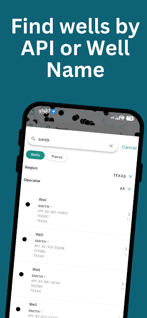
Well search by API and offline navigation to any wellsite or lease road.
About Oilfield Route - Offline GPS
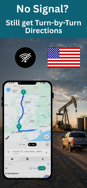
Oilfield Route is a well search and offline GPS navigation app for oil and gas crews working in 17 US states. Find the well, pick a route for your truck, and drive it - with no cell signal at all.
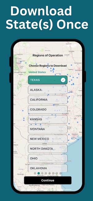
Wellsite routes calculate on your phone, not on a server. Download your state once, and after that Oilfield Route searches wells, calculates a brand-new route, reroutes after a missed turn, and gives you full turn-by-turn navigation with the phone in airplane mode. You do not have to preload one exact route
before you leave coverage.
What Pro adds
Pro is built for crews working past the edge of cell coverage. Includes everything in Essential plus:
• Downloadable offline maps and well data state by state
• Offline route calculation and rerouting
• Offline turn-by-turn navigation
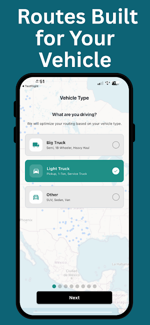
• Vehicle-optimized routing for car, light truck and heavy truck
• Multi-stop route planning with the stop order optimized
What Essential covers
Essential handles the day-to-day field work where coverage holds.
• Well search by API number, lease or well name
• Operator, depth, drill date, well status and more well details
• Wells, permits map layers
• Street, satellite and hybrid map views
• Saved wells and organized groups
• Location sharing with your crew
• Online turn-by-turn navigation
Built for oilfield work
Oilfield Route is built for pumpers, operators, inspectors, service crews and drivers who need to reach a wellsite and get home again, from the Permian to the Bakken. Enter an API number or a lease name, and the GPS takes you to the wellsite or pad coordinates rather than a street address. Routing
follows highways, county roads and oilfield access roads.
Coverage
Alaska, California, Colorado, Illinois, Kansas, Louisiana, Mississippi, Montana, New Mexico, North Dakota, Ohio, Oklahoma, Pennsylvania, Texas, Utah, West Virginia and Wyoming. Plays inside that footprint include the Permian Basin, the Bakken, the Eagle Ford, the Anadarko Basin, the Haynesville, the DJ Basin and the Marcellus. Crews who work both sides of the border also get Alberta, British Columbia, Saskatchewan and Manitoba.
No ads and no distractions.
A subscription is required for mapping, well search and navigation, and it includes a 7-day free trial.
Offline maps and well data come from licensed mapping and data services, which is why Oilfield Route runs on a subscription.
Oilfield Route assists navigation. It does not replace field judgment. Always confirm site access, road conditions and safety requirements on the ground.
Built by GeoActivity, 15+ years in oil and gas software.
Terms of Use: https://oilfieldroute.com/terms.html
Privacy Policy: https://oilfieldroute.com/privacy.html
Similar Apps
Footpath Route Planner
Running, Hiking, Bike Map - Draw routes with your finger and navigate with GPS

ConstructionOnline
The complete power of ConstructionOnline, with you wherever you go.

Speediance - Home Workout
Smart home gym

Trails Offroad: Offline Maps
Offroad and overland trail guides for offline use.

Halter
Halter enables ranchers to shift, manage and monitor their herd remotely.
Hikingbook: Hike, Bike & Run
Plan, track and share your trail adventures with Hikingbook.
