

Tide Now CA, California Tides, Sun and Moon Times
Lawrence Freytag Tools
A tide calculator for California. Simple. No internet use. No ads. Free.
- Rating
- 4.7
- 84 ratings
- Downloads
- 5K+
- on Google Play
- Price
- Free
- No in-app purchases
- Updated
- Jun 25
- 2019 · v8
Screenshots

About Tide Now CA, California Tides, Sun and Moon Times
Please see http://tide-now.lfreytag.com for update on darkened drop down menu
and usage tips.
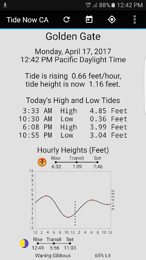
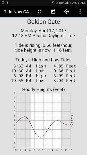
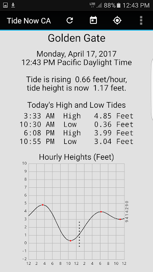
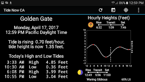
Tide Now CA is a tide calculator for the state of California. It displays a tide graph, daily tide table, present tide status, and daylight/sun/moon timing. It supports 146 locations in organized into 14 regions.
Fast, Off Line Operation- app works by calculation. Use swipe gestures for the next and prior day tides. There are no ads and app cannot access phone features.
User Options
Controls are provided by three action bar icons and five items in the settings menu. The action bar controls are Set Location, Set Date, and Refresh. The settings controls are Add Station to Favorites, GMap Station (internet), Change Color Scheme, Sun and Moon Info, and About Gestures.
Accurate Predictions
Designed for On The Spot Use
200 Year Calendar any date from 1901 to 2100.
Next Day, Prior Day Swipes Gestures to go to "next day" and "past day" to step day by day through a range of dates.
Favorites
The selected station can be added to a set of eight favorites. These can be accessed by a down-swipe.
Adjustable Colors
There are five color schemes, good for situations ranging from bright sun to night use.
Tide Regions and Stations.
Regions and Stations. There are 14 regions organized by county or counties.
Region Del Norte-Humboldt
Pyramid Point
Mad River Slough
Arcata Wharf
Eureka Slough
Crescent City
Trinidad Harbor
Eureka
Samoa
Bucksport
North Spit
Fields Landing
Shelter Cove
Region Mendocino-Sonoma
Westport
Fort Bragg Landing
Noyo Harbor
Mendocino Bay
Point Arena
Arena Cove
Green Cove Sea Ranch
Fort Ross
Bodega Harbor
Petaluma Marina
Petaluma River
Hog Island
Region Marin
Tomales Bay Entrance
Blake Landing
Marshall
Reynolds
Inverness
Point Reyes
Bolinas
Point Bonita
Sausalito
Point Chauncey
Point San Quentin
Point San Pedro
Region Solano
Vallejo
Mare Island
Benicia
Pierce Harbor
Suisun City
Bradmoor Island
Collinsville
Rio Vista
Snug Harbor
Region Sacramento-San Joaqin
Sacramento
Clarksburg
Blackslough Landing
Stockton
Terminous
Wards Island
New Hope Bridge
Orwood Old River
Bishop Cut
Irish Landing
Region Contra Costa
Point Isabel
Richmond Inner
Richmond
Point Orient
Pinole Point
Suisun Point
Crockett
Port Chicago
Pittsburg
Mallard Island
Antioch
Bethel Island
Region Alameda
Berkeley
Oakland Pier 40
Alameda
Oakland Inner Harbor
Park Street Bridge
San Leandro Marina
San Leandro Channel
Alameda Creek
Coyote Hills Slough
Dumbarton Bridge
Newark Slough
Coyote Creek
Region San Francisco
Golden Gate
Alcatraz Island
North Point Pier 41
Yerba Buena Island
Pier 22 Rincon Point
Potrero Point
Hunters Point
Ocean Beach Outer
San Francisco Bar
Farallon Island
Region San Mateo
South San Francisco
Oyster Point Marina
Point San Bruno
Seaplane Harbor
Coyote Point Marina
San Mateo Bridge
Smith Slough
Redwood City
Palo Alto Yacht Harbor
Pillar Point Harbor
Ano Nuevo Island
Region Santa Cruz-Monterey
Santa Cruz
Elkhorn Yacht Club
Moss Landing Harbor
Elkhorn
Elkhorn Slough RR
Moss Landing
Monterey
Carmel Cove
Mansfield Cone
Region SL Obispo-Santa Barbara
San Simeon
Port San Luis
Point Arguello
Gaviota State Park
Santa Barbara
San Miguel Island
Santa Rosa Island
Santa Cruz Island
Santa Barbara Island
Region Ventura
Mussell Shoals
Ventura
Port Hueneme
Mugo Lagoon Pier
San Nicolas Island
Region Los Angeles
Santa Monica
El Segundo
King Harbor
Cabrillo Beach
Los Angeles
Mormon Island
Long Beach
Long Beach Inner
Catalina Harbor
Avalon
San Clemente Island
Region Orange-San Diego
Los Patos
Santa Ana River
Balboa Pier
Newport Beach
San Clemente
La Jolla
Crown Point
Quivira Basin
Point Loma
San Diego
National City
Imperial Beach
What’s new
Version 8 · Updated June 25, 2019
Updated for Android 9
User reviews

My favorite tide app for sailing and kayaking. Been using it for years. I tried a bunch of em. This one is simple easy to read, add free, small and bug free. I would also like to to see a map of the tide stations and current data in future versions. Thanks Lawrence!

Thank you so much! Your app is by far the simplest most detailed and easy-to-understand! I use it to see when lowest tide is for the easiest walk on the beach. I would give you a donation if you accepted them. :-)

I love that there are no ads on this free, easy-to-use app. The layout is simple and easy to read. I love the different color schemes too!

simple, was just what I needed

Excellent and fast!
Very complete tool
Alternatives to Tide Now CA, California Tides, Sun and Moon Times
Looking for apps like Tide Now CA, California Tides, Sun and Moon Times? Here are 6 similar Android apps on Google Play. The highest rated is sail.me: Boat & Yacht rentals (5.0/5), and all 6 are free to download.
-
Wavve Boating: Easy Marine GPS 4.0
-
RocketRoute FlightPlan 4.0
-
APCI eBanking 4.9
-
sail.me: Boat & Yacht rentals 5.0
-
Harvest Hosts 4.8
-
Boatsetter - Boat Rentals 4.7
| App | Rating | Price | Installs | Last updated | Compare |
|---|---|---|---|---|---|
| Tide Now CA, California Tides, Sun and Moon Times | 4.7 / 5 | Free | 5,000+ | Jun 25, 2019 | |
| Wavve Boating: Easy Marine GPS | 4.0 / 5 | Free | 500,000+ | Oct 5, 2026 | Compare |
| RocketRoute FlightPlan | 4.0 / 5 | Free | 50,000+ | Feb 12, 2026 | Compare |
| APCI eBanking | 4.9 / 5 | Free | 1,000+ | Feb 27, 2026 | Compare |
| sail.me: Boat & Yacht rentals | 5.0 / 5 | Free | 5,000+ | Feb 19, 2021 | Compare |
| Harvest Hosts | 4.8 / 5 | Free | 100,000+ | Oct 7, 2026 | Compare |
| Boatsetter - Boat Rentals | 4.7 / 5 | Free | 50,000+ | Aug 10, 2026 | Compare |
Similar apps on Google Play
- Empower Mobile
- Wavve Boating: Easy Marine GPS
- RocketRoute FlightPlan
- APCI eBanking
- sail.me: Boat & Yacht rentals
- Harvest Hosts
- Boatsetter - Boat Rentals
- Sun Outdoors: RVing & Camping
- Marine Credit Union
- BoatLink
- Choice: Bitcoin in your IRA
- Dupaco Mobile
- Rally Coach™
- GetMyBoat: Boat Rentals
- bergfex: hiking & tracking
- Smart Traveller Global Rewards
- NV Charts GPS Navigation AIS
- Outbound: Hike, Camp, Roadtrip
- Aspiration Spend, Save, Invest