CR MAP by Canyon Runner
Inshore and Offshore Boat Tracking, Community, Weather, and Navigation System
About CR MAP by Canyon Runner
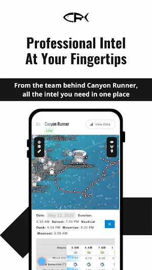
Introducing CR Map – the latest innovation from Canyon Runner. CR Map is a boat tracking system that brings together real-time monitoring, weather, water temperature, enhanced safety, a built-in warning system, and so much more!
FREE ACCESS IS OPEN FOR A LIMITED TIME! CREATE A FREE ACCOUNT AND START
The “Inshore Map” will limit you to only see boats within 10 miles of land – your boat will be visible to you all the time but any boat outside of ten miles will be invisible to you.
But all the “Offshore Map” features that are Coaching Members enjoy are available - like weather alerts on lightning (soon fog), water temp, (soon retail wave heights), various details charts, 10,000 wreck and fishing locations and a ton more are available anywhere on the water as far offshore as you can see.
VESSEL TRACKING
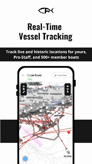
Track your vessel, all member vessels, and Pro-Staff IN REAL TIME.
Our system uses your cell phone or your Starlink Wi-Fi to locate your boat and display it on the CR Map in real-time. You can also see the real-time location of our 500+ member vessels, as well as our 18 Pro-Staff boats, fishing regionally from Maine through Florida, Bahamas and Costa Rica.
WEATHER
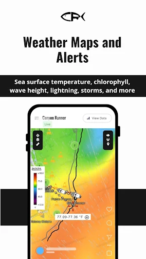
CR Map includes multiple paid weather services overlaid over your boat location and our charts and maps.
- Lighting
- Wind
- Wave height
- Fog
- Precipitation
WATER TEMP
Multiple daily water temperature and chlorophyll charts overlaid over Member and Pro-Staff boats in real-time – with in-depth analysis from 40+ years of experience.
ENHANCED SAFETY / WARNING SYSTEM
The CR Map tracks live lightning activity, real-time and forecasted wave heights, fog, storm, or other hazards to help you stay in front of inclement weather.
CR Map can configure text, email or in-app alerts in the event of bad weather approaching your vessel, giving you the chance to move or return home.
SEARCHABLE WRECKS AND FISHING LOCATIONS
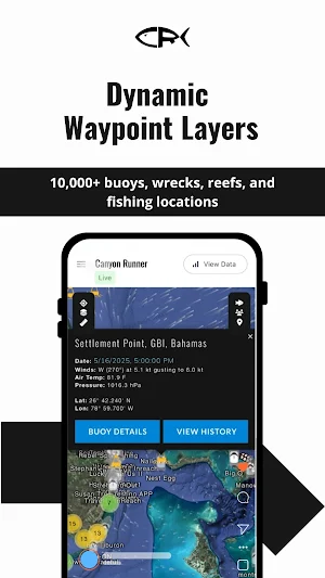
Get access to over 10,000 Wrecks, NOAA Buoys, and fishing locations in an easy and searchable format.
AIS
Built-in AIS tracking in real-time of the Longline and Dragger Fleet.
RICH MAPPING OVERLAYS & RESOURCES
Explore multiple chart overlays, locate 10,000+ wrecks and fishing spots, and utilize NOAA Buoy data directly on your map.
FISHING LOG
Keep track of your trips and catches with an integrated fishing log database.
CR MAP by Canyon Runner details
CR MAP by Canyon Runner is a free Maps & Navigation app for Android with 100+ installs on Google Play and a 5.0/5 average rating from 1 rating. It was released on April 4, 2024 and last updated on August 18, 2025. It's developed by CRMR Technology. It requires Android 10 or later.
- Category
- Maps & Navigation
- Rating
- 5.0 / 5 (1 rating)
- Installs
- 100+
- Price
- Free
- In-app purchases
- No
- Ads
- No ads
- Current version
- 2.1.0
- Requires Android
- 10
- Content rating
- Everyone
- Released
- April 4, 2024
- Last updated
- August 18, 2025
- Developer
- CRMR Technology
What’s new in CR MAP by Canyon Runner
- Misc bug fixes & improvments
Version 2.1.0 · Updated August 18, 2025
Similar Apps
Indi Locator
this app allows you to see your current address and save it for. Indi Locator
Hikers Assistant+
HA+ takes hiking to the next level. Safely plan and execute any hike or trek!
SailTimer Air Link™
App to configure Air Link™ for marine electronics.
MOBC - Passageiro
MOBC is an urban mobility application

Vilampo - Şarj İstasyon Ağı
Quickly access the charging station for your electric vehicle by downloading Vilampo!

Elint cloud
Elint Cloud offers world-class IoT and ML solutions that help clients to monitor
