About SeeOnTrail
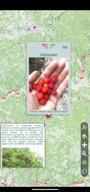
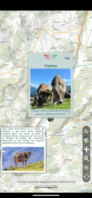
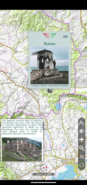
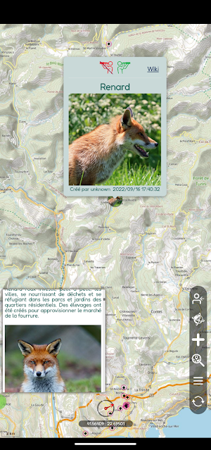
Creation of public or private Observations with possibility of adjustment for 24h in order to record the direction.
Observations can be confirmed by anyone.
Sharing private observations is reserved for a group or community for which they were made.
SeeOnTrail is worldwide usable, on all paths, in the mountains or on the coast.
5 types of observations are possible (that will be soon completed):
- Fauna
- Flora
- Natural events
- Human print
- Notable sites
Our mini-wiki presents for each observation additional information with text and photos captured from Wikipedia or from one of our scientific partners.
The search is intuitive with seasonality/dates and the possibility to select several types of Observations.
In addition to the basic functions, the concept includes:
- An offline mode
- A true multi language
- An internal messaging
- Multiple layers of presentation and many options to discover.
A User Guide is directly accessible at the first login or in the menu.
It is not mandatory to create an account to access the observation sharing map.
Without an account, access is permitted as "guest" ("Unknown" account) with some limited features but it is anyway possible to create and confirm observations.
Many functions are being developed and will soon complete the current version.
The goal is to show the wealth of our world by reaching out to as many people as possible to respect and protect it.
Come and join us!
SeeOnTrail details
SeeOnTrail is a free Maps & Navigation app for Android with 10+ installs on Google Play and a 5.0/5 average rating from 1 rating. It was released on September 29, 2022 and last updated on August 28, 2025. It's developed by SeeOnSea. It requires Android 5.0 or later.
- Category
- Maps & Navigation
- Rating
- 5.0 / 5 (1 rating)
- Installs
- 10+
- Price
- Free
- In-app purchases
- No
- Ads
- No ads
- Current version
- 212
- Requires Android
- 5.0
- Content rating
- Everyone
- Released
- September 29, 2022
- Last updated
- August 28, 2025
- Developer
- SeeOnSea
What’s new in SeeOnTrail
Optimization of checks when creating observations and refinement of land/sea limits
Version 212 · Updated August 28, 2025
Similar Apps

Poly Canyon
Explore like Never Before!

Joinup event driver
The app for drivers who are committed to quality in event management.

CityMovers
Book rides or send packages with real-time tracking and user-friendly features

PequeMap
Map of places, routes and events to go with children

Fleetz Driver
Votre nouvelle solution de transport personnelle.

Purple Satellite - Live Data
View live satellite time-lapse history of anywhere on earth.
