Washington DC Metro Map
Offline DC Metro map: all 6 lines, both airports, routes, 25 languages
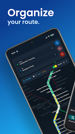
About Washington DC Metro Map
Washington DC Metro map with an offline route planner — all six Metrorail lines, both airports and every one of the 98 stations, in 25 languages. Free, no account.
Plan any Metro journey in two taps, then keep the whole network in your pocket. It works fully offline, which matters more here than in most cities: much of the DC Metro runs deep underground, and the signal goes the moment you ride the escalator down.
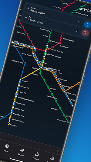
🚇 ALL SIX LINES, ALL 98 STATIONS • Red — Shady Grove ↔ Glenmont, via Bethesda, Dupont Circle, Union Station and Silver Spring • Orange — Vienna ↔ New Carrollton, via Ballston and Clarendon • Silver — Ashburn ↔ Downtown Largo, via Dulles Airport, Reston and Tysons • Blue — Franconia-Springfield ↔ Downtown Largo, via Reagan National, Pentagon and Arlington Cemetery • Yellow — Huntington ↔ Mt Vernon Sq, via King St-Old Town and Pentagon City • Green — Branch Ave ↔ Greenbelt, via Navy Yard-Ballpark, U Street and Columbia Heights
✈️ BOTH AIRPORTS ARE ON THE MAP Dulles International (IAD) has been a Silver Line station since 2022 — many visitors still do not know, and it saves an expensive taxi. Reagan National (DCA) is on the Blue and Yellow Lines, minutes from the centre.
⚠️ THREE LINES, ONE PLATFORM Between Rosslyn and Stadium-Armory the Orange, Blue and Silver Lines all run on the same track, so three different trains pull into the same platform and leave for three different suburbs. At Rosslyn the Blue Line turns south to Arlington Cemetery and the Pentagon, while Orange and Silver carry on west to Ballston, Vienna and Tysons. Green and Yellow share the same way between L'Enfant Plaza and Mt Vernon Sq. This map tells you which train is yours before the doors close.
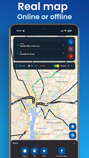
🗺️ TWO MAPS, NOT ONE • A clean colour Metro diagram — the one on the station wall, but you can zoom it • A real street map with all six lines drawn on top, so you can see where the entrance actually is • Tap any station for its lines, transfers and what is nearby
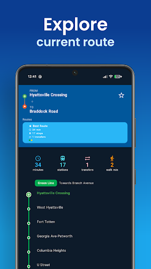
🧭 ROUTE PLANNER • Fastest route with every transfer, station by station • Ask for fewer changes instead of fewer minutes • Which way to travel — "towards Glenmont", not "northbound" • Save the trips you make often
📍 WHEN YOU GET THERE • Nearest station, found for you • An alert before your stop, so you can put the phone away • Works with the screen off
🏛️ WHAT TO SEE, AND THE STOP FOR IT The National Mall and the Smithsonian museums, the Capitol, the White House, Union Station, Arlington Cemetery, the National Zoo, Nationals Park and 50 more — each with the station you actually want. Including the one everybody asks about: Georgetown has no Metro station. The nearest is Foggy Bottom-GWU.
🌍 25 LANGUAGES English, Spanish, French, German, Italian, Dutch, Portuguese, Polish, Russian, Swedish, Danish, Turkish, Arabic, Hebrew, Persian, Amharic, Hindi, Bengali, Chinese, Japanese, Korean, Vietnamese, Thai, Indonesian and Filipino — with station names always in English too, so they match the signs.
Washington is not the English-only city it looks like, and this list is built for the people who actually ride it.
WHAT THIS APP IS NOT It is a rail map and a route planner. It does not show live train arrivals, it does not cover Metrobus, the DC Streetcar, MARC or VRE, and it cannot warn you about weekend track work — for those, use WMATA. What it does is work when nothing else will: no signal, no data, no account.
Free. No sign-up.
Official source:
https://www.wmata.com/schedules/maps/
This is an independent app. It does not represent, and is not affiliated with,
endorsed by, authorized by or sponsored by WMATA or any United States
government entity.
