Riyadh Metro Map & Routes
Offline Riyadh Metro map: 6 lines, airport stations, route planner, 25 languages
About Riyadh Metro Map & Routes
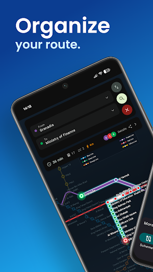
Offline Riyadh Metro map and route planner — all 6 lines, all 85 stations, no internet needed.
Riyadh Metro is new, and this map makes it simple. Plan any journey in two taps, then keep the whole Riyadh Metro map in your pocket. Everything works fully offline: no account, no signup, no data connection — so it still works underground, on arrival at the airport, and before you buy a local SIM.
🚇 THE COMPLETE RIYADH METRO NETWORK
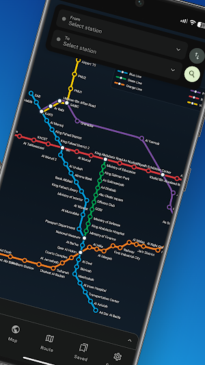
• Line 1 Blue — Olaya, Al Aqiq, Dhahrat Al Badiah
• Line 2 Red — King Saud University, Stadium, King Abdullah Financial District
• Line 3 Orange — Jeddah Road, Western Station, Khashm Al An
• Line 4 Yellow — King Khalid Airport Terminals 1-2, 3-4 and 5, KAFD
• Line 5 Green — Ministry of Interior, Ministry of Education, Ministry of Defense
• Line 6 Purple — An Naseem, Sheikh Hasan Bin Hussein
• Every station, interchange and station code — KAFD, Qasr Al Hokm, National Museum, Alinma Bank, Bank Albilad, Ministry of Finance and more
✈️ AIRPORT MADE EASY
• All three King Khalid International Airport metro stations on the map
• Route straight from any terminal to your hotel or to KAFD
• Works offline the second you land, before you have Saudi data
🗺️ TWO MAPS, NOT ONE
Most Riyadh Metro apps give you a single picture. This gives you both:
• A clean colour-coded metro map — the diagram from the station wall, but zoomable
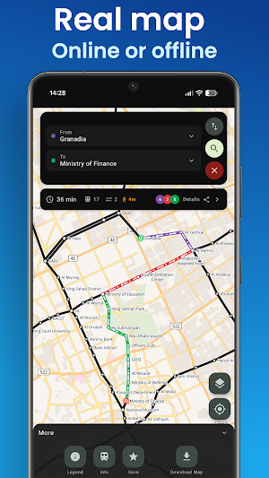
• A real street map with the metro lines drawn on top, so you can see exactly where a station sits and which exit to take
• Pinch, drag and tap any station for its lines, connections and nearby places
🧭 ROUTE PLANNER THAT ANSWERS THE REAL QUESTION
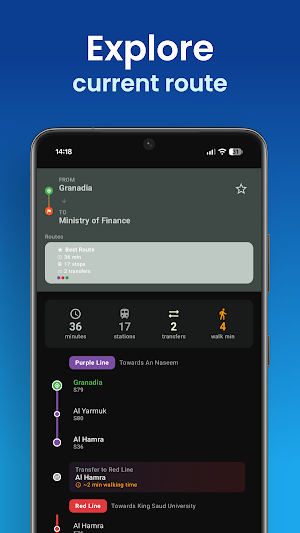
• Fastest route with every stop, transfer and travel time
• "Towards…" platform directions, so you never board in the wrong direction
• Number of stops, interchanges and walking minutes before you commit
• Compare alternative routes side by side
• Share a route with a friend in one tap
📴 GENUINELY OFFLINE
• Download the metro map once, then plan trips with zero data
• No account, no login, no tracking
• Ideal for visitors, pilgrims, business travellers and new residents
📍 FIND PLACES
• Search landmarks, malls and attractions, then get routed to the nearest metro station
• Kingdom Centre, Al Faisaliah, Diriyah, Boulevard, National Museum and more
🔔 NEVER MISS YOUR STOP
• Arrival alerts buzz your phone as you approach your destination, even with the screen off
• Nearest-station detection when you turn on location
🌍 25 LANGUAGES
Arabic, English, Urdu, Hindi, Malayalam, Tamil, Bengali, Nepali, Sinhala, Filipino, Indonesian, Malay, Persian, Turkish, French, German, Spanish, Italian, Portuguese, Russian, Japanese, Korean, Chinese, Punjabi. Station names show in Arabic and English together.
⭐ ALSO INSIDE
• Save your regular routes and stations
• Journey history
• Dark mode and a clean, fast interface
Independent app, not affiliated with the Riyadh Metro, the Royal Commission for Riyadh City or any transport operator. Travel times are estimates.
Similar Apps

Paris Metro - Map and Routes
Travel Through Paris with the Paris Metro App! Get the Metro Paris Route Planner

Rail Ninja
Rail Ninja: The most convenient way to book train tickets.

VoiceMap: Audio Tours & Guides
Walks and drives in 600 cities inc. London, NYC, Paris, Rome, Amsterdam, Prague

izi.TRAVEL: Audio Tour Guides
Use Self-Guided Audio Tours for 2500 Cities & 3000 Museums with AI Itineraries.

Tripomatic Planner & Maps
Plan your trips and create your own travel guide. Get offline maps.

Roadie: road trip planner & rv
Plan a road trip route, map out your trip itinerary, save points of interest.
