Singapore MRT Map: LRT Planner
Offline Singapore metro & train map — MRT, LRT, Sentosa route planner
About Singapore MRT Map: LRT Planner
Singapore MRT map & offline route planner — every MRT line, all three LRT systems and the Sentosa Express, in 25 languages.
Plan any train journey across Singapore in two taps, then keep the whole rail map in your pocket. Everything works fully offline, so it still works the moment you land at Changi — before you buy a SIM, before you find Wi-Fi, and deep underground where signal drops.
Built for visitors who have never seen an MRT map, and for commuters who ride it every day.
🚇 THE COMPLETE RAIL NETWORK
• North South Line and East West Line, including the Changi Airport branch
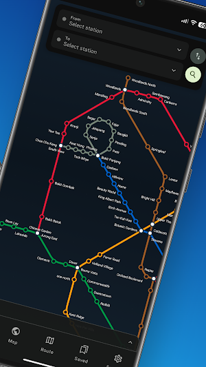
• North East Line, Circle Line and Downtown Line
• Thomson-East Coast Line
• Bukit Panjang, Sengkang and Punggol LRT
• Sentosa Express monorail
• Every station, interchange and station code (NS1, EW24, CC19…)
🗺️ TWO MAPS, NOT ONE
Most metro apps give you one. This gives you both:
• A clean colour-coded subway diagram — the map on the station wall, but zoomable
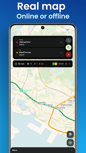
• A real street map with the train lines drawn on top, so you can see exactly where a station sits and which exit to take
• Pinch, drag and tap any station for lines, connections and nearby places
🧭 ROUTE PLANNER THAT ANSWERS THE REAL QUESTION
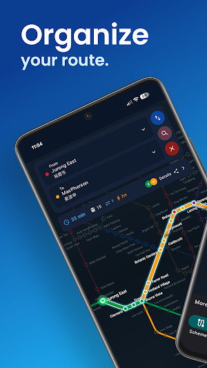
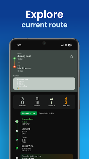
• Fastest route with every stop, transfer and travel time
• "Towards…" platform directions, so you never board in the wrong direction
• Number of stops, interchanges and walking minutes before you commit
• Compare alternative routes side by side
• Share a route with a friend in one tap
📴 GENUINELY OFFLINE
• Download the map once, then plan trips with zero data
• No roaming charges, no hunting for airport Wi-Fi
• Perfect for tourists, transit passengers and anyone on a short trip
📍 FIND THE PLACES YOU CAME FOR
Jump straight from an attraction to the nearest station — over 100 places built in:
• Marina Bay Sands, Gardens by the Bay, Merlion Park, Singapore Flyer
• Sentosa, Universal Studios, S.E.A. Aquarium, Siloso Beach
• Orchard Road, Chinatown, Little India, Kampong Glam, Haji Lane
• Singapore Zoo and Night Safari, Botanic Gardens, Jewel Changi Airport
• Hawker centres, museums, parks and nature reserves
🔔 NEVER MISS YOUR STOP
• Find the station nearest you with GPS
• Arrival alerts as you approach your destination
• Save favourite routes and revisit recent trips
🌍 IN YOUR LANGUAGE
• 25 languages, including English, 中文, Bahasa Melayu, தமிழ், 日本語, 한국어, Deutsch, Français, Español and Русский
• Show station names in Chinese alongside English
• Light, dark and colour themes
🔒 PRIVATE, LIGHT AND FREE
• No account, no sign-up, no personal data collected
• Saved routes stay on your device
• Small download, fast to open
Whether you are riding from Changi to Marina Bay, finding the quickest way to Sentosa, or working out which platform gets you to Jurong East, this is the Singapore MRT and LRT map that keeps working when your data does not.
Independent transit map, not affiliated with SMRT, SBS Transit or the Land Transport Authority. Travel times are estimates.
Similar Apps

NEMT Driver
Streamline your workday with NEMT Drive log in, clock in/out, and access trips

dasomaps
Mapping app for hiking and mountaineering.
Acrea: GPS Land Area Measure
Measure land area, distance & perimeter on a GPS satellite map - acres/hectares

DriveCore
Track your vehicles in real time. Manage your fleet from anywhere.

EV-Bees
Recharge your electric car using EV-Bees!

SAYR
Find public transport routes with maps, clear steps, alerts and saved places.
