About RockGeo
Take a complete geological project from preparation to final report.
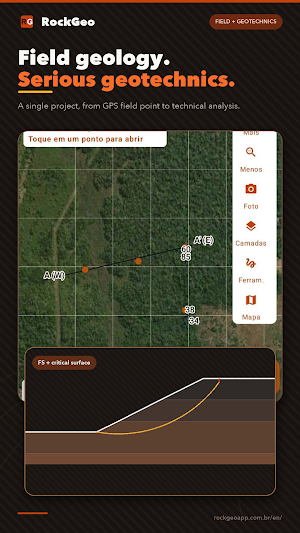
RockGeo combines offline geological mapping on Android, 2D cross sections, geotechnical tools, project-aware AI, and a synchronized web portal. Field data no longer needs to be scattered across notebooks, photo galleries, spreadsheets, and disconnected software.
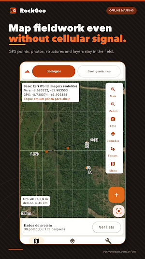
FIELDWORK, EVEN WITHOUT A SIGNAL
• Sign in with your Google account on initial launch, then work 100% offline in the field.
• Navigate the map, use device GPS, and record geological points offline with precise coordinates.
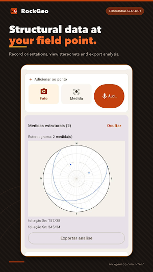
• Attach outcrop photos, audio notes, lithological descriptions, physical samples, and structural measurements to each point.
• Work with online or offline layers and custom base maps.
• Import GeoTIFF, GeoPDF, MBTiles, Shapefile, GeoJSON, KML, and KMZ.
GEOTECHNICS IN THE SAME PROJECT
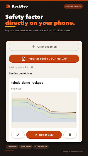
• Run 2D limit-equilibrium slope stability analyses (Bishop, Janbu, Spencer, and GLE) with water tables, surcharges, seismic action, and calculation records.
• View equal-area Schmidt stereonets and screen planar, wedge, and toppling rock slope failure modes.
• Organize borehole logs, SPT penetration tests, and geotechnical records georeferenced directly on your map.
2D SECTIONS AND A DESKTOP WORKFLOW
• Create geological-geotechnical cross sections from field points or import DXF and JSON files.
• Draw contacts and layers with guides and take the same section directly into LEM slope stability solvers.
• Continue in the RockGeo Portal from your browser, with automatic synchronization between phone and desktop.
AI THAT READS THE PROJECT CONTEXT
• Ask about data gaps, field risks, and recommended checks based on your registered field data.
• Generate comprehensive technical reports that incorporate fieldwork, geotechnics, sections, photos, and audio notes.
• Use RockGeo AI out of the box without configuring your own AI API key.
OUTPUT FOR YOUR TECHNICAL WORKFLOW
Export data in universal formats such as Shapefile, GeoJSON, KML/KMZ, CSV, XLSX, DXF, PDF, and DOCX, then seamlessly continue in QGIS, ArcGIS, AutoCAD, or your office reporting pipeline.
PLANS AND TRANSPARENCY
RockGeo provides permanent free features to start projects and work in the field with zero ads. Academic and Professional plans unlock the same analytical tools; the Professional plan offers expanded cloud storage and transfer allowances for commercial consulting. Subscriptions and optional AI credit packs are securely processed by Google Play.
Technical notice: RockGeo is a computational support and screening tool. Data, geotechnical parameters, interpretations, calculations, and AI drafts must be verified by a qualified licensed professional before any engineering design decision.
RockGeo is a product of Thard Tech (Brazilian Company ID 67.141.076/0001-08).
Similar Apps

UNITED24
Support Ukrainian defenders and get exclusive content from the units you help

Sportvibez
Be your best with Sportvibez, because your health deserves the very best.

TrainerRoad
Get faster with science-backed cycling training.

Sensi
Remote control your home comfort. Anytime, anywhere.

Home V
Home V is a smart camera app for mobile and wearable platforms.

HomeLight For Agents
HomeLight helps the best agents to compete and win.
