About AXPA Planner
AXPA Planner is the advanced platform for planning and evaluating unmanned aerial operations (UAS) directly from your mobile device. Designed for professional pilots and operators, our technology merges 3D geospatial intelligence, real-time regulatory compliance, and an aeronautical data architecture to deliver safety and absolute control on every mission, wherever you are.
Turn your mobile phone or tablet into a high-fidelity tactical planning center, ensuring compliance with aeronautical regulations directly on the ground before every takeoff.
🚀 KEY FEATURES
🗺️ 3D MISSION PLANNING
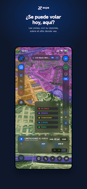
• High-Fidelity Operational Canvas: Interactive 3D map that integrates topographic relief (DTM), airspace, weather, and urban areas into a single planning environment.
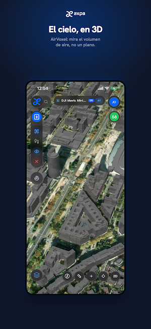
• AirVoxel Technology: Three-dimensional visualization of airspace topography and volumes for an immersive and accurate evaluation of your flight plans.
• • Automatic Compliance Engine: Instant mission classification and validation under the EASA regulatory framework (Open or Specific Category), SORA methodology, and the European standard ED-318.
• Operational Restrictions Panel: Visual translation of complex aeronautical regulations into clear and instantaneous flight parameters (maximum altitudes, distances, populated area flight rules).
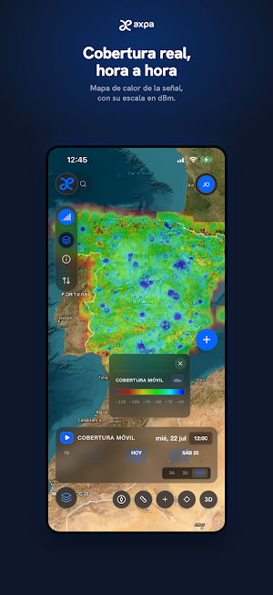
• RF Interference Viability: Advanced volumetric analysis of the electromagnetic field (mobile coverage, radars) to ensure a secure data link (C2/C3) during your operation.
📊 INTELLIGENCE AND SITUATIONAL AWARENESS
• Topographic Synchronization: High-resolution digital elevation models and altimetric calibration to accurately assess visual line of sight (VLOS).
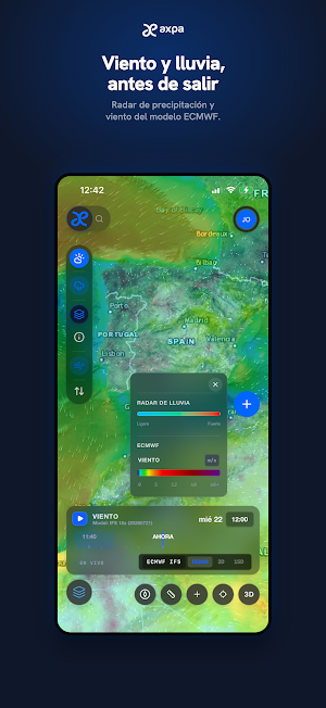
• Real-Time Environment: Layers of intelligence with meteorological and tactical data for distraction-free flight decision-making.
• Adaptive Mobile Performance: An optimized graphics engine that adapts the visual complexity of the 3D map to your device's capabilities, ensuring seamless performance in field operations.
AXPA Planner is the ultimate tactical tool for Pilots, UAS Consultants, and Operators seeking the most rigorous standard in topographic planning and regulatory certainty right on the job site.
Download the app, plan missions with professional precision, and always fly with the peace of mind of complying with current regulations.
See our Terms and Conditions at https://axpa.app/terms
Similar Apps

Cooperingá - Passageiro
Easy, fast and safe.

mobilecontrol
The official application for electronic surveillance and social monitoring.

NDPAS Agent
NDPAS Agent helps generate address codes for easy navigation across Liberia.

beeMob
The entire Béziers metropolitan area in my pocket!

GPS Tracker - Family Locator
Real-time GPS tracker & family location sharing app
GeoTag Map Camera - GPS Photo
Add GPS location, map, date & time stamp to photos & video with geotag camera.
