Maranox: Irish Seabed Charts
Offline Irish seabed charts: depth, ground type, wrecks, marks and tide data.
About Maranox: Irish Seabed Charts
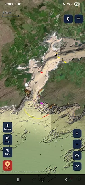
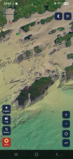
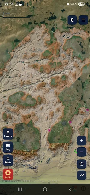
Maranox shows you what is under your hull. It puts INFOMAR — the Irish state's twenty-year seabed survey — into offline marine charts on the phone you already carry.
Built for every recreational boat on Irish waters: sea anglers, divers, cruising yachts, RIBs, kayakers and sailing schools. Download the chart packs once over Wi-Fi, then read seabed depth, ground type and shipwrecks at sea with no mobile signal.
Seabed and charts
• INFOMAR bathymetry — seabed depth and contour lines along the Irish coast, the most detailed marine survey made for these waters.
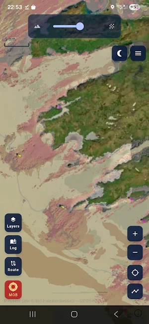
• Folk sediment classification — see the bottom at a glance: rock, coarse, mixed, sand or mud, so you know what is down there before you drop.
• 608 shipwrecks from the Geological Survey Ireland catalogue, pinned by GPS and bundled offline — a wreck map for diving and angling.
• Lighthouses, RNLI lifeboat stations, the twelve-mile limit, and OpenSeaMap buoys and marks.
• Satellite and nautical chart layers for the wider picture.
• Live tide gauges and wave-buoy data — height, wind and sea temperature from the Marine Institute.
Your own data
• Save fishing marks and waypoints — long-press to drop a spot, anchorage, dive site or hazard, then name and categorise it.
• Record GPS tracks and review your trips by week.
• Plan a route — set waypoints and see straight-line distance, bearing and ETA.
• Man Overboard — long-press to mark your current position to assist your own search (not a distress beacon).
• Keep a fishing logbook of species, weight and location across the season.
• Night mode with dark charts to protect night vision.
• Cloud sync keeps your marks, tracks and settings across your devices when you sign in.
• Your marks, tracks and settings stay yours, with cloud backup across your signed-in devices.
Why offline charts
Download the Irish chart packs on Wi-Fi and everything loads from the phone at sea. Keep it on the phone you already carry and your downloaded seabed layers do not depend on coverage.
Not for navigation
Maranox is a planning and situational-awareness tool. It is not a certified navigation system and must not be used as your primary means of navigation. Always carry paper charts, a VHF radio and proper safety equipment.
Who built it
Maranox is made by two Irish boaters who wanted the charts they use on the water to match the survey data the state already paid for. It uses public INFOMAR data under a Creative Commons Attribution 4.0 licence (Geological Survey Ireland and Marine Institute), with attribution shown in the app.
Feedback
Tap Send Feedback in the app and it reaches us directly. Bugs, ideas and harbour requests are all welcome at [email protected]
Similar Apps
ShipAtlas - Vessel Tracker
Live AIS vessel tracking at your fingertips

Gaggle Paragliding, Ultralight
Paragliding & Paramotor: Flight recording, vario, airspace alerts, 3D replays.

FLYFUEL
Your new fav healthy spot for breakfast, lunch, and dinner on the fly!

FarOut
GPS Maps: Hiking Bikepacking Paddling Rafting

SeaPeople: Boat Tracker
Find marinas, anchorages & boating routes shared by real boaters.

Harvest Hosts - RV Camping
Unique RV Camping at 8000+ Wineries, Farms, Golf Courses, and Private Properties