

GeoCollect: GIS & Field Maps
Above AS Productivity iPhoneiPadiPod touch
GeoCollect: GIS & Field Maps is a free Productivity app for iPhone and iPad by Above AS. Rated 5.0/5 from 3 ratings. Requires iOS 16.0.
- Rating
- 5.0
- 3 ratings
- Price
- Free
- on the App Store
- Size
- 37 MB
- Age 4+
- Updated
- Aug 27
- 2026 · v2.0.0
Screenshots
About GeoCollect: GIS & Field Maps
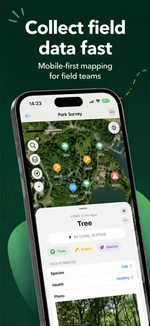
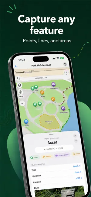
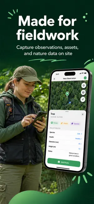
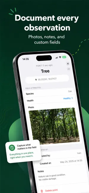
GeoCollect – Field Data Collection Made Simple Collect, document, and organize geographic data directly in the field. GeoCollect is a mobile field mapping tool built for anyone who needs to record real-world observations and assets — from trees, species and habitats to utility infrastructure, maintenance tasks, inspections, and surveys. Create your own data structure, capture locations on the map, add photos and attributes, and keep everything organized in projects. When the fieldwork is done, export your data as GeoJSON, KML, or CSV. Built for fieldwork • Collect points, lines, and areas Map anything you encounter in the field using GPS and an intuitive map interface. • Create custom data types Define exactly what you want to collect, with custom fields and attributes for each type of feature. • Add photos and notes Document observations with images, descriptions, and structured information. • Work offline Continue collecting and editing data even when you're working beyond network coverage. • Collaborate with your team Invite others to your projects and keep field data shared and up to date. • Export your data Export projects as GeoJSON, KML, or CSV and continue working with your data wherever you need it. • Organize your fieldwork Create unlimited projects with up to 1,000 features per project. From forests to city streets GeoCollect adapts to the work you're doing. Use it for: • Tree and forestry surveys • Species and habitat observations • Utility and infrastructure mapping • Asset inventories • Maintenance and inspection work • Environmental field surveys • Parks and public spaces • Custom field data collection GIS without the complexity GeoCollect is designed to make field data collection fast and approachable. You don't need a complicated desktop workflow just to record what you see around you. Open a project, collect your data, and get back to the work that matters. Take GeoCollect into the field and start mapping. Terms of Service: https://aboveapps.no/geocollector-pro-terms-of-service/
What’s new
Version 2.0.0 · Updated August 27, 2026
Thanks for all the great feedback! In this update, I’ve made GeoCollect a little better with small improvements and fixes to make field data collection even smoother.
App privacy
The developer, Above AS, reported these privacy practices to Apple.
Data Not Linked to You
The following data, which may be collected but is not linked to your identity, may be used for the following purposes:
- Usage Data: Product Interaction
- Diagnostics: Crash Data
- Location: Precise Location, Coarse Location
- Contact Info: Email Address, Name
- Identifiers: User ID
Used for: Analytics, App Functionality
Alternatives to GeoCollect: GIS & Field Maps
Looking for apps like GeoCollect: GIS & Field Maps? Here are 6 similar apps on the App Store. The highest rated is FieldMap Pro (5.0/5), and all 6 are free to download.
-
 FieldMap Pro
5.0
FieldMap Pro
5.0
-
 Locus Field Assets and Data
5.0
Locus Field Assets and Data
5.0
-
 GIS4Mobile
3.0
GIS4Mobile
3.0
-
 GIS Lite
1.0
GIS Lite
1.0
-
 Mobile Data Collection
4.8
Mobile Data Collection
4.8
-
 Mapit GIS
5.0
Mapit GIS
5.0
| App | Rating | Price | Last updated |
|---|---|---|---|
| GeoCollect: GIS & Field Maps | 5.0 / 5 (3 ratings) | Free | August 27, 2026 |
| FieldMap Pro | 5.0 / 5 (3) | Free | Sep 5, 2026 |
| Locus Field Assets and Data | 5.0 / 5 (1) | Free | Jul 11, 2024 |
| GIS4Mobile | 3.0 / 5 (1) | Free | Sep 18, 2026 |
| GIS Lite | 1.0 / 5 (1) | Free | May 10, 2024 |
| Mobile Data Collection | 4.8 / 5 (41) | Free | Sep 8, 2026 |
| Mapit GIS | 5.0 / 5 (1) | Free | Aug 8, 2026 |