

Mobile Data Collection
GIS Cloud Inc. Productivity iPhoneiPadiPod touch
Mobile Data Collection is a free Productivity app for iPhone and iPad by GIS Cloud Inc. Rated 4.8/5 from 41 ratings. Requires iOS 16.0.
- Rating
- 4.8
- 41 ratings
- Price
- Free
- on the App Store
- Size
- 24 MB
- Age 4+
- Updated
- Sep 8
- 2026 · v10.6.101
Screenshots
About Mobile Data Collection
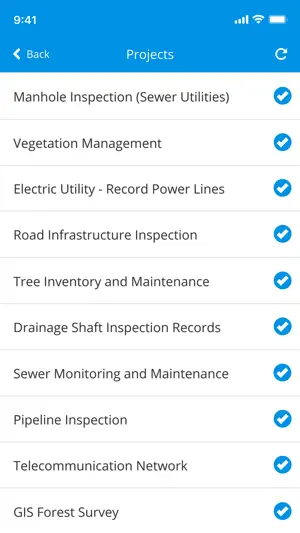
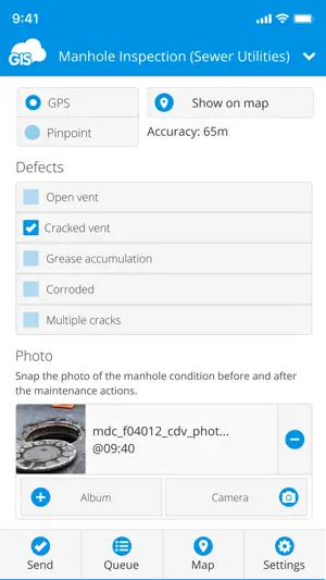
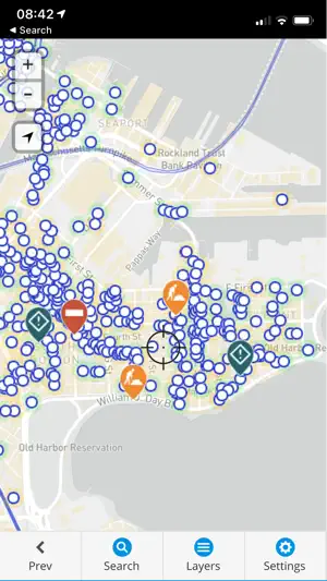
GIS Cloud Mobile Data Collection is a solution for recording and updating data in the field with mobile devices in real time, also allowing instant data access from the office. Digitize your workflow and eliminate errors and time-consuming paperwork! The mobile app enables you to accurately record data, online or offline, by filling in digital custom survey forms. You can create an unlimited number of your own unique forms in the user-friendly form builder, in the connected web app (Mobile Data Collection Portal). Continue working on your data, edit, share, and collaborate through GIS Cloud powerful web Map Editor app. Find everything you need for your workflow in one platform, no need for integrations. Collect points, lines, or polygons! Use GPS to capture data on the go, or switch to manual and use pinpoint and drawing tools for even better precision. Form fields are fully customizable and you can choose from text fields, selects lists, radio buttons, checkboxes, electronic signature, autofill, barcode, photo and audio, hidden fields, and much more. To control data accuracy and eliminate errors, make your form fields required, conditional (dependent on other form fields or data input), or persistent. Manage your field staff and share projects with custom forms to field workers by assigning them the collect and update permissions, and they can instantly start collecting data in the field. Simply sign into your GIS Cloud account (or sign up for free) and send collected data directly to your GIS Cloud app in the cloud. Data is immediately represented on a map, just click on any map feature to access collected data. Generate reports from the web app. Access data through GIS Cloud Map Editor, where you can further edit and style your data, overlay with additional data layers analyze data, share data with colleagues with different permissions to collaborate on projects. You can also export data and much more. Collect field data and conduct field surveys faster and easier than ever before. Start creating forms in the MDC Portal web app on https://giscloud.com and have your team out and about in a quarter of an hour! All you need in the field: - Offline data capture - Offline maps - Points, Lines, and Polygons geometry support - Media (photos & audio) enriched location information - QR code and barcode support - Electronic signature - Dropdowns, lists, input boxes, and comments based on custom forms - Review data attributes directly in the app - Search through data on the map - Control different layers in the map - Edit existing data - Listen to audio and view images - Real-time GPS location - View and explore maps in the field Prepare and analyze in the office: - Cloud-based web apps - Custom forms designer - Rich GIS symbology and visualization - Data editing and exporting - One-click map and data sharing - Real-time collaboration - Map publishing - Spatial Queries & Analysis - Account administration Note! This app will use GPS in the background to give you the most accurate and current location. Continued use of GPS running in the background can dramatically decrease battery life. If you have any questions or comments, feel free to contact us at [email protected]. Privacy Policy: https://www.giscloud.com/wp-content/uploads/privacy-policy.html Terms of Use: https://www.giscloud.com/wp-content/uploads/terms-of-use.html
Ratings & reviews
4.8
41 ratings
What’s new
Version 10.6.101 · Updated September 8, 2026
Internal updates and bugfixes
App privacy
The developer, GIS Cloud Inc., reported these privacy practices to Apple.
Data Used to Track You
The following data may be used to track you across apps and websites owned by other companies:
- Contact Info: Email Address, Name
Data Linked to You
The following data, which may be collected and linked to your identity, may be used for the following purposes:
- Contact Info: Email Address, Name, Phone Number
- Location: Precise Location, Coarse Location
- User Content: Photos or Videos, Audio Data, Customer Support, Other User Content
- Identifiers: User ID, Device ID
Used for: Developer’s Advertising or Marketing, Analytics, App Functionality, Other Purposes
Data Not Linked to You
The following data, which may be collected but is not linked to your identity, may be used for the following purposes:
- Search History: Search History
Used for: App Functionality
Alternatives to Mobile Data Collection
Looking for apps like Mobile Data Collection? Here are 6 similar apps on the App Store. The highest rated is FieldMap Pro (5.0/5), and all 6 are free to download.
-
 GIS4Mobile
3.0
GIS4Mobile
3.0
-
 GIS Lite
1.0
GIS Lite
1.0
-
 FieldMap Pro
5.0
FieldMap Pro
5.0
-
 Touch GIS
4.0
Touch GIS
4.0
-
 Locus Field Assets and Data
5.0
Locus Field Assets and Data
5.0
-
 GeoCollect: GIS & Field Maps
5.0
GeoCollect: GIS & Field Maps
5.0
| App | Rating | Price | Last updated |
|---|---|---|---|
| Mobile Data Collection | 4.8 / 5 (41 ratings) | Free | September 8, 2026 |
| GIS4Mobile | 3.0 / 5 (1) | Free | Sep 18, 2026 |
| GIS Lite | 1.0 / 5 (1) | Free | May 10, 2024 |
| FieldMap Pro | 5.0 / 5 (3) | Free | Sep 5, 2026 |
| Touch GIS | 4.0 / 5 (32) | Free | Jun 21, 2026 |
| Locus Field Assets and Data | 5.0 / 5 (1) | Free | Jul 11, 2024 |
| GeoCollect: GIS & Field Maps | 5.0 / 5 (3) | Free | Aug 27, 2026 |