
ROAD SYSTEM
Social Tech Projects ApS Tools
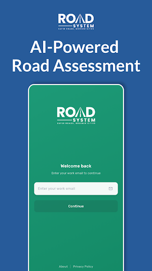
AI-Powered Road Assessment
- Downloads
- 79+
- on Google Play
- Price
- Free
- No in-app purchases
- Updated
- Sep 27
- 2026 · v1.0.9
Screenshots
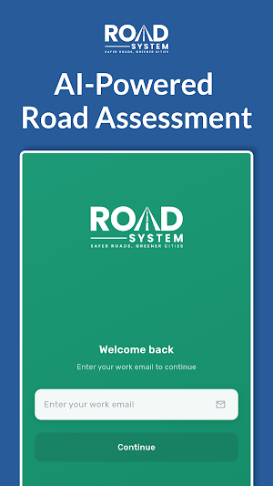


About ROAD SYSTEM
ROAD SYSTEM™ is a powerful mobile application designed for road maintenance teams, surveyors, and transportation departments to efficiently document and monitor road infrastructure conditions. Capture, track, and report road issues with ease—all while on the move.
🚗 AUTOMATIC ROAD DOCUMENTATION
Start recording and let ROAD SYSTEM™ do the work. The app automatically captures high-quality photos of road conditions as you travel, eliminating the need for manual photo-taking. Simply start a recording session, and the app intelligently captures images based on movement and distance traveled.
📍 REAL-TIME GPS TRACKING
Track your route with precision using integrated GPS technology. Monitor distance traveled in real-time, with automatic conversion between meters and kilometers. Every captured photo is geotagged with accurate location data for comprehensive road documentation.
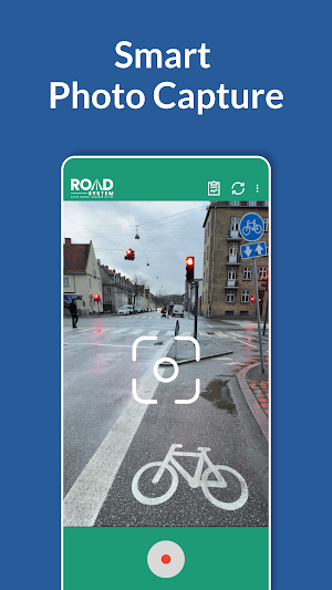
📸 SMART PHOTO CAPTURE
• Automatic photo capture during recording sessions
• High-quality image compression for efficient storage
• Optimized image resolution (2048x1080) for fast uploads
• Automatic deletion of original high-resolution images to save storage space
☁️ SEAMLESS CLOUD SYNCHRONIZATION
• Secure cloud storage
• Automatic upload of captured images when connected
• WiFi preference detection to minimize data usage
• Offline capability—capture and store locally, sync when connected
• Progress tracking for upload operations
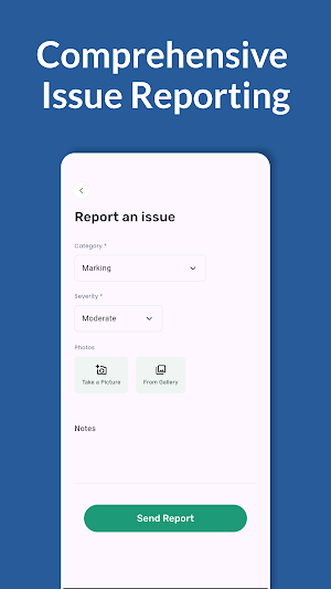
🚨 COMPREHENSIVE ISSUE REPORTING
Report road issues manually with detailed categorization:
• Severity Levels: Informational, Low, Moderate, High, Critical
• Photo Support: Attach multiple photos from camera or gallery
• Notes: Add detailed descriptions and observations
• Location Tagging: Automatic GPS location for every report
🌍 MULTI-LANGUAGE SUPPORT
🔒 SECURE & RELIABLE
• Secure authentication
• Organization-based access control
• Local data encryption
• Automatic session management
⚡ KEY FEATURES
• One-Tap Recording: Start/stop recording with a simple tap
• Distance Tracking: Real-time distance measurement (meters/kilometers)
• Offline Mode: Continue working without internet connection
• Connectivity Detection: Smart WiFi and mobile data detection
• Wake Lock: Prevents screen from sleeping during recording
• Permission Management: Easy access to camera and location permissions
🎯 PERFECT FOR
• Road maintenance teams
• Infrastructure surveyors
• Transportation departments
• Road inspection professionals
• Municipal road management teams
• Highway maintenance creww
What’s new
Version 1.0.9 · Updated September 27, 2026
• Pending scans are kept more reliably • More reliable syncing of data
Alternatives to ROAD SYSTEM
Looking for apps like ROAD SYSTEM? Here are 6 similar Android apps on Google Play. All of them are free to download.
-
KodeScanner: AI PDF & OCR Scan
-
StreameX
-
TempPro Air
-
Bee Frequency Effect
-
Image Watermark Maker
-
Ugarit Hub
| App | Rating | Price | Installs | Last updated | Compare |
|---|---|---|---|---|---|
| ROAD SYSTEM | – | Free | 50+ | Sep 27, 2026 | |
| KodeScanner: AI PDF & OCR Scan | – | Free | 1,000+ | – | Compare |
| StreameX | – | Free | 5,000+ | May 4, 2026 | Compare |
| TempPro Air | – | Free | 50+ | Aug 17, 2026 | Compare |
| Bee Frequency Effect | – | Free | 50+ | – | Compare |
| Image Watermark Maker | – | Free | 50+ | – | Compare |
| Ugarit Hub | – | Free | 1,000+ | – | Compare |
Compare ROAD SYSTEM with the top alternatives: ratings, updates, ASO score and keyword gaps →
Similar apps on Google Play
- KodeScanner: AI PDF & OCR Scan
- StreameX
- TempPro Air
- Bee Frequency Effect
- Image Watermark Maker
- Ugarit Hub
- CondoApp
- My GPS Altitude: Altimeter
- Safeguard-Me
- St. Mark Festival Nashville TN
- ADB AppControl
- DramaBite: Short Dramas
- CoinPay
- ToolVault
- MP2 Calculator 2026
- AI Video Blur - Faces & Plates
- Pontabot
- Vestek
- Pagofacil.io
- Private Photo Vault Locker
- Anresco
- LockBox - Password manager
- iArgus
- RFID Read Writer
- Swipe: Photo Gallery Cleaner