
PeakForecast - Outdoor Weather
samkim Weather Contains ads
Summit-corrected forecasts, hiking & camping index. Powered by MET Norway.
- Downloads
- 95+
- on Google Play
- Price
- Free
- No in-app purchases
- Updated
- Sep 21
- 2026 · v1.0.11
Screenshots
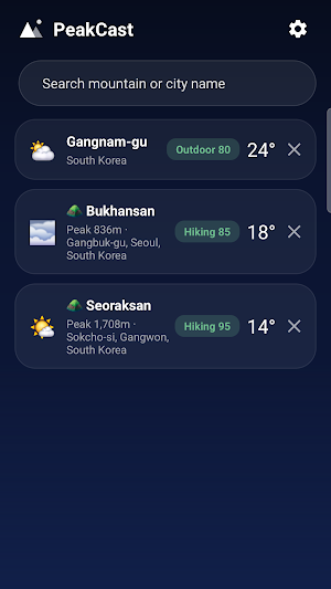


About PeakForecast - Outdoor Weather
⛰️ City weather apps tell you the weather at the trailhead.
PeakCast tells you the weather at the summit.
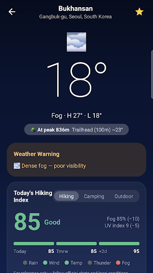
■ Summit-based forecasts
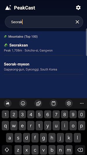
・Search any city worldwide, or pick from 100 famous Korean mountains built in
・World-renowned MET Norway forecasts, corrected for summit altitude
・Compare expected summit vs. trailhead temperature on one screen
■ Today's hiking & camping index
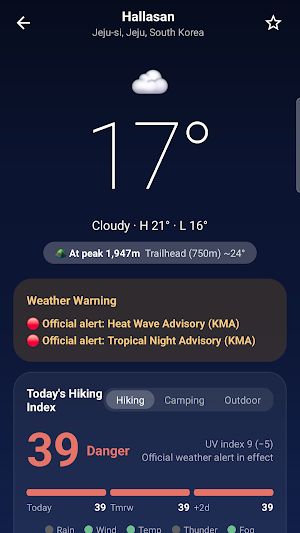
・A 0–100 score combining rain, wind, temperature, thunderstorms and fog, with a traffic light for each factor
・Thunderstorm risk or an active weather warning forces the score down to "Danger" — no matter how nice it looks
・Transparent scoring: every deduction is listed, so you see exactly why
・Camping index covers the night (6 PM – 9 AM next day): overnight low, tent condensation, wind
・🌌 "Great night for stargazing" badge (cloud cover + moonlight combined)
■ Safety warnings, worldwide
・Automatic warnings built from forecast data: strong wind, gusts, heavy rain, snow, cold snap, heat, UV, lightning and fog — available everywhere on Earth
・In Korea, official KMA weather warnings and Korea Forest Service forest-fire risk are shown as well
■ Forecast data made for the mountains
・Lightning probability — know the risky hours before you're on a ridge
・Fog (visibility), wind gusts and dew point (predicts tent condensation)
・Precipitation range (min–max) — decide whether your pack needs a rain cover
・Sunrise/sunset countdown, golden hour, moon phase
■ Air quality
・Korea: AirKorea PM2.5 / PM10 with CAI grade
・Everywhere else: nearest-station data via OpenAQ
■ The basics, done right
・Hourly (24 h) and daily forecasts, precipitation probability chart
・3 home-screen widgets (light/dark)
・Morning weather briefing and sunset reminder notifications
・Offline cache — the last forecast stays visible even when you lose signal on the trail
Data sources: MET Norway (CC BY 4.0) · KMA · Korea Forest Service · K-eco · OpenAQ (CC BY 4.0) · © OpenStreetMap contributors
The hiking and camping indexes are reference indicators. Always follow official warnings and local conditions when making decisions outdoors.
What’s new
Version 1.0.11 · Updated September 21, 2026
Optimization
Alternatives to PeakForecast - Outdoor Weather
Looking for apps like PeakForecast - Outdoor Weather? Here are 6 similar Android apps on Google Play. The highest rated is Време Србија (3.8/5), and 5 of the 6 are free to download.
-
AuroraTonight
-
SkyPal: Weather Forecast
-
PredictCurrent
-
Horizon Weather - Watch face
-
Време Србија 3.8
-
ATLAS MET
| App | Rating | Price | Installs | Last updated | Compare |
|---|---|---|---|---|---|
| PeakForecast - Outdoor Weather | – | Free | 50+ | Sep 21, 2026 | |
| AuroraTonight | – | Free | 100+ | – | Compare |
| SkyPal: Weather Forecast | – | Free | 100+ | Aug 8, 2026 | Compare |
| PredictCurrent | – | Free | 5,000+ | Sep 21, 2026 | Compare |
| Horizon Weather - Watch face | – | 1.49 USD | 10+ | Aug 5, 2026 | Compare |
| Време Србија | 3.8 / 5 | Free | 1,000+ | Oct 14, 2026 | Compare |
| ATLAS MET | – | Free | 100+ | – | Compare |
Similar apps on Google Play
- AuroraTonight
- SkyPal: Weather Forecast
- PredictCurrent
- Horizon Weather - Watch face
- Време Србија
- ATLAS MET
- Sea Sparkle: Bioluminescence
- Smart Forecast Watch Face
- Noorderlicht Vandaag
- Aromatizador
- Weather Radar & Live Forecast
- 여기날씨
- Monochrome Weather
- Mazha: Know Before You Go
- Rain Tracker: Weather Radar
- Deprem Uyarı & Son Depremler
- GaIA
- ChronoForge Tourbillon
- 별바라기
- Get A Nibble: Fishing Times
- SkyForest AI: Mushroom App
- Weather watch face W8.5
- Weather Update and Forecast
- Glass Weather 4 - Watch face
- Skyde — Weather-Smart Plans