Fornfunn II
Fornfunn - app for metal detecting, find report, track log, events and find map
About Fornfunn II
Important information about sources and affiliations:
Fornfunn is a private and independent app. The app does not represent the Norwegian Mapping Authority, the county municipalities or any other public authority, and is not affiliated with, approved by or published on behalf of them.
Some optional map layers display publicly available map data from the Norwegian Mapping Authority:
• Terrain and elevation data:
https://www.kartverket.no/api-og-data
• Historical maps and county maps:
https://www.kartverket.no/om-kartverket/historie/historiske-kart
https://histkart.kartverket.no/
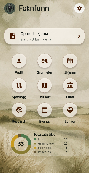
Fornfunn is the first and original app for metal detecting, metal detector finds, track logs, landowner information, find maps, messages, events and professional find reports.
Fornfunn is developed by an experienced detectorist who knows the challenges of registering metal detector finds out in the field. The app is made for detectorists, metal detectors and others who want a neat, accurate and efficient way to document finds.
The app helps you collect the right information about finds, finders, landowners and discovery sites. You register GPS position, attach photos, write notes and create an automatically filled-in discovery form that can be sent to the correct county council. You simply select the county from the list, and the app does the rest.
Fornfunn is suitable for active detectorists who want to spend more time on the actual search and less time on manual filling in afterwards. Registration can be done with just a few keystrokes while you are still out in the field, in the forest or in the field.
With Fornfunn you can:
• Create and fill out find forms directly in the field
• Register metal detector finds with image, GPS position, find information and notes
• Register information about finder, landowner, property and find site
• Retrieve property information directly from the map and save landowners for later use
• Keep track of areas you have permission to search with **My search areas**
• Save and reuse landowner, property and form data locally on the device
• Create professional PDF reports for finds and documentation
• Create PDF, image and CSV files automatically when a find form is completed
• Prepare find documentation for submission to the correct county municipality
• Call the landowner directly from the app
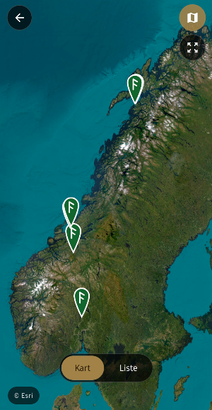
• View registered finds collected in map and gallery
• Open previous finds directly in the map and see where they were registered
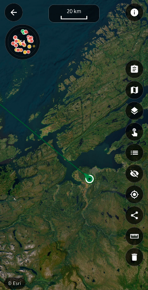
• Use the track log to document where you have gone while metal detecting
• Add images and notes along the way in a track
• Display multiple tracks on top of each other to compare search areas
• Use several different map types adapted to fieldwork and metal detecting
• Display optional map layers including property boundaries, cultural monuments, terrain, elevation and area information
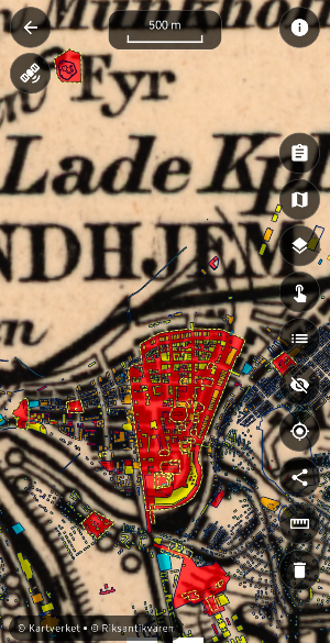
• Display historical maps and other publicly available map data from the Norwegian Mapping Authority and other public map services
• View your own finds, tracks and search areas directly in the map view
• Get an overview of metal detecting events in Norway and add them to your calendar
• Find useful links and resources for metal detecting, cultural monuments and the hobby
• Mark plots, properties or draw a search area yourself.
Fornfunn is developed with a focus on **practical fieldwork, local storage and privacy**. No login is required, and registered finds, landowner information, tracks and other user data are stored locally on the device.
The app does not send or store your registered data on an external server.
Fornfunn is designed specifically for practical use during metal detecting. Maps, GPS, find registration, landowner information, search areas, track log and reporting are combined in one app, so that documentation can be done while you are out in the field instead of being reconstructed afterwards.
Whether you are searching in fields, meadows, pastures, forests or other areas, the goal of Fornfunn is to make it easier to keep track of **where you have searched, what you have found, who the landowner is and what documentation belongs to each find**.
Similar Apps

ConstructionOnline
The complete power of ConstructionOnline, with you wherever you go.

Maserati Tridente
Your full Maserati experience, via mobile

Sea Trials - USCG License Exam
Upgrade USCG License

Walkbox Self-Guided Tours
Explore Portugal Your Way
Daily Harvest
Delicious plant-based meals, delivered to your freezer, ready when you are.
BaseMap: 3D Hunting Maps & GPS
3D Maps, Offline 3D, Location Sharing, Public & Private land, weather, wind, GPS
