CES Mobile GIS
Mobile GIS for field engineers to verify and document site infrastructure.

About CES Mobile GIS
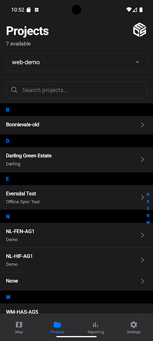
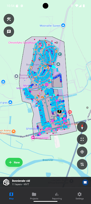
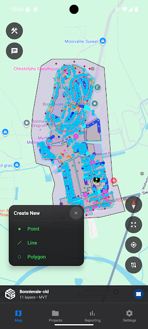
CES Mobile GIS empowers field engineers to efficiently verify, document, and manage site infrastructure data directly from the field.
Key Features:
- Interactive offline maps for site navigation and data capture
- Create and edit site elements (chambers, ducts, demand points, boundaries)
- Attach photos to site features for comprehensive documentation
- Work offline with automatic synchronization when connected
- Real-time location tracking and GPS accuracy monitoring
- Project-based organization for multi-site operations
- Secure authentication and role-based access control
Designed for telecommunications and utilities infrastructure verification, CES Mobile GIS streamlines field data collection with an intuitive interface optimized for both phones and tablets. All data syncs securely with your backend systems when connectivity is available.
Perfect for site surveys, as-built documentation, and infrastructure audits.
Similar Apps

ARI Maps
We put your life on the map

Velox Nc
Drive with VELOX. Generate excellent income, pay lower commission, and be your own boss.

EVN Drive
Fast & Smart EV Charging

Street View-360
Navigate with live GPS maps street view 3D globe traffic and family tracking.

台9線-蘇花路段即時路況資訊
We've converted construction mileage into precise coordinates on a map. Whether it's construction warnings or real-time road conditions, everything is displayed intuitively on the map, making it clearer for you before you set off, saving you time and giving you peace of mind on the road.
GPS Navigation & Route Finder
Easy GPS navigation app with maps, routes & live traffic info.
