台9線-蘇花路段即時路況資訊
We've converted construction mileage into precise coordinates on a map. Whether it's construction warnings or real-time road conditions, everything is displayed intuitively on the map, making it clearer for you before you set off, saving you time and giving you peace of mind on the road.

About 台9線-蘇花路段即時路況資訊
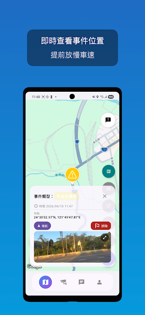
The core of the Provincial Highway 9 real-time traffic information app is to transform traffic information, originally displayed in kilometers, into an intuitive map display, helping road users quickly grasp the location of events and road conditions.
Key Features
【Kilometer Marker → Map Visualization】
• No more difficult-to-match information like "113K"
• Convert construction and incident locations into map markers, reducing searches and guesswork
• Quickly understand road sections and location relationships before setting off
【Government Construction Information Integration】
• Centralized organization of government construction information
• Makes construction sections and their impacts clearer, facilitating advance planning of itineraries and alternative routes
【Real-Time Traffic Reporting】
• Road users can report accidents, rockfalls, police, warnings, etc. in real time
• Fast updates, more closely reflecting actual road conditions
【CCTV Live Footage】
• Directly view the situation on-site, reducing uncertainty
• Combined with map location, it's easier to decide which route to take, wait, or change course
【Clear Coordinates and Road Section Marking】
• Provides not only event details but also clear location and road section information
• Lets you know "what happened" and "where it happened"
【Real-Time Forum】
• Check the latest discussions and on-site consensus before setting off
• In case of emergencies, users can exchange and supplement information, making road conditions more transparent and real-time.
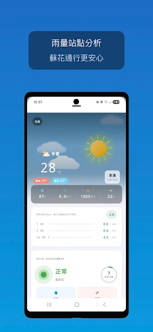
【Weather Risk Assessment】
• Integrates rainfall and earthquake data to automatically calculate risk scores.
• Maps simultaneously mark rain gauge stations along the route, making your driving safer.
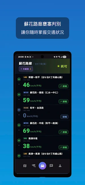
【Traffic Congestion Assessment】
• Marks congestion levels for different sections of the Suhua Highway.
• Provides a clear overview of current traffic conditions.
Reminders
• Road conditions may change at any time; please refer to on-site conditions and traffic control measures.
• Please concentrate on driving; it is recommended to check information when safely stopped.
Disclaimer: This application is a privately developed tool and is not a government agency or its affiliate, nor has it been authorized by any government agency.
All information sources are from publicly available government data (such as the Highway Bureau, Ministry of Transportation and Communications) or user reports, and are for reference only. Please refer to official announcements for actual information.
Similar Apps

izi.TRAVEL: Audio Tour Guides
Use Self-Guided Audio Tours for 2500 Cities & 3000 Museums with AI Itineraries.

Hikingbook: Hike, Bike & Run
Plan, track and share your trail adventures with Hikingbook.

TABA - Get a taxi in Korea
Affordable, Safe & Convenient - Korea’s Official Taxi App for Travelers

Tabelog - Food Guide in Japan
Find beloved restaurants in Japan and food guides for travelers from the U.S.
