

NaturTrak Sentinel
Maps & Navigation
Protecting nature is in your hands!
- Downloads
- 10+
- on Google Play
- Price
- Free
- No in-app purchases
- Updated
- Sep 20
- 2026 · v9.0.26
Screenshots


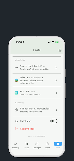
About NaturTrak Sentinel
NaturTrak – Nature protection in your hands
NaturTrak is a Hungarian-developed mobile application, which was specifically developed to support the everyday tasks of professionals, volunteers and government authorities working in the field of nature conservation.
GPS TRACK RECORDING
Record your field trips and observation routes in real time. The app also works with offline maps, so it won't let you down in forests, mountains, or areas without a mobile network. Routes can be exported.
MAPS AND NAVIGATION
Display topographic and orthophoto base layers, protected areas, Natura 2000 areas and individual points. The interactive map allows you to plan area divisions and task locations.
FAUNA AND FLORA IDENTIFICATION
Photo-based species identification with AI assistance. Document the animals and plants you observe, attach GPS coordinates and timestamps, and submit directly to the observation database.
COMMUNITY FEATURES AND SHARING
Share your observations with your colleagues and the conservation community. Real-time notifications about extraordinary events, rare species sightings, or emergencies.
STATE CONSERVATION TASKS
Built-in workflows for national park directorates, forestry authorities, and municipal conservation officers. Official event logs, report templates, and digital signature support.
NaturTrak was developed in collaboration with conservation professionals, based on their real-world field experiences. Join the national conservation network!
NaturTrak is a Hungarian-developed mobile application, which was specifically developed to support the everyday tasks of professionals, volunteers and government authorities working in the field of nature conservation.
GPS TRACK RECORDING
Record your field trips and observation routes in real time. The app also works with offline maps, so it won't let you down in forests, mountains, or areas without a mobile network. Routes can be exported.
MAPS AND NAVIGATION
Display topographic and orthophoto base layers, protected areas, Natura 2000 areas and individual points. The interactive map allows you to plan area divisions and task locations.
FAUNA AND FLORA IDENTIFICATION
Photo-based species identification with AI assistance. Document the animals and plants you observe, attach GPS coordinates and timestamps, and submit directly to the observation database.
COMMUNITY FEATURES AND SHARING
Share your observations with your colleagues and the conservation community. Real-time notifications about extraordinary events, rare species sightings, or emergencies.
STATE CONSERVATION TASKS
Built-in workflows for national park directorates, forestry authorities, and municipal conservation officers. Official event logs, report templates, and digital signature support.
NaturTrak was developed in collaboration with conservation professionals, based on their real-world field experiences. Join the national conservation network!
Alternatives to NaturTrak Sentinel
Looking for apps like NaturTrak Sentinel? Here is 1 similar Android app on Google Play.

| App | Rating | Price | Installs |
|---|---|---|---|
| NaturTrak Sentinel | – | Free | 10+ |
| KisTiszAPP | – | Free | 10+ |