Boonpoint: Boondocking
Dispersed camping on BLM & USFS land - official sources, water, dump, offline.
About Boonpoint: Boondocking
NOT A GOVERNMENT APP
Boonpoint is an independent app. It is not affiliated with, endorsed by, or representing the U.S. Government, the National Park Service, the
U.S. Forest Service, the Bureau of Land Management, Recreation.gov, California State Parks, or any other government agency. Public-land and
recreation data comes from publicly available datasets published by Recreation.gov (recreation.gov), the U.S. Forest Service (fs.usda.gov),
the Bureau of Land Management (blm.gov), California State Parks (parks.ca.gov), and OpenStreetMap (openstreetmap.org). Always confirm current rules, closures, and legality with the managing agency before camping.
LIVE PUBLIC-LAND MAP
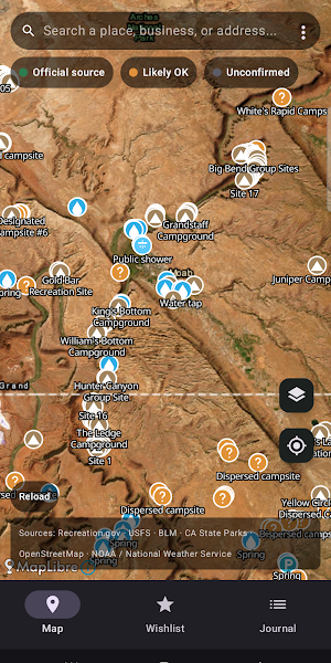
Real campsite data from Recreation.gov, US Forest Service, Bureau of Land Management, California State Parks, and OpenStreetMap. Boonpoint tells you where a pin came from, not whether camping is legal: "Official source" means a government dataset lists it, "Likely OK" means it's community-mapped and plausible, "Unconfirmed" means nobody has vouched for it. You still check the signs on-site.
VERIFIED TRIP JOURNAL
Anyone can claim they camped somewhere. On Boonpoint you only log a stay if your phone confirms you were actually there — within 200 meters of the spot. Add photos, fuel cost, companions, and a mini map; export any trip as a PDF.
COMMUNITY REVIEWS
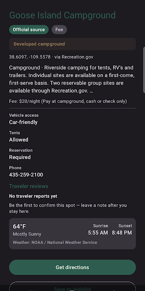
After a verified stay you can post how a spot was — and read what other travelers reported. Being there is the proof, not how long you stayed: got the knock and had to move on at 2am? You can still review from down the road. Water, dump, and propane spots can be reviewed too. Report or block anything off.
WATER, DUMP & PROPANE
A live resource layer maps drinking water (springs, taps, wells, RV potable-fill), RV dump stations, and propane refill — from OpenStreetMap. Tap a water pin to see whether it's potable.
BLM + USFS OVERLAYS
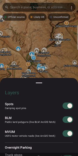
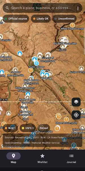
Amber polygons show BLM land where dispersed camping is typically legal. Yellow lines show USFS motor vehicle routes — the only legal access for dispersed camping in National Forests.
OFFLINE REGIONS
Download a region before you leave home — Boonpoint falls back to it when you're off-grid.
WEATHER + GOLDEN HOUR
NOAA National Weather Service forecast and sunrise/sunset at every spot.
DIRECTIONS HAND-OFF
One tap to Google Maps or Waze.
PRIVATE BY DESIGN
No analytics SDKs. No trackers. No ad IDs. No background location tracking — Boonpoint only reads your location while the app is open. Your trip journal stays private to you. The one public thing is community reviews you choose to post. Sign-in is only needed to post a review.
UNITED STATES ONLY
Boonpoint's spot data comes from US federal and state sources, so the map is empty outside the United States.
—— Pricing ——
Boonpoint is free for 7 days — the full app, no card required. After the 7 days you'll need Boonpoint Pro to keep using it.
• Monthly: $9.99/month
• Yearly: $49.99/year (~58% off)
Subscriptions renew automatically unless cancelled at least 24 hours before the end of the period. Payment is charged when you subscribe. Manage or cancel anytime in Google Play → Subscriptions.
Privacy: https://boonpoint.netlify.app/privacy.html
Terms: https://boonpoint.netlify.app/terms.html
Similar Apps

Maserati Tridente
Your full Maserati experience, via mobile

onWater Fish - Fishing Spots
Fishing points, maps, weather forecasts, property boundaries, & usgs streamflows
ParkUsher: Find Parking Easily
ParkUsher, Find Street Parking Instantly

Croux
Where Talent Meets Opportunity

Detecht - Motorcycle App & GPS
Motorcycle gps app for tracking, planning and navigation with crash detection.

Realbricks - Real Estate App
Passively invest in real estate to earn rental income + appreciation.
