

台北捷運路網圖
Maps & Navigation Contains ads
Select a MRT station to check the estimated travel time and fare. The system can automatically locate the nearest MRT station by pinpointing your phone's location. It also provides exit information and TPASS assistant functions.
- Downloads
- 2.4K+
- on Google Play
- Price
- Free
- No in-app purchases
- Updated
- Oct 2
- 2026 · v1.9
Screenshots



About 台北捷運路網圖
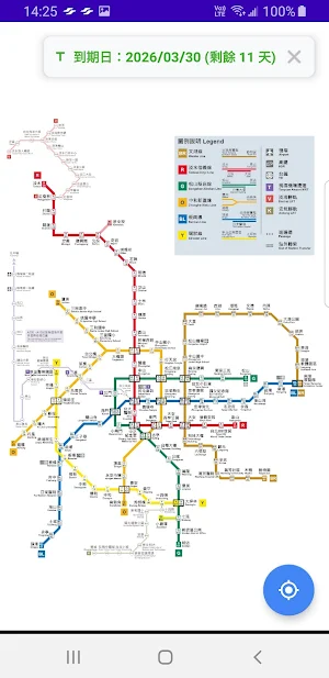
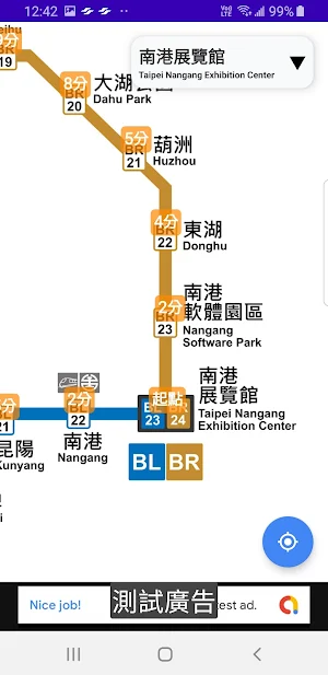
1. Select a MRT station to check estimated travel time and fare.
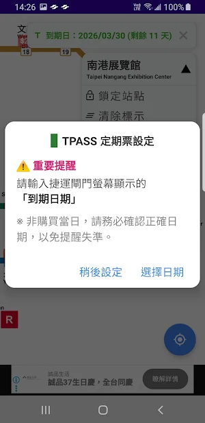
2. The upper right corner displays the current station name. The drop-down menu allows you to lock a station, clear its marker, display estimated travel time, switch between regular and discounted fares, access map navigation, exit information, and TPASS assistant.
3. The location function in the lower right corner retrieves your phone's GPS location and displays the nearest station.
Data Sources:
1. Taipei City Data Platform.
2. TDX Transportation Data Circulation Service.
2. The upper right corner displays the current station name. The drop-down menu allows you to lock a station, clear its marker, display estimated travel time, switch between regular and discounted fares, access map navigation, exit information, and TPASS assistant.
3. The location function in the lower right corner retrieves your phone's GPS location and displays the nearest station.
Data Sources:
1. Taipei City Data Platform.
2. TDX Transportation Data Circulation Service.
Alternatives to 台北捷運路網圖
Looking for apps like 台北捷運路網圖? Here are 6 similar Android apps on Google Play. 5 of the 6 are free to download.
-
卡拉影片合成
-
SList: Grocery Shopping List
-
Event Recorder
-
說話鬧鐘 / 語音新增鬧鐘 / 語音新增行事曆
-
EQR - Easy QR Code Reader
-
料理佳人( 付費無廣告 ) - 所有食譜一次收藏
| App | Rating | Price | Installs | Last updated | Compare |
|---|---|---|---|---|---|
| 台北捷運路網圖 | – | Free | 1,000+ | Oct 2, 2026 | |
| 卡拉影片合成 | – | Free | 50+ | Nov 5, 2026 | Compare |
| SList: Grocery Shopping List | – | Free | 100+ | Jul 17, 2024 | Compare |
| Event Recorder | – | Free | 100+ | – | Compare |
| 說話鬧鐘 / 語音新增鬧鐘 / 語音新增行事曆 | – | Free | 500+ | May 20, 2022 | Compare |
| EQR - Easy QR Code Reader | – | Free | 1,000+ | Jul 17, 2024 | Compare |
| 料理佳人( 付費無廣告 ) - 所有食譜一次收藏 | – | 4.99 USD | 10+ | Aug 14, 2023 | Compare |
Compare 台北捷運路網圖 with the top alternatives: ratings, updates, ASO score and keyword gaps →