

Map It Vilas County
Pilch & Barnet Travel iPhoneiPadiPod touch
Map It Vilas County is a free Travel app for iPhone and iPad by Pilch & Barnet. Rated 4.4/5 from 92 ratings. Requires iOS 15.4. Updated January 6, 2026.
- Rating
- 4.4
- 92 ratings
- Price
- Free
- on the App Store
- Size
- 292 MB
- Age 4+
- Updated
- Jan 6
- 2026 · v2.1.5
Screenshots



About Map It Vilas County
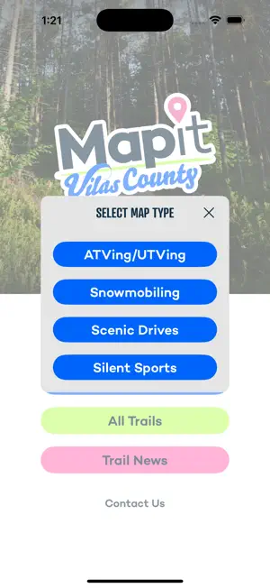
Explore dozens of public recreational trails in Vilas County, Wisconsin, with this app. Interactive maps help you explore the best spots for snowmobiling, ATVing, biking, hiking, cross-country skiing and more. Find and sort trails by length, location, activities, amenities and more.
Ratings & reviews
4.4
92 ratings
What’s new
Version 2.1.5 · Updated January 6, 2026
Updated surface type key for ATV/UTV and OHM trails
App privacy
The developer, Pilch & Barnet, reported these privacy practices to Apple.
Data Not Linked to You
The following data, which may be collected but is not linked to your identity, may be used for the following purposes:
- Usage Data: Product Interaction
Used for: Analytics
Alternatives to Map It Vilas County
Looking for apps like Map It Vilas County? Here are 6 similar apps on the App Store. The highest rated is The Next Trail (4.8/5), and all 6 are free to download.
-
 Groomer Tracking Systems
2.6
-
 The Next Trail
4.8
-
 GroomerTracker
4.7
-
 511 Wisconsin Road Conditions
4.6
-
 Trailbot: MTB Trail Conditions
4.8
-
 511 Wisconsin
1.8
| App | Rating | Price | Last updated | Compare |
|---|---|---|---|---|
| Map It Vilas County | 4.4 / 5 (92 ratings) | Free | January 6, 2026 | |
| Groomer Tracking Systems | 2.6 / 5 (7) | Free | Oct 4, 2026 | Compare |
| The Next Trail | 4.8 / 5 (42) | Free | Jan 31, 2026 | Compare |
| GroomerTracker | 4.7 / 5 (944) | Free | Mar 15, 2026 | Compare |
| 511 Wisconsin Road Conditions | 4.6 / 5 (1,174) | Free | Oct 21, 2026 | Compare |
| Trailbot: MTB Trail Conditions | 4.8 / 5 (360) | Free | Oct 20, 2026 | Compare |
| 511 Wisconsin | 1.8 / 5 (81) | Free | Aug 25, 2026 | Compare |