

HurriMap: Hurricane Tracker
Ultimate Enterprises Weather iPhoneiPadiPod touchApple Watch
HurriMap: Hurricane Tracker is a free Weather app for iPhone and iPad by Ultimate Enterprises. Rated 5.0/5 from 1 ratings. Requires iOS 15.0.
- Rating
- 5.0
- 1 ratings
- Price
- Free
- on the App Store
- Size
- 44 MB
- Age 4+
- Updated
- Oct 24
- 2026 · v1.1.1
Screenshots



About HurriMap: Hurricane Tracker
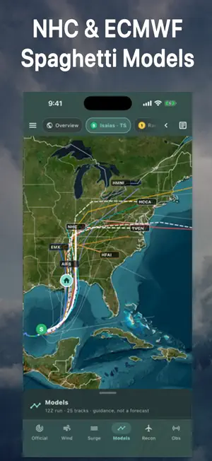
HurriMap: Hurricane and Typhoon Tracker When a storm is coming, every hour matters. HurriMap shows where it could go, when damaging winds could reach you, and when to be finished preparing. It's personal hurricane decision support: the official forecast, turned into a timeline for your own place. KNOW WHEN TO PREPARE • Enter the hours you need to get ready and see your "finish preparations by" time, built from the earliest reasonable arrival of tropical-storm-force winds. • See the earliest reasonable and most likely arrival of 39, 58 and 74 mph winds, drawn as labeled contours on the map. • Check your chances of damaging winds, whether you're in the cone, and how close the center will pass. Dangerous conditions can extend well beyond the cone. FOLLOW EVERY STORM • Hurricanes, tropical storms and developing systems in the Atlantic, Gulf of Mexico, Caribbean, and eastern and central Pacific, including Hawaii. • NEW: Typhoons and South Pacific cyclones for Guam, the Northern Mariana Islands and American Samoa, with track, wind field, danger area, models, wind chances and arrival times. • Forecast tracks, the cone of uncertainty, storm history, wind fields, and coastal and inland watches and warnings. • Two-day and seven-day formation chances for developing systems. • National Hurricane Center advisories, discussions, key messages and hazards, and Joint Typhoon Warning Center warnings, reflowed for your phone. • Infrared, visible and water vapor satellite imagery. ALERTS YOUR PHONE DOESN'T GET Your phone already receives hurricane, storm surge and tornado warnings through Wireless Emergency Alerts. HurriMap sends the alerts those don't: • Tropical storm warnings for your place, free. • With HurriMap Pro, hurricane, tropical storm, storm surge and typhoon watches: your head start, about 48 hours before the winds. • Private by design: your phone follows its National Weather Service forecast zone, and your location is never sent to our servers. • Every active watch, warning and local hurricane statement for your place, right in the app. FIND LOCAL INFORMATION • Check mapped storm surge risk where coverage is available. • View Florida evacuation zones and reported county evacuation, curfew and re-entry information. • Find nearby open U.S. shelters, with pet policies, accessibility and directions. Confirm availability before traveling. • Check buoy and coastal station reports for wind, pressure and waves. SHARE AND READ YOUR WAY • Share map images sized for posts, stories and video. • In English and Spanish, with NHC's Spanish advisories. EXPLORE MORE WITH HURRIMAP PRO An optional paid subscription adds: • Watch alerts for hurricane, tropical storm, storm surge and typhoon watches at your place. • Spaghetti model tracks, including European and AI models, and ensemble comparisons. • Intensity charts for every model. • Hurricane Hunter flight tracks and reconnaissance observations when available. • Scenario editing: change a storm's path or strength to explore "what if" possibilities. Scenarios are estimates, not forecasts. • An Apple Watch app and watch-face complications. • Drawing tools to mark up and share maps. Forecasts, watches and warnings in the app, tropical storm warning alerts, storm surge information, wind arrival times, NHC advisories and My place are free. Pro subscriptions renew automatically until canceled in your App Store account settings. Download HurriMap and be ready before the wind arrives. HurriMap is independent and is not affiliated with or endorsed by NOAA, NHC, NWS, JTWC, the U.S. Navy, the U.S. Air Force or FEMA. Typhoon wind chances and arrival times are HurriMap's estimates from JTWC forecasts. Alerts need internet access and notification permission; delivery isn't guaranteed. Keep Wireless Emergency Alerts enabled, use a weather radio, and follow local officials and evacuation orders. Privacy Policy: https://www.hurrimap.com/privacy.html Terms of Use: https://www.hurrimap.com/terms.html
What’s new
Version 1.1.1 · Updated October 24, 2026
Sharper maps, wherever you're tracking. • Step back through past Joint Typhoon Warning Center warnings, just like National Hurricane Center advisories. • Wind: the forecast-time slider now sits at the top of the panel, so the map stays in view while you drag it. • Models: typhoon forecasts are labeled JTWC, the agency that issues them.
App privacy
The developer, Ultimate Enterprises, reported these privacy practices to Apple.
Data Linked to You
The following data, which may be collected and linked to your identity, may be used for the following purposes:
- Location: Precise Location
- Identifiers: Device ID
Used for: App Functionality
Alternatives to HurriMap: Hurricane Tracker
Looking for apps like HurriMap: Hurricane Tracker? Here are 6 similar apps on the App Store. The highest rated is VortexWeather (5.0/5), and all 6 are free to download.
-
 VortexWeather
5.0
-
 WeatherMax: Daily Forecast
-
 Hurricane Tracker & Storm Map
-
 MesoRadar: Storm & Snow Radar
-
 NOAA Weather Radar - Forecast
-
 OBX Hurricane Tracker
2.9
| App | Rating | Price | Last updated | Compare |
|---|---|---|---|---|
| HurriMap: Hurricane Tracker | 5.0 / 5 (1 rating) | Free | October 24, 2026 | |
| VortexWeather | 5.0 / 5 (2) | Free | Oct 20, 2026 | Compare |
| WeatherMax: Daily Forecast | – | Free | Jan 30, 2026 | Compare |
| Hurricane Tracker & Storm Map | – | Free | Oct 12, 2026 | Compare |
| MesoRadar: Storm & Snow Radar | – | Free | Oct 20, 2026 | Compare |
| NOAA Weather Radar - Forecast | – | Free | Oct 12, 2026 | Compare |
| OBX Hurricane Tracker | 2.9 / 5 (14) | Free | Aug 13, 2025 | Compare |