

Zlatno Shetalishte
Georgy Iakovlev Travel iPhoneiPadiPod touch
Zlatno Shetalishte is a free Travel app for iPhone and iPad by Georgy Iakovlev. Requires iOS 16.4. Updated September 23, 2026.
- Price
- Free
- on the App Store
- Size
- 128 MB
- Age 4+
- Updated
- Sep 23
- 2026 · v1.0.1
Screenshots



About Zlatno Shetalishte
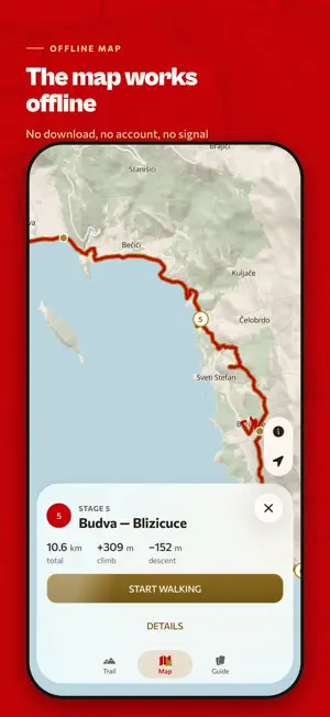
Zlatno Shetalishte is an offline guide to the coastal ecotrail that runs the length of Montenegro — from Herceg Novi on the Croatian border to Ada Bojana on the Albanian one. 190 km, ten stages, 5259 m of climb. The route is missing from general-purpose maps. This app carries it whole: the line from end to end, the ten stages it breaks into, and your own place on it — with no signal, no account and nothing to download. OFFLINE MAP The vector base map of the trail corridor and its hillshade ship inside the app. Nothing downloads on first launch and there is no tile server behind it. Panning, zooming and your own position on the route all work in airplane mode. TEN STAGES Every stage carries its length, its climb and an elevation profile built from SRTM data. Nineteen route variants come with it: bonus loops, and storm bypasses that pull the route off the water when the sea is rough. WALKING MODE Start a stage and the app follows it with you: how far is left, how much climb is left, how much of the stage is behind you — and what the route itself is about to do. A ferry crossing, a steep pitch, a stretch to treat with care. FIFTY-FIVE CARDS The trail's own cards, earned on foot: 44 places, the ten stages, and one for the whole trail. They open when you get there — no photo to take and no task to complete, just the walking. Four further slots are yours to fill: a selfie and three photos of your own kit. FIVE LANGUAGES English, Russian, Ukrainian, German and Montenegrin. WORKS WITH NO SIGNAL The map, the tracks and the stages live in the app bundle. There is no account and no sign-up. Your location is read to place you on the route and to measure what is left of the stage; it stays on the phone, and the app has no server to send it to. The trail is a project of NVO Ukrainogorci, Podgorica.
What’s new
Version 1.0.1 · Updated September 23, 2026
Corrected trail figures. The route is 190 km with 5259 m of climb, recomputed from the tracks end to end; stage lengths and elevation profiles moved with them. Every stage is now named by where it starts and where it ends, so it carries the same name on its card, on the map and in the stage list.
App privacy
The developer, Georgy Iakovlev, reported these privacy practices to Apple.
Data Not Collected
The developer does not collect any data from this app.
Alternatives to Zlatno Shetalishte
Looking for apps like Zlatno Shetalishte? Here are 6 similar apps on the App Store. The highest rated is Peak Passport (5.0/5), and all 6 are free to download.
-
 Peak Passport
5.0
-
 Travel Istanbul: Audio Guide
-
 Budva Audio Tour
-
 Прогулка по миру
-
 WanderBuddy
5.0
-
 Белград Путеводитель и Карта
| App | Rating | Price | Last updated | Compare |
|---|---|---|---|---|
| Zlatno Shetalishte | – | Free | September 23, 2026 | |
| Peak Passport | 5.0 / 5 (5) | Free | Sep 6, 2026 | Compare |
| Travel Istanbul: Audio Guide | – | Free | Oct 9, 2026 | Compare |
| Budva Audio Tour | – | Free | Jun 16, 2024 | Compare |
| Прогулка по миру | – | Free | Dec 11, 2025 | Compare |
| WanderBuddy | 5.0 / 5 (2) | Free | Oct 21, 2025 | Compare |
| Белград Путеводитель и Карта | – | Free | Apr 22, 2026 | Compare |
Compare Zlatno Shetalishte with the top alternatives: ratings, updates, ASO score and keyword gaps →