

CALINT Satellite View
株式会社moegi Education iPhoneiPadiPod touch
CALINT Satellite View is a free Education app for iPhone and iPad by 株式会社moegi. Requires iOS 17.0. Updated August 26, 2026.
- Price
- Free
- on the App Store
- Size
- 8 MB
- Age 4+
- Updated
- Aug 26
- 2026 · v1.3
Screenshots

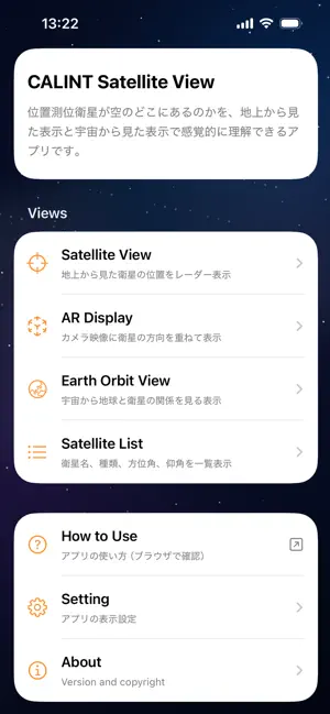

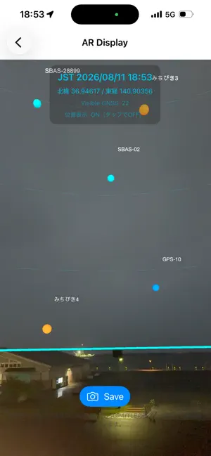
About CALINT Satellite View
CALINT Satellite View is an application for visualizing information about GNSS (Global Navigation Satellite System) satellites. Based on your current location, the app provides an intuitive view of where positioning satellites are located in the sky. It also helps users better understand satellite positioning systems, including Japan's Quasi-Zenith Satellite System (QZSS), known as Michibiki. Key Features: • Display GNSS satellite information • Visualize satellite positions • View satellite information on a map • Filter displayed satellites • Explore satellite positions at different times CALINT Satellite View is designed for anyone interested in satellite positioning, GNSS, and location-based technologies. CALINT is a series of applications designed to make location-based technologies more accessible, understandable, and useful.
What’s new
Version 1.3 · Updated August 26, 2026
Following the confirmation that QZS-7 reached its operational position in quasi-geostationary orbit, we updated its display using the latest publicly available orbital data. We also made minor adjustments.
App privacy
The developer, 株式会社moegi, reported these privacy practices to Apple.
Data Not Linked to You
The following data, which may be collected but is not linked to your identity, may be used for the following purposes:
- Location: Coarse Location
- Identifiers: Device ID
- Usage Data: Product Interaction, Advertising Data
- Diagnostics: Crash Data, Performance Data
Used for: Third-Party Advertising, App Functionality