

Asterousia Trails
Minas Liapakis Navigation iPhoneiPadiPod touch
Asterousia Trails is a free Navigation app for iPhone and iPad by Minas Liapakis. Requires iOS 13.0. Updated September 3, 2026.
- Price
- Free
- on the App Store
- Size
- 22 MB
- Age 4+
- Updated
- Sep 3
- 2026 · v1.0.2
Screenshots


About Asterousia Trails
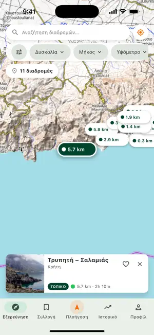
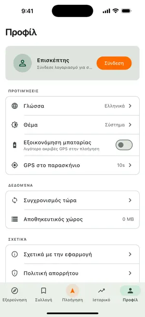
The Asterousia mountains run along the southern edge of Crete, between the Messara plain and the Libyan Sea. Their paths lead through gorges to beaches you can only reach on foot, past Byzantine chapels, old shepherds' crossings and long open views south towards Africa. Asterousia Trails takes you along those paths — and keeps working where the signal stops. CURATED TRAILS Every trail here was walked and documented on the ground: real distance, elevation gain, honest time estimate and difficulty. This is checked content, not a pile of user-uploaded tracks. WORKS OFFLINE Download a trail before you set off and the map, the route and every point of interest stay with you on the mountain — no data, no signal needed. NAVIGATION ON THE TRAIL See where you are on the route, how far you have come and how long is left. If you drift off the path, the app tells you. The map can turn with you or stay north-up, whichever you read more easily. RECORD YOUR HIKE Track your walk with the screen off to save battery. Distance, ascent and time are worked out for you. Your recordings stay on your phone. POINTS OF INTEREST Over 500 mapped points: trail waymarks, viewpoints, water sources, shelters, trailheads and places to take care. ELEVATION PROFILE See where the climbs are, and how steep, before you start. GREEK AND ENGLISH Fully translated, with a light and a dark theme. IN AN EMERGENCY Your coordinates in one tap, and a direct call to 112. NO ACCOUNT NEEDED The app works completely without signing up. An account is only for writing a review or building your own trail lists. YOUR DATA STAYS YOURS No ads. No trackers. Your location and your recorded hikes never leave your phone. PLEASE NOTE: Mountain walking carries risk. Always check the forecast, carry enough water, and tell someone where you are going. This app is an aid — not a substitute for your own judgement and preparation. Continued use of GPS running in the background can dramatically decrease battery life.
What’s new
Version 1.0.2 · Updated September 3, 2026
The UNESCO MaB emblem on the home screen. A new map layer with the Asterousia Biosphere Reserve boundary, in navigation. Cleaner trail cards, and filters without options that match no trail.
App privacy
The developer, Minas Liapakis, reported these privacy practices to Apple.
Data Linked to You
The following data, which may be collected and linked to your identity, may be used for the following purposes:
- Contact Info: Email Address, Name
- User Content: Other User Content
- Identifiers: User ID
Used for: App Functionality
Data Not Linked to You
The following data, which may be collected but is not linked to your identity, may be used for the following purposes:
- Usage Data: Product Interaction
Used for: Analytics
Alternatives to Asterousia Trails
Looking for apps like Asterousia Trails? Here are 6 similar apps on the App Store.


| App | Rating | Price | Last updated | Compare |
|---|---|---|---|---|
| Asterousia Trails | – | Free | September 3, 2026 | |
| Crete Bus | – | Free | Sep 3, 2026 | Compare |
| Maravel Garden | – | Free | Feb 27, 2026 | Compare |
| KtelBus Karditsas | – | Free | Aug 3, 2026 | Compare |
| KtelBus Thivas | – | Free | Jan 22, 2026 | Compare |
| KtelBus Xanthis | – | Free | Jan 23, 2026 | Compare |
| Thessaloniki Tourism Card | – | Free | Aug 28, 2026 | Compare |
Compare Asterousia Trails with the top alternatives: ratings, updates, ASO score and keyword gaps →