

geoROAD.ai
OFO Tech Utilities iPhoneiPadiPod touch
geoROAD.ai is a free Utilities app for iPhone and iPad by OFO Tech. Requires iOS 15.1. Updated October 21, 2026.
- Price
- Free
- on the App Store
- Size
- 199 MB
- Age 4+
- Updated
- Oct 21
- 2026 · v1.12.2
Screenshots

About geoROAD.ai
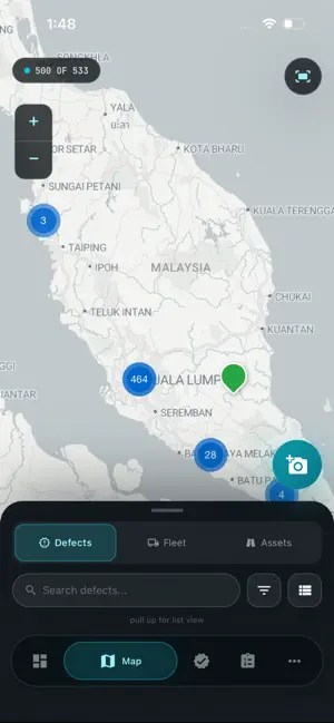
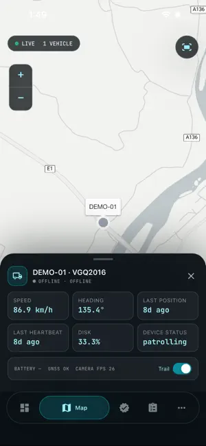
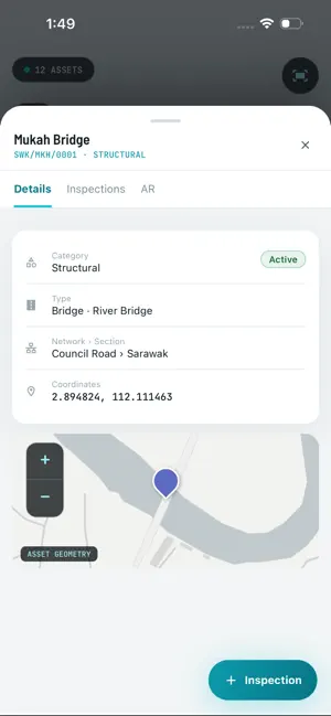
geoROAD.ai brings road and infrastructure asset management into the field. Part of the geoROAD.ai platform, the app gives inspectors, engineers and operations teams a live, map-based view of their network — assets, defects, devices and vehicles — with the tools to inspect, report and act on the spot. MAP-BASED NETWORK VIEW • See your organization's road network, assets and AI-detected defects on an interactive map. • Switch between defects and live fleet without leaving the map. AI DEFECT DETECTION & VALIDATION • Review road defects surfaced by geoROAD's AI vision system. • Validate or reject findings directly from your phone. • File manual defect reports with photos and GPS location. INSPECTIONS & WORK ORDERS • Capture field inspections with multi-photo uploads. • View and manage the work orders assigned to you and your team. LIVE VIEW — DEVICE CAMERAS • Stream live camera feeds from ENViS edge devices in the field. FLEET & DEVICE HEALTH • Track your organization's vehicles live on the map — position, status (moving, idle or offline) and a 24-hour trail. • Check per-device heartbeat and health at a glance. DASHBOARD & REPORTS • Monitor key metrics and generate reports on the go. BUILT FOR TEAMS, IN FIVE LANGUAGES • Fully localized in English, Spanish, Italian, Ukrainian and Greek. • Real-time updates keep your whole team in sync. ACCOUNT REQUIRED geoROAD.ai is a companion to the geoROAD.ai platform and requires an account provided by your organization. Contact your administrator or visit georoad.ai to get started.
What’s new
Version 1.12.2 · Updated October 21, 2026
Work orders: tap any milestone ahead to update status, so an assigned job can be marked completed in one step. After measuring with PotholeScan you return to the Update Progress sheet with the measurement shown, ready to confirm. Road patches measured after a repair now carry a 3D snapshot. Patrol in cars: steadier tracking of distant potholes, a guard against bonnet reflections, and the road model keeps running when the phone gets warm.
App privacy
The developer, OFO Tech, reported these privacy practices to Apple.
Data Not Collected
The developer does not collect any data from this app.
Alternatives to geoROAD.ai
Looking for apps like geoROAD.ai? Here are 6 similar apps on the App Store. The highest rated is TotalPave PCI (5.0/5), and all 6 are free to download.
-
 TapStory - Spatial Copilot
-
 Civil Site Calculator
-
 RCLink: Maintenance Management
-
 TotalPave PCI
5.0
-
 Roadly
-
 Roadly PRO
3.0
| App | Rating | Price | Last updated | Compare |
|---|---|---|---|---|
| geoROAD.ai | – | Free | October 21, 2026 | |
| TapStory - Spatial Copilot | – | Free | Apr 7, 2026 | Compare |
| Civil Site Calculator | – | Free | Aug 20, 2026 | Compare |
| RCLink: Maintenance Management | – | Free | Aug 29, 2026 | Compare |
| TotalPave PCI | 5.0 / 5 (2) | Free | Aug 6, 2026 | Compare |
| Roadly | – | Free | Jun 25, 2024 | Compare |
| Roadly PRO | 3.0 / 5 (1) | Free | Sep 15, 2026 | Compare |
Compare geoROAD.ai with the top alternatives: ratings, updates, ASO score and keyword gaps →