

MyRailwayMap
Yasuaki Yamashita Travel iPhoneiPadiPod touch
MyRailwayMap is a free Travel app for iPhone and iPad by Yasuaki Yamashita. Requires iOS 16.0. Updated October 22, 2026.
- Price
- Free
- on the App Store
- Size
- 65 MB
- Age 4+
- Updated
- Oct 22
- 2026 · v1.1.2
Screenshots
About MyRailwayMap
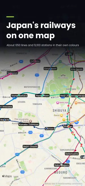
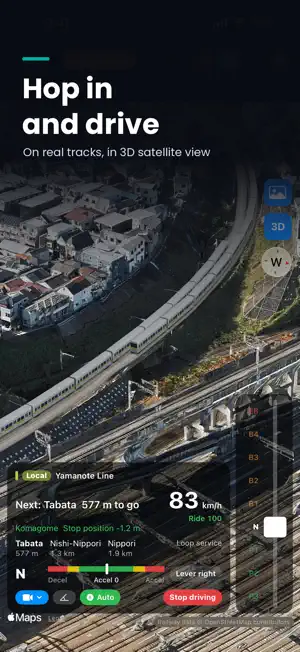
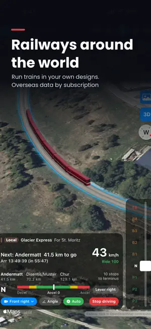
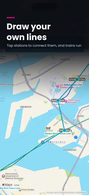
Explore railways in Japan and around the world on a map, and watch the trains run. ■ All of Japan's railways About 650 lines and 9,100 stations in their line colors: Shinkansen, JR, private railways, subways, trams, monorails and cable cars. Filter by type, such as just the Shinkansen. ■ Railways around the world (World Rail Packs) Download rail data by country or region: Europe (Switzerland, Germany, France, UK, Norway, Türkiye), Asia (South Korea, Taiwan, Hong Kong, Singapore), North America (US, Canada) and Oceania (Australia, New Zealand). Use it just like Japan's data, trains and your own lines included. More countries are on the way. * Requires a World Rail Packs subscription. Japan's rail data stays free. ■ Watch the trains run In train mode, trains move across the map. Move time with the clock bar or speed up to 3600×. Tap a train for its destination and arrival times, and "Follow" it. Tilt the map for 3D, or switch to satellite imagery (new). * All schedules are simulated by the app. They are not real timetables. * In tilted satellite view, lines and trains may appear off the tracks near tall buildings. ■ Drive the trains (new) Take the controls of any running train. Power and brake with the lever, stop on the mark and keep to the timetable. 8 camera positions and 4 angles, in 3D or top-down 2D. Start in Auto and take over anytime. ■ Design your trains Zoom in to see full-length car bodies. Design trains from 19 shapes, 13 paint styles and your own colors, and assign them to a line, service, timetable or single train. ■ Station and line details Tap a station for its lines and timetable, or a line for its stations. Search by name or show only chosen lines. ■ Build your own lines (one ad for an hour of use, or Premium) Place stations, connect them into lines and run through onto real lines. Extend existing lines from their end stations too. ■ Your own timetables and services Write timetables on a whole line or just a section: enter a departure time and the rest fill in. Create named rapid and express services, run through onto other lines, and let automatic trains run through or stay within a section. Add arrival times to hold trains for overtaking. (100 of your trains at once for free, unlimited with Premium.) ■ Stop charts and route maps Turn your services into a stop chart, or lines into a route map laid out from real station locations. Export as PDF or image. ■ Share your works Share lines, timetables, stop charts and route maps as a link or file. Links expire after 30 days; extend up to a year, update or revoke them. * Creating a link requires iCloud sign-in (not needed to receive). Anyone with the link can download it. ■ English and Japanese Use the app in English or Japanese. Names are shown in English with the Japanese alongside; search by either. ■ Premium (one-time purchase) - Unlimited train nodes (your own timetables) - CSV and JSON export and import - No ads ■ World Rail Packs (auto-renewable subscription) - Monthly or yearly, with a one-week free trial for new subscribers. Prices vary by country and are shown in the app - One subscription covers every pack. Separate from Premium - Payment is charged to your Apple ID at confirmation of purchase - It renews automatically unless auto-renew is turned off at least 24 hours before the end of the current period. Renewal is charged within 24 hours before the period ends - Manage or cancel in your App Store account settings - Any unused part of a free trial is forfeited when you purchase a subscription - Terms of Use: https://www.apple.com/legal/internet-services/itunes/dev/stdeula/ - Privacy Policy: https://github.com/yaapp1682-wq/railviewer-data/blob/main/PRIVACY.md ■ About the data Rail data © OpenStreetMap contributors (ODbL), published on GitHub. Some details may differ from reality; please tell us via the support page. All timetables and train movements are simulated; do not use them for real journeys.
What’s new
Version 1.1.2 · Updated October 22, 2026
You can now draw the track itself (ballast, sleepers and rails) when the map is zoomed in (turn it on under Settings → Display; tracks can also glow in the line color). Trains now run on separate tracks in each direction. Where there are four tracks, trains that stop at every station use the tracks with platforms. You can now set lines to single or double track. ・Under a line's "Line settings" → "Track (single & passing)", you can switch between double and single track and choose passing stations. Your own lines can be single track too ・On single track, trains wait at passing stations for oncoming trains ・On mostly single-track lines, the interval and times are calculated so trains pass each other at passing stations (these lines run fewer trains) ・Train details show where and how long a train waits, and station timetables mark these trains with ◆ While driving or following a train, "Selected lines" shows only that train's line. While driving, the train button at the top lets you end driving. In 3D satellite view, lines and trains now stay closer to the tracks in the photo. Flickering of train bodies and tracks is reduced. In some regions, you can now change your ad privacy settings. We have also updated the rail data for Japan.
App privacy
The developer, Yasuaki Yamashita, reported these privacy practices to Apple.
Data Used to Track You
The following data may be used to track you across apps and websites owned by other companies:
- Identifiers: Device ID
- Usage Data: Advertising Data
Data Linked to You
The following data, which may be collected and linked to your identity, may be used for the following purposes:
- Identifiers: Device ID
- Usage Data: Advertising Data
- User Content: Other User Content
Used for: Third-Party Advertising, App Functionality
Data Not Linked to You
The following data, which may be collected but is not linked to your identity, may be used for the following purposes:
- Location: Coarse Location
- Usage Data: Product Interaction
- Diagnostics: Crash Data, Performance Data, Other Diagnostic Data
Used for: Third-Party Advertising, App Functionality
Alternatives to MyRailwayMap
Looking for apps like MyRailwayMap? Here are 6 similar apps on the App Store. The highest rated is RailAround - Japan Railway Map (5.0/5), and all 6 are free to download.


| App | Rating | Price | Last updated | Compare |
|---|---|---|---|---|
| MyRailwayMap | – | Free | October 22, 2026 | |
| 全国路線地図 | – | Free | Oct 3, 2026 | Compare |
| Tetsulog - Japan Rail Log | – | Free | Oct 22, 2026 | Compare |
| Overtrain | – | Free | Oct 22, 2026 | Compare |
| DiaTouch | – | Free | Apr 15, 2026 | Compare |
| RailAround - Japan Railway Map | 5.0 / 5 (2) | Free | Sep 15, 2026 | Compare |
| TrainLCD | 5.0 / 5 (2) | Free | Oct 15, 2026 | Compare |
Compare MyRailwayMap with the top alternatives: ratings, updates, ASO score and keyword gaps →