

Drone Map: Airspace & Weather
YIGIT CAN TASOGLU Navigation iPhoneiPadiPod touch
Drone Map: Airspace & Weather is a free Navigation app for iPhone and iPad by YIGIT CAN TASOGLU. Requires iOS 18. Updated September 15, 2026.
- Price
- Free
- on the App Store
- Size
- 84 MB
- Age 4+
- Updated
- Sep 15
- 2026 · v1.0.4
Screenshots
About Drone Map: Airspace & Weather
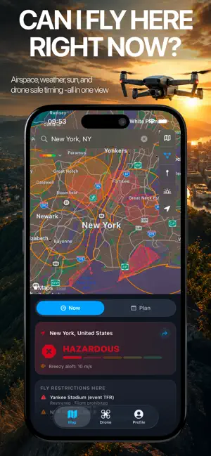
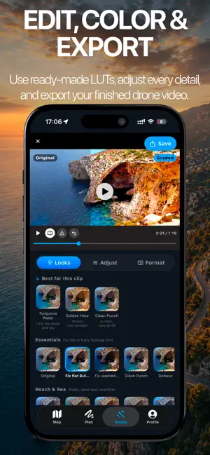
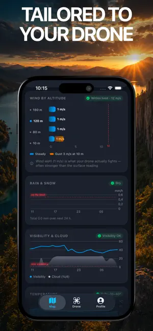
Drone Map Forecast is the cleanest answer to the one question that matters before takeoff: "Can I fly here, right now or in the next 7 days?" One map. Real airspace. Real wind aloft. Tuned to your drone. WHAT MAKES IT DIFFERENT • Airspace and flight weather on a single screen — not two apps, not a PDF • Wind at the altitudes you actually fly (10, 80, 120, 180 m), not just the calm reading on the ground • A 5-level fly verdict (Hazardous → Optimal) that combines wind, gusts, rain, visibility, temperature and any zone you are standing in • Drone-aware: pick your aircraft and the limits adapt — Mini 4 Pro is judged differently than Mavic 3 Pro • Anonymous by design: no sign-in, no accounts, no profile FLY-ZONE COVERAGE 22 countries bundled, with the official live overlays where regulators publish them: • Germany — live DFS dipul WMS (every restricted zone, every embassy, every hospital exclusion) • United States — 7,500+ zones from FAA, plus National Parks (NPS) and USFWS Wildlife Refuges as no-fly • Switzerland — official ED-318 geozones • 19 other countries — curated advisory zones around major airports and sensitive sites Coverage updates automatically when source data changes. No app update needed. WEATHER YOU CAN TRUST • Open-Meteo global forecast — no API key, no quota • Wind speed at 10/80/120/180 m above ground — see the column of air your drone actually fights through • 10-meter gusts overlaid on steady wind • Rain, visibility, cloud cover, temperature, sunrise, sunset, golden hours • NOAA Kp index for GPS reliability PLAN YOUR FLIGHT • 7-day hourly outlook with a verdict color per hour • Best windows — automatically surfaced 1–3 hour flying periods • Golden hour suggestions, sortable by score or by earliest • Tap any hour in the next 24 to get a custom score for that exact slot ON THE MAP • Apple MapKit — Standard, Muted, Satellite, Satellite 3D, Hybrid, Hybrid 3D • Sun bearings drawn from your pin so you can compose against the light • POI toggle for parks, beaches, marinas, campgrounds, stadiums, amusement parks • 1-tap recenter to roughly 500 m around you PRIVACY • No account, no sign-up, no email • Location stays on device unless you opt into update notifications • No advertising SDKs, no analytics SDKs, no third-party trackers • Optional push notifications use an anonymous Apple-issued token DISCLAIMER Drone Map Forecast is a planning aid, not a flight authority. Always confirm local rules and active NOTAMs/TFRs with your national aviation authority before flying. Advisory zones are best-effort — verdicts in those countries are guidance, not regulation. Made by drone pilots, for drone pilots. Drone Map Pro The following features require Drone Map Pro, available as a monthly or annual subscription (3-day free trial) or a one-time Lifetime purchase: • Full airspace restriction map (ENAIRE / DFS / IGN / BAZL / LFV overlays) • All weather charts (rain, visibility, cloud, temperature, Kp space weather) • Wind at flight altitude (10 / 80 / 120 / 180 m wind & gust profile) • 7-day flight planner (best windows, golden-hour timing, and hourly verdicts) Terms of Use (EULA): https://visionlabtech.com/products/drone-map/terms Privacy Policy: https://visionlabtech.com/products/drone-map/privacy
What’s new
Version 1.0.4 · Updated September 15, 2026
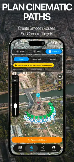
Two new countries, 66 new drones and a sharper route planner. NEW COUNTRIES • Denmark: official Trafikstyrelsen drone zones, refreshed nightly, including temporary no-fly zones for state visits and events • Norway: airport and aerodrome zones added to the map MORE DRONES • 66 new models, including DJI Neo 2, Avata 360, Lito X1 and Lito 1, Matrice 4E, Mavic 3 Enterprise, HoverAir X1 series, Antigravity A1, Autel EVO II, Potensic ATOM 3, Holy Stone, Ruko, Bwine, FIMI and BetaFPV • Separate profiles for Mini drones with the Plus battery, which changes the flight class • Corrected EU class labels for several DJI and Autel models. Your saved drone updates automatically PLAN • Camera beams now show for every waypoint, also when the camera points far away or at the horizon SUBSCRIPTIONS • Clearer plans: every annual price now shows its monthly equivalent Always check the official authority and current NOTAMs before you fly. Drone Map is a planning aid, not a flight authorisation.
App privacy
The developer, YIGIT CAN TASOGLU, reported these privacy practices to Apple.
Data Not Linked to You
The following data, which may be collected but is not linked to your identity, may be used for the following purposes:
- Purchases: Purchase History
- Usage Data: Product Interaction, Other Usage Data
- Location: Precise Location
- Identifiers: Device ID
Used for: Analytics, App Functionality
Alternatives to Drone Map: Airspace & Weather
Looking for apps like Drone Map: Airspace & Weather? Here are 6 similar apps on the App Store. The highest rated is DroneKoll - Airspace and map (5.0/5), and 5 of the 6 are free to download.
-
 DroneKoll - Airspace and map
5.0
DroneKoll - Airspace and map
5.0
-
 Hoverpoint: Drone No-Fly Zones
-
 Drone Scout: Flight Simulator
4.2
Drone Scout: Flight Simulator
4.2
-
 Drone Port
-
 Droniq TraX
-
 Swiss DroneMap
5.0
Swiss DroneMap
5.0
| App | Rating | Price | Last updated | Compare |
|---|---|---|---|---|
| Drone Map: Airspace & Weather | – | Free | September 15, 2026 | |
| DroneKoll - Airspace and map | 5.0 / 5 (1) | Free | Sep 27, 2026 | Compare |
| Hoverpoint: Drone No-Fly Zones | – | Free | Oct 6, 2026 | Compare |
| Drone Scout: Flight Simulator | 4.3 / 5 (8) | Free | Aug 25, 2026 | Compare |
| Drone Port | – | Free | Jan 24, 2026 | Compare |
| Droniq TraX | – | Free | Jul 20, 2026 | Compare |
| Swiss DroneMap | 5.0 / 5 (1) | 9.99 USD | Sep 1, 2026 | Compare |