

MTplans LiDAR Plan Point Cloud
Jerome Terrain Productivity iPhoneiPadiPod touch
MTplans LiDAR Plan Point Cloud is a free Productivity app for iPhone and iPad by Jerome Terrain. Requires iOS 17.6. Updated September 8, 2026.
- Price
- Free
- on the App Store
- Size
- 8 MB
- Age 4+
- Updated
- Sep 8
- 2026 · v2.1.1
Screenshots


About MTplans LiDAR Plan Point Cloud
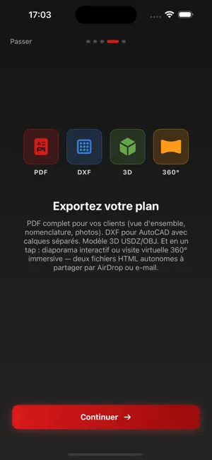
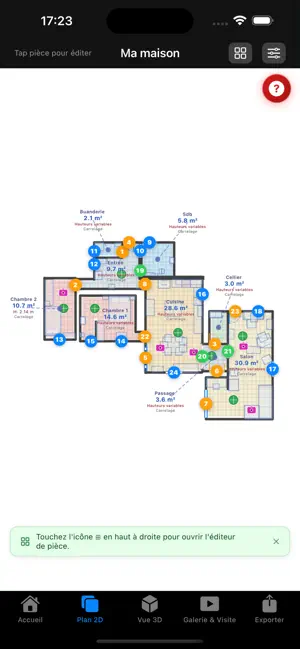
2D dimensioned plan AND pro 3D point cloud, in a single iPhone/iPad app. DXF with real technical layers, exportable E57, customizable client PDF. Building survey, new generation. I don't sell an app. I sell my experience as a self-employed building surveyor. NEW IN V2.0: FULL IPAD PRO SUPPORT Enjoy the big screen to visualize, organize and export your surveys in a layout designed for iPad: project sidebar, tool inspector, full-screen plan, natural gestures. LIDAR SCAN ROOM BY ROOM Walls, openings, furniture detected automatically. Multiple rooms assembled into a coherent global plan. Fast quantity takeoff, clean dimensioning, effortless building surveys. 3D POINT CLOUD For facades, complex interiors, strategic sections and height measurements. E57 export for your professional point cloud software. ROOM EDITOR Edit openings (type, direction, double leaf), add custom furniture (bathtub, WC, stairs, fireplace), place photos and 360 photos, take measurements. PROFESSIONAL EXPORTS • Full client PDF with customizable title block • DXF with distinct layers for your CAD software • E57 for your point cloud software • USDZ for augmented reality visualization • OBJ for your 3D software • Standalone 360 HTML virtual tour • PNG, JPEG, SVG images FOR WHOM • Building diagnosticians (energy audits, asbestos, lead) • Architects (fast preliminary design, pre-survey) • Quantity surveyors (takeoff, pricing) • Craftsmen (on-site quotes) • Real estate agents (visits, valuation) • Building contractors (quotes) • Project managers (dossier preparation) • Interior designers and home stagers FIELD HONESTY MTplans is a visual productivity tool, not a certified measuring device. iPhone/iPad LiDAR is centimeter accurate, enough for a preliminary project, a client sketch, a quick quote. For a document with legal value (certified habitable surface, regulatory diagnosis), use a certified land surveyor or diagnostician. YOUR DATA STAYS YOURS No tracking. No collection. No advertising. Everything stays on your device. Optional iCloud sync, encrypted by Apple. COMPATIBLE HARDWARE • iPhone 12 Pro and later (with LiDAR): full scan • iPad Pro 11 and 13 with LiDAR (since 2020): full scan • iPad without LiDAR (Air, mini, standard): view and export only • iOS / iPadOS 17.6 minimum FREE AND PRO Scan, visualize and edit for free. Professional exports (full PDF, DXF with layers, E57, printing) require the Pro subscription. Test everything before committing. jterraplans.fr · Independent iOS studio · Made in France Terms of Use: https://www.apple.com/legal/internet-services/itunes/dev/stdeula/
What’s new
Version 2.1.1 · Updated September 8, 2026
Fixed a rare crash when opening the scanner on iPhones that don't have a LiDAR sensor.
App privacy
The developer, Jerome Terrain, reported these privacy practices to Apple.
Data Not Collected
The developer does not collect any data from this app.
Alternatives to MTplans LiDAR Plan Point Cloud
Looking for apps like MTplans LiDAR Plan Point Cloud? Here are 6 similar apps on the App Store. The highest rated is ScanSpace: 3D LiDAR Floor Plan (5.0/5), and all 6 are free to download.
-
 FieldGraph - CAD made Easy
-
 ScanSpace: 3D LiDAR Floor Plan
5.0
-
 ALPHA Scan: Floor Plan Maker
-
 A3 Atlas Scanner
-
 Pointscape: Point Cloud Viewer
5.0
-
 SiteScope Tech: 3D Scan to CAD
5.0
| App | Rating | Price | Last updated | Compare |
|---|---|---|---|---|
| MTplans LiDAR Plan Point Cloud | – | Free | September 8, 2026 | |
| FieldGraph - CAD made Easy | – | Free | Apr 19, 2026 | Compare |
| ScanSpace: 3D LiDAR Floor Plan | 5.0 / 5 (1) | Free | Sep 17, 2026 | Compare |
| ALPHA Scan: Floor Plan Maker | – | Free | Oct 14, 2026 | Compare |
| A3 Atlas Scanner | – | Free | Sep 20, 2026 | Compare |
| Pointscape: Point Cloud Viewer | 5.0 / 5 (1) | Free | Oct 9, 2026 | Compare |
| SiteScope Tech: 3D Scan to CAD | 5.0 / 5 (4) | Free | Oct 14, 2026 | Compare |