

DirtMap - Offroad GPS & Trails
KING DROID SRL Navigation iPhoneiPadiPod touch
DirtMap - Offroad GPS & Trails is a free Navigation app for iPhone and iPad by KING DROID SRL. Requires iOS 15.0. Updated October 12, 2026.
- Price
- Free
- on the App Store
- Size
- 79 MB
- Age 4+
- Updated
- Oct 12
- 2026 · v1.2.359
Screenshots


About DirtMap - Offroad GPS & Trails
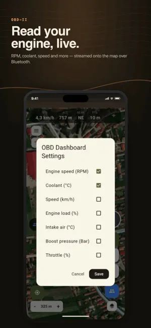
DirtMap is offroad navigation built for the trail, not the highway. Offline topographic and satellite maps, turn-by-turn offroad GPS navigation, GPX route planning, live convoy tracking with voice messages and SOS, and a full rally/competition engine — one rugged app for 4x4, overlanding, enduro and ATV. OFFLINE MAPS & TERRAIN • Topographic, satellite and OpenStreetMap layers with 3D terrain and hillshade • Download whole regions at home, then navigate with zero signal • Trail-difficulty overlay and offroad POIs (camping, water, fuel, viewpoints) OFFROAD TURN-BY-TURN NAVIGATION • Plan 4x4 routes point by point, or import any GPX track • Navigation and off-track alerts on dirt roads and forest tracks TRACK RECORDING + GPX • Record GPS tracks in the background with the screen off • Import and export GPX — your routes are always yours • Turn a trail day into a shareable map-flyby trip video LIVE CONVOY TRACKING • See every vehicle's live position on the map and follow the leader's trail • Push-to-talk voice messages to the whole group — no phone calls • SOS alert with position for emergencies • Friends join with a link or QR code — no account needed OFFROAD RALLY & COMPETITION ENGINE • Organize club runs, treasure hunts and offroad competitions with checkpoints • Live scoring, leaderboards, vehicle categories, TSD stages, no-go zones and penalties • Works fully offline on race day and syncs when signal returns — engineered for events with 100+ vehicles • Your first event is free VEHICLE & OBD-II • Live gauges from a Bluetooth OBD-II adapter: speed, RPM, coolant, battery, fault codes • Service, insurance and inspection reminders AND MORE • AR peak finder: point your camera at the horizon and name the mountains • Live rain radar and weather alerts • Area survey: walk a boundary, get m²/hectares • Try everything without creating an account (guest mode) Free to start — offline maps, route planning, track recording and GPX are included. Premium unlocks unlimited convoys, offline areas and cloud routes, with a 14-day free trial.
What’s new
Version 1.2.359 · Updated October 12, 2026
Buf fixes and improvements
App privacy
The developer, KING DROID SRL, reported these privacy practices to Apple.
Data Linked to You
The following data, which may be collected and linked to your identity, may be used for the following purposes:
- Location: Precise Location, Coarse Location
- Contact Info: Email Address, Name
- User Content: Photos or Videos, Audio Data
Used for: App Functionality