

Topoferrarisviewer
NGI-IGN National Geograhical Institute of Belgium Navigation iPhoneiPadiPod touch
Topoferrarisviewer is a free Navigation app for iPhone and iPad by NGI-IGN National Geograhical Institute of Belgium. Requires iOS 15.0.
- Price
- Free
- on the App Store
- Size
- 105 MB
- Age 4+
- Updated
- Jun 9
- 2026 · v1.0.4
Screenshots



About Topoferrarisviewer
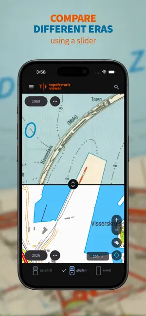
With the Topoferrarisviewer, or in short Topoferraris, you can view the Ferraris Cabinet Map from 1777 and compare it with various historical series of topographic maps from the National Geographic Institute. Naturally, the NGI's most recent topographic map at a scale of 1:25,000 is also included. You can choose from a total of 8 map layers depicting the Belgian landscape in different periods over the past 250 years. If you would like to know which traces of the past are still visible today, or how the landscape you are traveling through has changed over the past 250 years, select one of the walking suggestions or import your own GPX track, and head out with Topoferrarisviewer.
What’s new
Version 1.0.4 · Updated June 9, 2026
Minor performance and UI refinements Stability updates
App privacy
The developer, NGI-IGN National Geograhical Institute of Belgium, reported these privacy practices to Apple.
Data Not Linked to You
The following data, which may be collected but is not linked to your identity, may be used for the following purposes:
- Location: Precise Location, Coarse Location
Used for: App Functionality
Alternatives to Topoferrarisviewer
Looking for apps like Topoferrarisviewer? Here are 6 similar apps on the App Store. The highest rated is RoadmApp (1.0/5), and all 6 are free to download.
-
 Stoute schoenen
-
 RoadmApp
1.0
-
 SNCB Lab
-
 D'Ieteren Energy - Charging
-
 Mobiflow - smarter EV Charging
-
 Crashform
| App | Rating | Price | Last updated | Compare |
|---|---|---|---|---|
| Topoferrarisviewer | – | Free | June 9, 2026 | |
| Stoute schoenen | – | Free | Jul 3, 2026 | Compare |
| RoadmApp | 1.0 / 5 (1) | Free | Oct 22, 2026 | Compare |
| SNCB Lab | – | Free | Mar 11, 2026 | Compare |
| D'Ieteren Energy - Charging | – | Free | Oct 22, 2026 | Compare |
| Mobiflow - smarter EV Charging | – | Free | Oct 19, 2026 | Compare |
| Crashform | – | Free | Dec 5, 2025 | Compare |
Compare Topoferrarisviewer with the top alternatives: ratings, updates, ASO score and keyword gaps →