

Live Earth Camera: GPS Map 3D
Kim Yen Nguyen Travel iPhoneiPadiPod touch
Live Earth Camera: GPS Map 3D is a free Travel app for iPhone and iPad by Kim Yen Nguyen. Requires iOS 15.0. Updated March 4, 2026.
- Price
- Free
- on the App Store
- Size
- 96 MB
- Age 4+
- Updated
- Mar 4
- 2026 · v1.0.0
Screenshots
About Live Earth Camera: GPS Map 3D
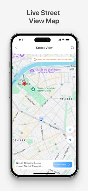
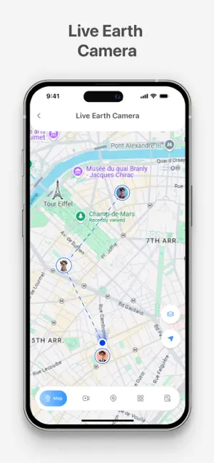
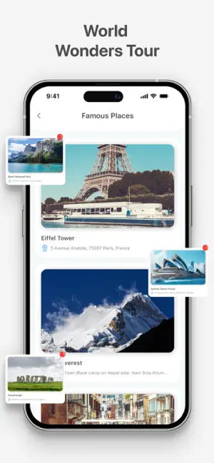
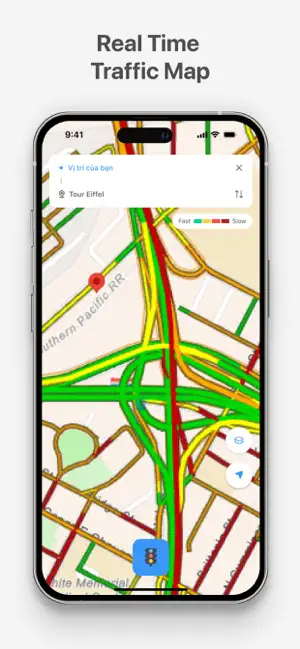
Live Earth Camera: GPS Map is a map and navigation app that helps you explore places using live street view and GPS tools. You can search locations, view maps, check traffic, and explore famous landmarks in one simple interface. The app supports daily navigation and virtual map exploration. Key Features of this Live Earth Camera App: - Live Earth Camera lets you view locations through live street view. Search for cities, landmarks, or addresses and see them on a 3D GPS map. - Street View allows you to move the map and select an address to see street-level images. It helps you check roads and surroundings for better planning. - GPS Map and Navigation provides route directions from your current location to your destination. The route is displayed clearly on the map for easy travel. - Traffic Status shows traffic conditions with color indicators. You can review traffic before starting your trip and choose a suitable route. - Famous Places and Seven Wonders sections allow you to explore well-known landmarks with map locations and basic details. - Share Address lets you select a location and send it to others. Favorites and Search History help you quickly return to previously viewed places. Why Choose Live Earth Camera: GPS Map - Simple and clear GPS map interface - Live street view and map exploration - Route directions with GPS navigation - Traffic status updates on the map - Explore famous places and world landmarks - Easy location search and address sharing - Save and manage favorite locations Live Earth Camera: GPS Map brings together live street view, GPS navigation, traffic map, and world exploration features in one app. It supports both practical navigation and virtual travel using maps and live earth camera access. Download Live Earth Camera: GPS Map to explore maps, check routes, and discover places around the world. If the app meets your needs, please leave a review and share your feedback.
App privacy
The developer, Kim Yen Nguyen, reported these privacy practices to Apple.
Data Used to Track You
The following data may be used to track you across apps and websites owned by other companies:
- Identifiers: Device ID
Data Linked to You
The following data, which may be collected and linked to your identity, may be used for the following purposes:
- Identifiers: Device ID
Used for: Third-Party Advertising, Analytics
Data Not Linked to You
The following data, which may be collected but is not linked to your identity, may be used for the following purposes:
- Usage Data: Product Interaction, Advertising Data
- Location: Precise Location
Used for: Third-Party Advertising, Analytics, App Functionality
Alternatives to Live Earth Camera: GPS Map 3D
Looking for apps like Live Earth Camera: GPS Map 3D? Here are 6 similar apps on the App Store. The highest rated is Earth Maps 3D: Live Satellite (5.0/5), and all 6 are free to download.
-
 Live Earth Camera Street View
4.6
Live Earth Camera Street View
4.6
-
 Globe 3D: Maps, Street & GPS
4.9
Globe 3D: Maps, Street & GPS
4.9
-
 Earth Maps 3D: Live Satellite
5.0
Earth Maps 3D: Live Satellite
5.0
-
 Street View : GPS Map Panorama
-
 Live Earth Map - Online Camera
-
 Live Earth Map :3D Street View
5.0
Live Earth Map :3D Street View
5.0
| App | Rating | Price | Last updated |
|---|---|---|---|
| Live Earth Camera: GPS Map 3D | – | Free | March 4, 2026 |
| Live Earth Camera Street View | 4.6 / 5 (18) | Free | Jul 28, 2026 |
| Globe 3D: Maps, Street & GPS | 4.9 / 5 (10) | Free | Sep 22, 2026 |
| Earth Maps 3D: Live Satellite | 5.0 / 5 (13) | Free | May 9, 2026 |
| Street View : GPS Map Panorama | – | Free | Feb 21, 2026 |
| Live Earth Map - Online Camera | – | Free | Sep 25, 2024 |
| Live Earth Map :3D Street View | 5.0 / 5 (1) | Free | Mar 22, 2026 |