

Orbital: Earth Monitor
Tolga MERIC Weather iPhoneiPadiPod touch
Orbital: Earth Monitor is a free Weather app for iPhone and iPad by Tolga MERIC. Rated 5.0/5 from 3 ratings. Requires iOS 17. Updated March 15, 2026.
- Rating
- 5.0
- 3 ratings
- Price
- Free
- on the App Store
- Size
- 36 MB
- Age 4+
- Updated
- Mar 15
- 2026 · v1.22
Screenshots

About Orbital: Earth Monitor
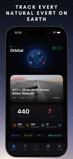
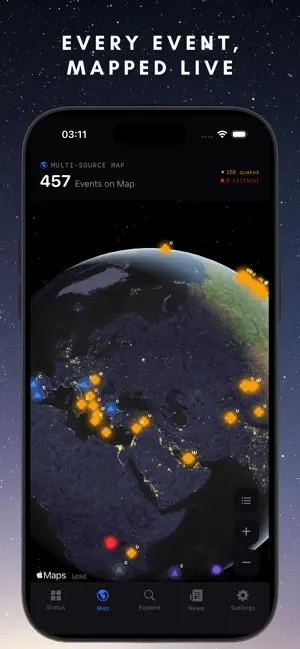
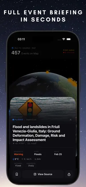
Orbital brings together data from the world's most trusted scientific agencies into one beautifully designed app — giving you a real-time view of natural events happening across the planet. REAL-TIME GLOBAL MONITORING Track earthquakes, wildfires, volcanic eruptions, severe storms, tsunamis, floods, and ice events as they happen. Every event is plotted on an interactive satellite map with detailed information at your fingertips. 10+ VERIFIED DATA SOURCES Orbital aggregates publicly available data from open government and scientific APIs — including EONET, FIRMS, FDSNWS, NWS, Copernicus EMS, GDACS, ReliefWeb, PTWC, and Open-Meteo — all in one unified interface. EXPLORE & DISCOVER Browse trending events, filter by type, search by region, and discover what's happening near you. Every event includes severity assessment, source attribution, and location data. NEWS & ALERTS Stay informed with verified humanitarian reports and real-time disaster alerts from global coordination systems. BEAUTIFUL DESIGN A carefully crafted dark interface designed for clarity and readability. Satellite map views, photo-rich event cards, and smooth animations throughout. KEY FEATURES — Live satellite map with event markers — Trending events ranked by severity — Nearby events with distance calculation — Detailed event sheets with weather data — Tsunami alerts from Pacific & Atlantic warning centers — News feed from international relief organizations — Severity-based color coding and alerts — Pull-to-refresh for latest data — Watchlist for saved events DATA SOURCES EONET · FIRMS · FDSNWS · NWS · Copernicus EMS · GDACS · ReliefWeb · PTWC · Open-Meteo Built with SwiftUI. No account required. No ads. Free to use.
What’s new
Version 1.22 · Updated March 15, 2026
Tsunami Tracking & Major Visual Upgrade NEW DATA SOURCES Real-time tsunami alerts from NOAA Pacific & Atlantic Tsunami Warning Centers GDACS (Global Disaster Alert & Coordination System) events now appear on the map with full detail cards 10 data sources now powering Orbital — the most comprehensive free disaster tracker ENHANCED EVENT DETAIL CARDS Satellite mini-map inset on event details showing exact location Severity color bar at the top of every card for instant visual priority Tsunami risk badge on earthquake events with potential ocean threat Estimated impact radius display for earthquakes based on magnitude Nearby events timeline — see what else happened within 48 hours in the same region Live relative time indicator ("2h ago") with event-colored accent Weather condition now shows SF Symbol icon + condition name, not just numbers Source reliability indicator (verified/official/satellite) next to data source name Magnitude visual scale bar for earthquakes (1.0–10.0 gradient fill) FIXES & IMPROVEMENTS EONET day range selector (7/14/30/60/90 days) now properly refreshes all data sources Drought events now display correct photo assets Improved unified event pipeline — all sources rebuild when settings change
App privacy
The developer, Tolga MERIC, reported these privacy practices to Apple.
Data Not Collected
The developer does not collect any data from this app.
Alternatives to Orbital: Earth Monitor
Looking for apps like Orbital: Earth Monitor? Here are 6 similar apps on the App Store. The highest rated is Comparecast: Weather Models (5.0/5), and all 6 are free to download.
-
 Zephyr Weather
3.9
Zephyr Weather
3.9
-
 MyWeather One - Smart Weather
-
 Weather Goose
4.9
Weather Goose
4.9
-
 Comparecast: Weather Models
5.0
Comparecast: Weather Models
5.0
-
 Radar Pro
4.6
Radar Pro
4.6
-
 VeriSky: Weather & Rain Radar
5.0
VeriSky: Weather & Rain Radar
5.0
| App | Rating | Price | Last updated |
|---|---|---|---|
| Orbital: Earth Monitor | 5.0 / 5 (3 ratings) | Free | March 15, 2026 |
| Zephyr Weather | 3.9 / 5 (7) | Free | Mar 21, 2026 |
| MyWeather One - Smart Weather | – | Free | Mar 22, 2026 |
| Weather Goose | 4.9 / 5 (25) | Free | Sep 28, 2026 |
| Comparecast: Weather Models | 5.0 / 5 (4) | Free | Aug 10, 2026 |
| Radar Pro | 4.6 / 5 (182) | Free | Mar 21, 2026 |
| VeriSky: Weather & Rain Radar | 5.0 / 5 (18) | Free | Sep 16, 2026 |