

Township Canada
MAPS & APPS INC. Navigation iPhoneiPadiPod touch
Township Canada is a free Navigation app for iPhone and iPad by MAPS & APPS INC. Requires iOS 18.0. Updated September 3, 2026.
- Price
- Free
- on the App Store
- Size
- 68 MB
- Age 4+
- Updated
- Sep 3
- 2026 · v2.3
Screenshots
About Township Canada
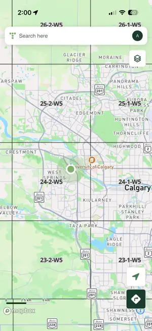
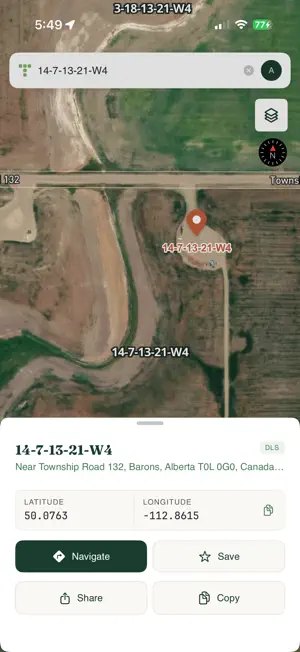
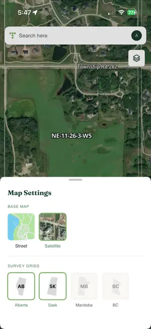
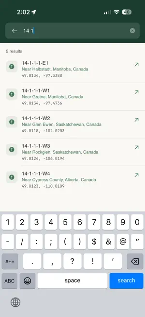
Township Canada is the go-to app for professionals who work with legal land in Western Canada — find any parcel, and everything on it. Trusted since 2017 by thousands of surveyors, oil & gas workers, and agricultural consultants. Search by legal description, GPS coordinates, or place name to instantly locate any parcel. Get turn-by-turn directions to remote sites. View precise survey grids overlaid on satellite and street maps. Open detailed parcel reports with soil, crop, well, and pipeline data. Save your most-visited parcels for quick access. FEATURES • Search by Legal Description, Coordinates, or Place Name Locate any parcel using DLS notation like NE-14-24-4-W5M or NTS references for British Columbia. Search by GPS coordinates or place names when you need flexibility. Peace River parcels in BC show both their DLS and NTS references. • Turn-by-Turn Navigation Get directions to any land parcel. No street address needed. Navigate directly to remote locations for field work, site visits, and inspections. • Precise Grid Overlays View township, range, section, quarter-section, and legal subdivision boundaries. BC users get full NTS series, block, unit, and quarter-unit overlays. All grids are vector-based for crisp rendering at any zoom level. • Save Favourite Locations Bookmark frequently accessed parcels for instant recall. Ideal for ongoing projects and repeat site visits. • Professional Map Views Switch between Street and Satellite views. Both support full DLS/NTS grid overlays for complete situational awareness. PARCEL REPORTS Tap any parcel to open a report. Two optional data bundles take you beyond the boundary line: • Agriculture Soil order, texture, drainage, and slope. LSRS productivity scores, Land Capability (CLI) classes, five-year crop rotation history, drought severity, and wetlands — plus an Agriculture map overlay. Sourced from AAFC, AGRASID, CLI, ABMI, and the Canadian Drought Monitor. • Energy Wells with licence status and fluid type, trailing-12-month production, pipeline crossings with substance and H₂S level, facilities, operator breakdowns, and Crown mineral tenure — plus an Energy map overlay with status-coded wells. Sourced from the AER, OWA, Petrinex, and Alberta Crown tenure. COVERAGE Alberta: Full DLS grid (townships, sections, quarters, LSDs) Saskatchewan: Full DLS grid Manitoba: Full DLS grid and River Lots British Columbia: Full DLS and NTS grids (series, blocks, units, quarter-units) Energy & Agriculture map layers: all four provinces WHO IT'S FOR • Surveyors and geomatics professionals • Landmen and land agents • Oil and gas field workers • Agricultural consultants and farm managers • Real estate professionals • Forestry and natural resource managers • Anyone working with legal land in Western Canada SUBSCRIPTION Township Canada requires a license key. Subscriptions are available monthly or annually at townshipcanada.com, with optional Agriculture and Energy data bundles. One license works on one device at a time; deactivate and transfer between devices as needed. PRIVACY No analytics tracking. No ads. Your search history and saved locations stay on your device. See our full privacy policy at https://www.townshipcanada.com/privacy-policy. SUPPORT Questions or feedback? Email [email protected] or visit townshipcanada.com.
What’s new
Version 2.3 · Updated September 3, 2026
Fixes an issue where satellite imagery could fail to load, leaving the map dark while roads and labels still appeared. Maps now recover on their own, and show a clear message with a retry if they cannot. More reliable turn-by-turn navigation.
App privacy
The developer, MAPS & APPS INC., reported these privacy practices to Apple.
Data Not Linked to You
The following data, which may be collected but is not linked to your identity, may be used for the following purposes:
- Location: Precise Location
Used for: App Functionality
Alternatives to Township Canada
Looking for apps like Township Canada? Here are 6 similar apps on the App Store. The highest rated is Land Lookup (5.0/5), and all 6 are free to download.
-
 Land Lookup
5.0
-
 Oilfield Route: Offline GPS
5.0
-
 Prairie Locator
1.0
-
 Rangeline: LSD & Land GPS
-
 OilTrails
4.2
-
 Rig Finder - GeoActivity
4.4
| App | Rating | Price | Last updated | Compare |
|---|---|---|---|---|
| Township Canada | – | Free | September 3, 2026 | |
| Land Lookup | 5.0 / 5 (2) | Free | Sep 7, 2026 | Compare |
| Oilfield Route: Offline GPS | 5.0 / 5 (1) | Free | Oct 10, 2026 | Compare |
| Prairie Locator | 1.0 / 5 (1) | Free | May 28, 2024 | Compare |
| Rangeline: LSD & Land GPS | – | Free | Aug 26, 2026 | Compare |
| OilTrails | 4.2 / 5 (11) | Free | Aug 31, 2026 | Compare |
| Rig Finder - GeoActivity | 4.4 / 5 (12) | Free | Oct 17, 2026 | Compare |
Compare Township Canada with the top alternatives: ratings, updates, ASO score and keyword gaps →