

Gressoney Hikes
Angelo Attilio Mariani Travel iPhoneiPadiPod touch
Gressoney Hikes is a free Travel app for iPhone and iPad by Angelo Attilio Mariani. Rated 5.0/5 from 1 ratings. Requires iOS 15.0. Updated October 8, 2026.
- Rating
- 5.0
- 1 ratings
- Price
- Free
- on the App Store
- Size
- 122 MB
- Age 4+
- Updated
- Oct 8
- 2026 · v2.8.0
Screenshots
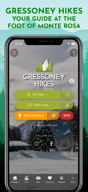


About Gressoney Hikes
Explore the Gressoney trails like never before! Whether you are in Gressoney-Saint-Jean or Gressoney-La-Trinité, the "Sentieri di Gressoney" app is your ideal companion for discovering the best itineraries at the foot of Monte Rosa. The app can still be used anywhere. Why choose this app? • Offline maps, photos, and trail descriptions: Don't worry about your connection. Download maps and trail information and consult them even in the most isolated parts of the mountains. • Navigation and GPX: view your location in real time and record your tracks. You can also import external GPX files to follow new routes. • Audible alert when you stray from the trail: even if your phone is in your pocket, an alarm will alert you if you're straying from the trail • Mountain Safety: in case of emergency, quickly send an SMS with your precise location to a contact in your address book. • Useful Real-Time Info: up-to-date local weather, bus schedules, ski lift status, and mountain huts always at your fingertips. • Check out the full calendar of all the tourist events included in the Gressoney Walser Festival. • Keep track of the peaks you have reached thanks to your Personal Diary. • Pre-hike checklist: you will never forget anything before setting off on your day on the trails. Plan your next adventure in Gressoney with the most comprehensive tool!
What’s new
Version 2.8.0 · Updated October 8, 2026
1 October 2026 • New "Calculate route" feature to plan your hikes by freely setting start and end points. • Trails starting at Stafal/Tschaval are now listed separately from Gressoney-La-Trinité. • "Tips for hikers" can now be found in the "... More" menu on the homepage. • Fixed an error when sharing personal GPX tracks.
App privacy
The developer, Angelo Attilio Mariani, reported these privacy practices to Apple.
Data Not Linked to You
The following data, which may be collected but is not linked to your identity, may be used for the following purposes:
- Location: Precise Location, Coarse Location
- Identifiers: User ID, Device ID
- Usage Data: Product Interaction, Other Usage Data
- Diagnostics: Performance Data
- Contacts: Contacts
Used for: Analytics, Product Personalization, App Functionality
Alternatives to Gressoney Hikes
Looking for apps like Gressoney Hikes? Here are 6 similar apps on the App Store. The highest rated is #vdatransports (3.4/5), and all 6 are free to download.
-
 SentieriDelLys
-
 Cervino Outdoor
-
 Aosta Valley Card
-
 Cultura a porte aperte
-
 #vdatransports
3.4
-
 Alagna.it
| App | Rating | Price | Last updated | Compare |
|---|---|---|---|---|
| Gressoney Hikes | 5.0 / 5 (1 rating) | Free | October 8, 2026 | |
| SentieriDelLys | – | Free | Jun 18, 2024 | Compare |
| Cervino Outdoor | – | Free | Sep 28, 2026 | Compare |
| Aosta Valley Card | – | Free | Aug 26, 2026 | Compare |
| Cultura a porte aperte | – | Free | Aug 27, 2026 | Compare |
| #vdatransports | 3.4 / 5 (5) | Free | Apr 27, 2026 | Compare |
| Alagna.it | – | Free | Aug 11, 2026 | Compare |
Compare Gressoney Hikes with the top alternatives: ratings, updates, ASO score and keyword gaps →