

Macoui: Marine Weather Routing
SELIM ARSLAN BENALI BENSENOUCI Navigation iPhoneiPadiPod touch
Macoui: Marine Weather Routing is a free Navigation app for iPhone and iPad by SELIM ARSLAN BENALI BENSENOUCI. Requires iOS 15.0. Updated October 4, 2026.
- Price
- Free
- on the App Store
- Size
- 21 MB
- Age 4+
- Updated
- Oct 4
- 2026 · v1.4.11
Screenshots
About Macoui: Marine Weather Routing
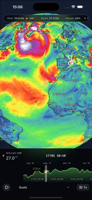
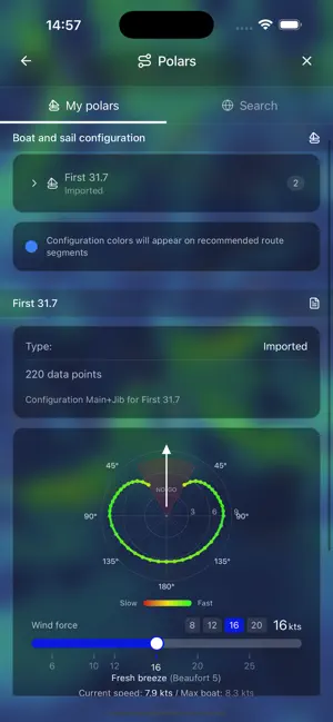
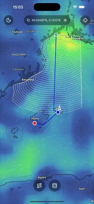
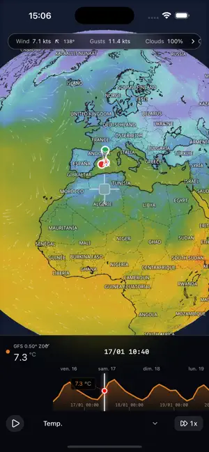
Macoui helps you prepare sailing passages and follow your progress on board. Keep marine weather, charts, GPS tracks and boat instruments in one app. Marine weather View wind, gusts, waves and currents on the map, play the forecast animation or follow changes in the weather graphs. Depending on the model and available data, you can also check pressure, rain, cloud cover, temperature and atmospheric instability (CAPE). Choose GFS 0.25° or 0.50°, ECMWF IFS, ARPEGE, AROME, ICON Global, ICON-EU or ICON-D2. GFS Wave provides wave forecasts. Current models include Copernicus Global, IBI, MED, Baltic and ENWS. Forecast coverage and duration vary by model. Routes and boat polars Create routes and waypoints on the map. Import your boat's polars or search for them directly in the app. View the polar diagrams, manage sail configurations and export your polars. Calculate and compare routes using different weather models and departure times. Set wind and wave limits, current options, distance from the coast, polar efficiency and sailing or motoring parameters. Review duration, distance, speed, VMG and estimated arrival times. Export routes and routing results as GPX files. With an internet connection, share a route by link or import a route shared by another sailor. GPS position and tracks Follow your position using your device's GPS or your connected boat GPS. Copy GPS coordinates and measure distance and bearing between two points. Start and stop a track recording, view saved tracks on the map and check their statistics. Import and export tracks in GPX format. Location permission is required. Boat instruments and AIS On the boat's Wi-Fi network, connect a NMEA gateway over TCP or UDP, or a compatible Signal K server. Build your instrument display from the measurements received, such as speed, heading, wind, depth and water temperature. A wind dial shows apparent and true wind. View AIS targets supplied by your equipment. An AIS receiver or compatible source is required. Macoui does not provide a worldwide internet AIS feed. Keep the app in the foreground to receive instrument data. Offline charts and data Import raster MBTiles charts and display them over the base map. Vector MBTiles files are not supported. You must have the charts and the rights needed to use them. Before departure, complete the app's initial setup and download the maps and forecasts you need. Select the area, models and forecast duration, then check your downloads and storage use. You can enable automatic updates when you return to the app. Data saved on your device can be used for weather viewing and routing without internet access. Updates need a connection, as do online polar searches and route sharing. Macoui is available on iPhone and iPad. Night mode, French and English language settings and tutorials are available in the app. Suggested routes are a navigation aid. Check forecast dates and coverage. Macoui does not replace current official nautical charts and information, onboard instruments or your judgement as a navigator.
What’s new
Version 1.4.11 · Updated October 4, 2026
- Improved AIS target display, with vessel details accessible directly on the map. - Your boat stays visible above AIS targets. - Consistent recentering when using GPS or onboard instruments. - Fixed the weather crosshair and information bubble disappearing outside GRIB coverage.
App privacy
The developer, SELIM ARSLAN BENALI BENSENOUCI, reported these privacy practices to Apple.
Data Not Collected
The developer does not collect any data from this app.
Alternatives to Macoui: Marine Weather Routing
Looking for apps like Macoui: Marine Weather Routing? Here are 6 similar apps on the App Store. The highest rated is qtVlm (3.7/5), and all 6 are free to download.


| App | Rating | Price | Last updated | Compare |
|---|---|---|---|---|
| Macoui: Marine Weather Routing | – | Free | October 4, 2026 | |
| CH16 | – | Free | Aug 15, 2026 | Compare |
| Routage Voile | – | Free | Sep 22, 2026 | Compare |
| qtVlm-Companion | – | Free | Oct 23, 2023 | Compare |
| qtVlm | 3.7 / 5 (9) | Free | Jul 24, 2026 | Compare |
| BoatMap - Charts, GPS, Weather | – | Free | Oct 6, 2026 | Compare |
| ProSkipper | – | Free | Aug 7, 2024 | Compare |