

MarineWaves
RGKlouda Navigation iPhoneiPadiPod touch
MarineWaves is a free Navigation app for iPhone and iPad by RGKlouda. Requires iOS 16.0. Updated July 29, 2026.
- Price
- Free
- on the App Store
- Size
- 20 MB
- Age 4+
- Updated
- Jul 29
- 2026 · v1.3
Screenshots

About MarineWaves
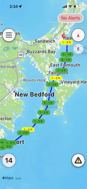
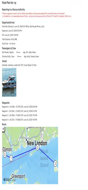
CROWD-SOURCED CONDITIONS See wave height, weather, debris, wildlife, and Coast Guard sightings reported by other boaters nearby — updated live, with a clear distinction between a report at someone's actual position and one pinned to a spot on the chart. ROUTE CHARTING Draw a route by hand, drop waypoints with a tap, or import one straight from Navionics as a GPX file. FLOAT PLANS Log your vessel, your crew, departure and ETA, and a rescue authority contact before you leave the dock — then share it. LIVE POSITION SHARING Share your real-time position and ETA with the crew and contacts on your float plan while you're underway. WEATHER, TIDES & ALERTS NWS weather alerts and a live NOAA tide curve for your nearest station, right on the chart screen. BOAT & CREW PROFILES Save your boat's details and your regular crew once, then reuse them across every trip. MarineWaze is an informational aid, not a substitute for official navigation resources or prudent seamanship. See the in-app Navigation and Safety Disclaimer for details.
App privacy
The developer, RGKlouda, reported these privacy practices to Apple.
Data Linked to You
The following data, which may be collected and linked to your identity, may be used for the following purposes:
- Location: Precise Location
- Contact Info: Name
- Identifiers: User ID
Used for: App Functionality