

GPS Geotag Photos & Camera Map
truong nguyen xuan Utilities iPhoneiPadiPod touch
GPS Geotag Photos & Camera Map is a free Utilities app for iPhone and iPad by truong nguyen xuan. Rated 2.3/5 from 20 ratings. Requires iOS 16.4.
- Rating
- 2.3
- 20 ratings
- Price
- Free
- on the App Store
- Size
- 109 MB
- Age 4+
- Updated
- Aug 21
- 2026 · v5.3
Screenshots



About GPS Geotag Photos & Camera Map
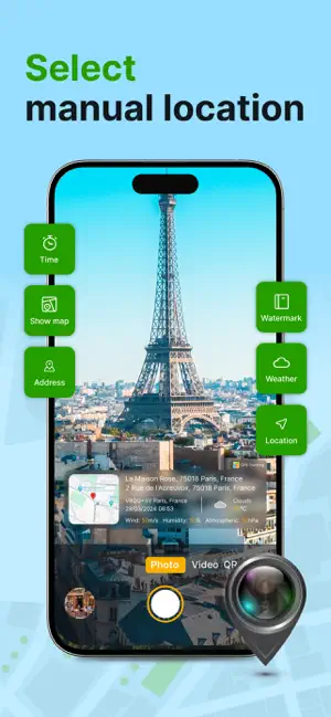
Capture, Tag, Remember. All in One Place. Geotag Photos & Camera Map is your ultimate companion for capturing memories with precise location context. More than just a camera, it's a powerful tool that automatically tags every photo and video with GPS coordinates, weather data, and creates a personal visual map of your adventures. Key Features: All-in-One Media Hub: Seamlessly switch between high-quality Photo Camera and Video Recorder right within the app. No need to jump between different applications. Automatic & Rich Geotagging: Every shot is automatically embedded with precise GPS location (latitude/longitude), address, and even real-time weather conditions (temperature, conditions) at that moment. Never forget "where" or "when" again. Your Personal Camera Map: Visualize your life's journey on an interactive map! See all your geotagged photos and videos displayed as pins. Tap any pin to instantly view the media and its saved details. Relive your travels and memories geographically. Built-in QR Code Scanner: A versatile tool at your fingertips. Quickly scan QR codes for links, menus, information, or Wi-Fi access without leaving the app. Powerful Media Management: Browse all your geotagged media in a sleek gallery. View, manage, and export your photos and videos along with their valuable location metadata (EXIF/GPS data intact). Privacy First: We respect your privacy. Your photos, videos, and location data belong to you. We do not upload them to any cloud server without your explicit permission. Perfect For: Travelers & Explorers documenting their journeys. Real estate agents, inspectors, or field workers needing location-stamped visual reports. Bloggers and content creators adding rich context to their media. Anyone who wants to organize their memories by place and time effortlessly. Download Geotag Photos & Camera Map today and start building your intelligent visual diary of the world!
Ratings & reviews
2.3
20 ratings
What’s new
Version 5.3 · Updated August 21, 2026
fix bug
App privacy
The developer, truong nguyen xuan, reported these privacy practices to Apple.
Data Used to Track You
The following data may be used to track you across apps and websites owned by other companies:
- Identifiers: Device ID
Data Not Linked to You
The following data, which may be collected but is not linked to your identity, may be used for the following purposes:
- Identifiers: Device ID
Used for: Third-Party Advertising
Alternatives to GPS Geotag Photos & Camera Map
Looking for apps like GPS Geotag Photos & Camera Map? Here are 6 similar apps on the App Store. The highest rated is LiveLoc: GPS Phone Tracker (5.0/5), and all 6 are free to download.
-
 GeoScope: GPS Map Camera
4.2
-
 Family Tracker - GPS Locator
4.5
-
 WorldScope: GPS Map Camera
4.3
-
 Family Radar
3.7
-
 LiveLoc: GPS Phone Tracker
5.0
-
 Travel Camera & Compass
4.7
| App | Rating | Price | Last updated | Compare |
|---|---|---|---|---|
| GPS Geotag Photos & Camera Map | 2.3 / 5 (20 ratings) | Free | August 21, 2026 | |
| GeoScope: GPS Map Camera | 4.2 / 5 (4,676) | Free | Jun 14, 2026 | Compare |
| Family Tracker - GPS Locator | 4.5 / 5 (524) | Free | Sep 24, 2026 | Compare |
| WorldScope: GPS Map Camera | 4.3 / 5 (2,140) | Free | Sep 21, 2026 | Compare |
| Family Radar | 3.7 / 5 (6) | Free | Sep 14, 2026 | Compare |
| LiveLoc: GPS Phone Tracker | 5.0 / 5 (1) | Free | Jun 8, 2026 | Compare |
| Travel Camera & Compass | 4.7 / 5 (12,473) | Free | Sep 29, 2026 | Compare |