

Echoes Weather: Radar & Models
Echoes Weather LLC Weather iPhoneiPadiPod touch
Echoes Weather: Radar & Models is a free Weather app for iPhone and iPad by Echoes Weather LLC. Rated 4.8/5 from 59 ratings. Requires iOS 17.0.
- Rating
- 4.8
- 59 ratings
- Price
- Free
- on the App Store
- Size
- 77 MB
- Age 4+
- Updated
- Sep 23
- 2026 · v3.8.0
Screenshots
About Echoes Weather: Radar & Models
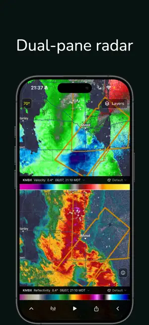
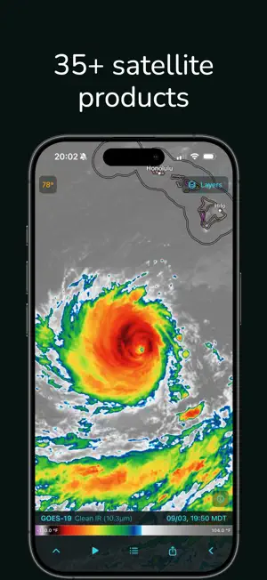
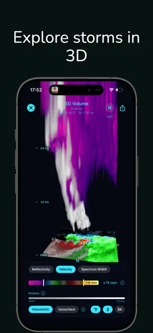
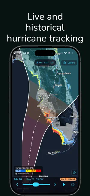
Track storms in real time with NEXRAD radar and GOES-19 satellite imagery. RADAR COVERAGE • 75+ radar products from 160+ NEXRAD sites including Level 2 and Level 3 reflectivity, velocity, dual-pol, precipitation type, and more • Hide weak radar values or highlight strong ones • National radar mosaic (MRMS): 20 products including precipitation type (rain/snow/ice), rotation, hail size and probability, echo tops, VIL, shear, and rainfall accumulation • Future radar: the MRMS loop continues 1 hour ahead with HRRR forecast frames every 15 minutes FORECASTS • Hourly forecasts 36 hours out: temperature, conditions, wind, and precipitation • 10-day forecasts with high/low temps, precipitation accumulation, and wind • NWS Area Forecast Discussions from your local forecast office (long-press any location) REAL-TIME WEATHER DATA • NWS severe weather alerts with polygon overlays and push notifications you customize per location • Storm Prediction Center (SPC) convective and fire weather outlooks • Flood outlooks: WPC Excessive Rainfall Outlook (Days 1-5) and NWS Significant River Flood Outlook • Live hurricane tracking: official NHC forecast cone, track, and position with Saffir-Simpson intensity and coastal watch and warning lines • NHC Tropical Weather Outlook: formation areas with 2-day and 7-day odds, disturbances and invests, and the outlook discussion • NHC bulletins: Public Advisory (TCP) and Forecast Discussion (TCD) • Real-time storm spotter positions from Spotter Network • Observations from thousands of weather stations • EPA AirNow air quality (AQI) with per-pollutant detail (PM2.5, ozone, PM10, NO2, SO2) and health guidance • Population density layer • Location search and saved favorites COMMUNITY WEATHER REPORTS • Submit observations and see reports from other users on the map • Precipitation type, hail size, severe weather, and more; flagging keeps data accurate ECHOES PREMIUM: $2.99/mo or $24.99/yr • LIVE Sweep: watch the radar paint the storm arc by arc as the antenna turns, on any Level 2 product, tilt, and NEXRAD radar • Historical radar data from 1991 to present • Dual Products: compare two radar products side by side on one synced map • Storm Cross-Section: draw a line across any storm to see a vertical slice, with updraft cores, hail above the freezing level, and the bright band • 3D Storm Volume: orbit a full 3D render of the radar volume, with echo tops, hail cores, a temperature axis, and wind barbs • Storm Attributes: cells, forecast tracks, MESO and TVS rotation, people in path, and a VAD wind profile from the selected radar • Tropical Guidance: multi-model spaghetti, forecast and past wind extents, and NHC wind speed probability, plus the 1851-to-present hurricane archive • Storm surge: NHC surge watches and warnings, peak surge heights, and flood depth at each advisory, with a crosshair depth readout • Real-time lightning strikes • 37 GOES-19 and GOES-18 satellite products across Pacific, CONUS, and Atlantic: visible, infrared, water vapor, sea surface temperature, fire, smoke, dust, and more • 12 weather models with contours, wind barbs, and pressure tracking: HRRR, NAM, NBM, RAP, RRFS, GFS, GEFS, AIGFS, AIGEFS, HGEFS, IFS, and AIFS • RTMA surface analysis: station plots and temp, dewpoint, and gust contours over radar • NWPS river gauges with flood-category coloring and hydrographs of observed and forecast stage • Air Quality Forecast: EPA AQI outlook up to 6 days out with Action Day (Spare-the-Air) alerts and the forecaster's discussion • Skew-T soundings with SARS supercell and hail analogs (forecast and observed) • Forecast plots: meteogram time series for any model variable • 28,000+ weather stations with 48-hour historical charts • Alert filtering with 13 categories and quick filters • Extended 52-frame animations • Future radar up to 18 hours ahead • Premium map styles • 7-day free trial on annual plan Terms of Use: https://echoeswx.com/terms Privacy Policy: https://echoeswx.com/privacy
Ratings & reviews
4.8
59 ratings
What’s new
Version 3.8.0 · Updated September 23, 2026
Population Density. A new Map Overlay in the side menu shows where people live. Peek. Tap the half-filled rectangle in the tools tray, then drag the line to clear the weather off one side of the map. Hide weak values and highlight strong ones. Drag from the left end of the color scale to hide values below that point. Drag from the right end to brighten values above it. Blocky or smooth mosaic. Choose Blocky or Smooth above the MRMS list on reflectivity and rainfall products. Settings has a new Tips and Tricks screen. The Tropical Weather Outlook no longer disappears after you change map styles. Plus bug fixes and stability improvements.
App privacy
The developer, Echoes Weather LLC, reported these privacy practices to Apple.
Data Not Linked to You
The following data, which may be collected but is not linked to your identity, may be used for the following purposes:
- Purchases: Purchase History
- Usage Data: Product Interaction
- Location: Precise Location
- Diagnostics: Crash Data, Performance Data
Used for: Analytics, App Functionality
Alternatives to Echoes Weather: Radar & Models
Looking for apps like Echoes Weather: Radar & Models? Here are 6 similar apps on the App Store. The highest rated is StormNet (4.9/5), and all 6 are free to download.
-
 Radar Pro X
4.8
Radar Pro X
4.8
-
 Xtreme Weather - Pro Radar
4.7
Xtreme Weather - Pro Radar
4.7
-
 StormNet
4.9
StormNet
4.9
-
 WeatherEye Live
4.9
WeatherEye Live
4.9
-
 Radar Pro
4.6
Radar Pro
4.6
-
 RadarCast: Live Weather Radar
4.8
RadarCast: Live Weather Radar
4.8
| App | Rating | Price | Last updated |
|---|---|---|---|
| Echoes Weather: Radar & Models | 4.8 / 5 (59 ratings) | Free | September 23, 2026 |
| Radar Pro X | 4.8 / 5 (113) | Free | Aug 3, 2026 |
| Xtreme Weather - Pro Radar | 4.7 / 5 (53) | Free | May 7, 2025 |
| StormNet | 4.9 / 5 (20) | Free | May 21, 2026 |
| WeatherEye Live | 4.9 / 5 (27) | Free | Aug 12, 2026 |
| Radar Pro | 4.6 / 5 (181) | Free | Mar 21, 2026 |
| RadarCast: Live Weather Radar | 4.8 / 5 (28) | Free | Sep 5, 2026 |