

Wbando: FPV Flight Planner
Nazarii Ovcharchyn Navigation iPhoneiPadiPod touch
Wbando: FPV Flight Planner is a free Navigation app for iPhone and iPad by Nazarii Ovcharchyn. Requires iOS 17.6. Updated September 7, 2026.
- Price
- Free
- on the App Store
- Size
- 94 MB
- Age 4+
- Updated
- Sep 7
- 2026 · v0.2.12
Screenshots

About Wbando: FPV Flight Planner
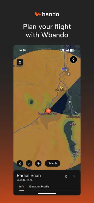
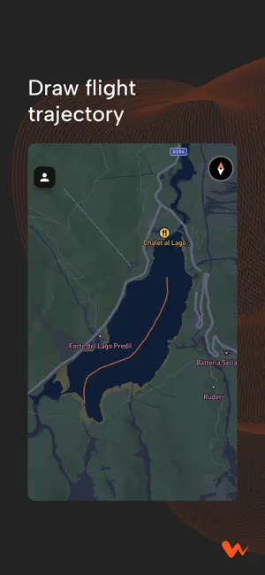
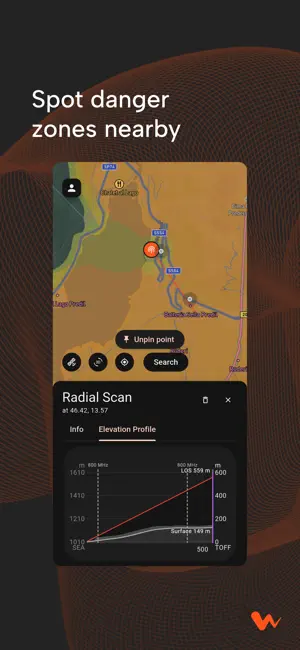
Every failsafe has a reason. Wbando is tactical flight intelligence for FPV pilots. Before you arm, it maps the invisible forces that cause failsafes — terrain shadows, tree-canopy attenuation, RF interference, and Fresnel-zone clearance — so you know where your link will hold and where it won't. IT STARTS WITH LINE OF SIGHT Your radio signal travels in a straight line — that's where the marketed range numbers come from. Clear line of sight means full control. But the world isn't flat. THEN THE TERRAIN GETS IN THE WAY Terrain casts a radio shadow — and what you can't see on a flat map can kill your link. Wbando scans global elevation data (30 m resolution, 195+ countries) to predict exactly where those shadows fall. EVEN TREES FIGHT AGAINST YOU Vegetation absorbs and scatters your signal with every meter of foliage. Wbando factors satellite-derived canopy height (10 m resolution) into every line-of-sight prediction — critical for flights over forested mountains. COMPETE WITH THE NOISE FLOOR The radio spectrum is crowded with emitters you can't see. Wbando maps thousands of cell towers, FM/AM and TV broadcast stations around your flight zone so you can plan around interference hotspots. VISUAL LINE OF SIGHT IS A LIE Radio waves travel in a thick elliptical volume — the Fresnel zone. If terrain clips it, your signal drops even when you can still see your drone. Wbando flags marginal zones before you find out mid-flight. WHAT YOU GET • Radial Scan — line-of-sight coverage around your take-off point, with elevation profiles showing exactly where terrain blocks your signal • TOFF — draw your flight trajectory and see what percentage of the path stays in coverage • RF emitter map — thousands of towers and broadcast stations around your spot • Saved spots — build a library of proven launch points • Works worldwide — 195+ countries, no local setup WHAT PILOTS SAY "Sometimes I want to fly behind a mountain, but it's hard to say how low I can go to not lose signal." — long-range pilot "It's a major task planning flights in the Swiss mountains. Often it's more of a feel than knowing how far I can push." — mountain cinematographer "It could actually prove invaluable to someone who's doing complex orchestrated flights." — drone connoisseur No account required — jump straight in as a guest and run your first scan in under a minute. Built for cinematic and long-range pilots who've already tasted a failsafe and never want another. Terms of Use: https://wbando.com/terms/terms.html Privacy Policy: https://wbando.com/privacy/privacy.html
What’s new
Version 0.2.12 · Updated September 7, 2026
Sign in with Apple and Google sign-in are now available. You can still use email or continue as a guest.
App privacy
The developer, Nazarii Ovcharchyn, reported these privacy practices to Apple.
Data Linked to You
The following data, which may be collected and linked to your identity, may be used for the following purposes:
- Purchases: Purchase History
- Identifiers: User ID
- Usage Data: Product Interaction
- Location: Precise Location
- Contact Info: Email Address
- Diagnostics: Crash Data
Used for: Analytics, App Functionality
Data Not Linked to You
The following data, which may be collected but is not linked to your identity, may be used for the following purposes:
- Identifiers: Device ID
Used for: Analytics
Alternatives to Wbando: FPV Flight Planner
Looking for apps like Wbando: FPV Flight Planner? Here are 6 similar apps on the App Store. The highest rated is Alpine Quest: Tactical GPS Pro (5.0/5), and all 6 are free to download.
-
 Terrain Elevation Profile
-
 Marine Radar: Ship Tracking
1.0
-
 Alpine Quest: Tactical GPS Pro
5.0
-
 HIA Qatar
4.2
-
 Military GPS Survival Kit
4.5
-
 AeroADSB
1.7
| App | Rating | Price | Last updated | Compare |
|---|---|---|---|---|
| Wbando: FPV Flight Planner | – | Free | September 7, 2026 | |
| Terrain Elevation Profile | – | Free | Jul 27, 2026 | Compare |
| Marine Radar: Ship Tracking | 1.0 / 5 (1) | Free | Oct 21, 2026 | Compare |
| Alpine Quest: Tactical GPS Pro | 5.0 / 5 (7) | Free | Oct 22, 2026 | Compare |
| HIA Qatar | 4.2 / 5 (31) | Free | May 24, 2026 | Compare |
| Military GPS Survival Kit | 4.5 / 5 (104) | Free | Sep 27, 2026 | Compare |
| AeroADSB | 1.7 / 5 (28) | Free | May 20, 2026 | Compare |