

Felt: Field App, Maps, GIS
Felt Utilities iPhoneiPadiPod touch
Felt: Field App, Maps, GIS is a free Utilities app for iPhone and iPad by Felt. Rated 5.0/5 from 5 ratings. Requires iOS 15.5. Updated October 14, 2026.
- Rating
- 5.0
- 5 ratings
- Price
- Free
- on the App Store
- Size
- 39 MB
- Age 4+
- Updated
- Oct 14
- 2026 · v1.3.2
Screenshots
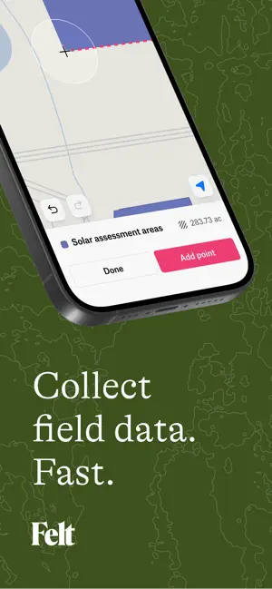


About Felt: Field App, Maps, GIS
Transform Field Work With Mobile GIS. Felt brings professional-grade GIS capabilities to your mobile device, empowering field teams to collect data, edit maps, and collaborate in real-time—no matter where the job takes you. Whether you're conducting site surveys, managing assets, or coordinating field operations, Felt puts the full power of spatial data in your pocket. Designed for Teams Who Work Outside. Built on Felt's industry-leading browser-based mapping platform, our mobile app extends the same intuitive, powerful experience to fieldwork. From construction sites to conservation areas, utility inspections to urban planning surveys, Felt makes complex GIS workflows simple and accessible for everyone on your team. Powerful Field Data Collection. • Custom Forms & Surveys: Create forms to capture exactly the information you need with structured geometry and attributes • Direct Map Editing: Add points, lines, and polygons directly on the map as you move through the field • Geotagged Photos with GPS Accuracy: Attach images that automatically place at the correct map location to document site conditions, capture evidence, or record progress • Precision Measurements: Measure distances, areas, and perimeters with accuracy while on-site Professional GIS Tools. • Annotations & Styling: Create notes, highlight important features, and customize map elements with colors, icons, and labels • Comprehensive Legend: Access all your field data at your fingertips with full GIS power • Intuitive Interface: Every interaction is designed to be smooth and responsive, even in challenging field conditions Real-Time Collaboration. • Instant Sharing: Share maps immediately with team members in the field or back at the office • Commenting: Leave feedback directly on map features to keep everyone aligned • Automatic Syncing: Changes sync in real-time so your entire team works from the same up-to-date information • No Version Conflicts: Say goodbye to outdated field sheets and version confusion Enterprise Power, Consumer Simplicity. Felt handles spreadsheets, cloud data sources, and terabytes of spatial information with ease. Our browser-based architecture delivers enterprise field data collection software capabilities without enterprise complexity. Field data integrates seamlessly with desktop workflows, creating a unified system for your entire organization. From Field to Dashboard. Data collected in the field flows directly into Felt's platform where you can build maps, apps, and dashboards that drive business decisions. Transform raw field observations into actionable insights and share results through beautiful, interactive maps that anyone can understand. Works On All Your Devices. Felt adapts to the phones and tablets your team already uses. The interface remains clear and responsive whether you're wearing gloves, dealing with bright sunlight, or working in tight spaces. Join The Innovation. Felt reimagines mobile data capture from the ground up. We put design and user experience at the center of everything we build, creating data collection tools that teams actually love to use. Get Started Today. Download Felt and experience the future of mobile GIS. Sign up for free and see how easy it is to collect field data, create professional maps, and collaborate with your team—all from your mobile device. Whether you're working on your first survey or your thousandth, Felt makes field data collectionsimple, powerful, and delightful.
Ratings & reviews
5.0
5 ratings
What’s new
Version 1.3.2 · Updated October 14, 2026
Improved in-app camera controls
App privacy
The developer, Felt, reported these privacy practices to Apple.
Data Linked to You
The following data, which may be collected and linked to your identity, may be used for the following purposes:
- Contact Info: Name, Email Address
- Search History: Search History
- Identifiers: User ID
- Diagnostics: Crash Data, Performance Data, Other Diagnostic Data
- User Content: Photos or Videos
Used for: Analytics, App Functionality
Data Not Linked to You
The following data, which may be collected but is not linked to your identity, may be used for the following purposes:
- Identifiers: Device ID
- Usage Data: Product Interaction
- Location: Precise Location, Coarse Location
Used for: Analytics, App Functionality
Alternatives to Felt: Field App, Maps, GIS
Looking for apps like Felt: Field App, Maps, GIS? Here are 6 similar apps on the App Store. The highest rated is OneSoil Scouting: Farming Tool (4.8/5), and all 6 are free to download.
-
 Area Measure & GIS GPS GMapper
4.5
-
 PIX4Dcatch: 3D scanner
4.7
-
 Emlid Flow
3.9
-
 Mapbox Studio Preview
3.6
-
 ArcGIS QuickCapture
4.3
-
 OneSoil Scouting: Farming Tool
4.8
| App | Rating | Price | Last updated | Compare |
|---|---|---|---|---|
| Felt: Field App, Maps, GIS | 5.0 / 5 (5 ratings) | Free | October 14, 2026 | |
| Area Measure & GIS GPS GMapper | 4.5 / 5 (10) | Free | Apr 8, 2026 | Compare |
| PIX4Dcatch: 3D scanner | 4.7 / 5 (266) | Free | Oct 7, 2026 | Compare |
| Emlid Flow | 3.9 / 5 (36) | Free | Oct 21, 2026 | Compare |
| Mapbox Studio Preview | 3.6 / 5 (32) | Free | Oct 16, 2026 | Compare |
| ArcGIS QuickCapture | 4.3 / 5 (35) | Free | Apr 21, 2026 | Compare |
| OneSoil Scouting: Farming Tool | 4.8 / 5 (142) | Free | Oct 19, 2026 | Compare |