

Topomapviewer
NGI-IGN National Geograhical Institute of Belgium Navigation iPhoneiPadiPod touch
Topomapviewer is a free Navigation app for iPhone and iPad by NGI-IGN National Geograhical Institute of Belgium. Requires iOS 15.0. Updated July 24, 2026.
- Price
- Free
- on the App Store
- Size
- 78 MB
- Age 4+
- Updated
- Jul 24
- 2026 · v1.0.10
Screenshots

About Topomapviewer
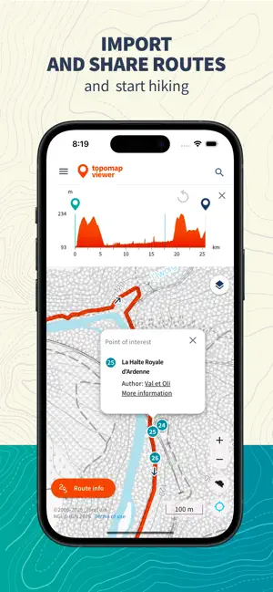
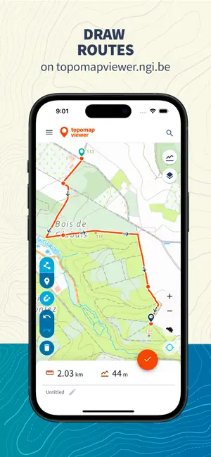
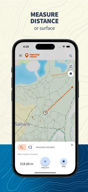
The Topomapviewer is an application that allows you to view the standard topographic maps and aerial photographs of the National Geographic Institute of Belgium. Measure distances, print a pdf version, send comments about mistakes on the map. Import and share gpx trails and discover our beautiful country.
What’s new
Version 1.0.10 · Updated July 24, 2026
New preview video.
App privacy
The developer, NGI-IGN National Geograhical Institute of Belgium, reported these privacy practices to Apple.
Data Linked to You
The following data, which may be collected and linked to your identity, may be used for the following purposes:
- Contact Info: Email Address
Used for: App Functionality
Data Not Linked to You
The following data, which may be collected but is not linked to your identity, may be used for the following purposes:
- Location: Precise Location, Coarse Location
- Contact Info: Name
Used for: App Functionality
Alternatives to Topomapviewer
Looking for apps like Topomapviewer? Here are 6 similar apps on the App Store.
-
 MyMove - Flexible Mobility
-
 SNCB Lab
-
 Fais Tes Balises
-
 Welcome To My Garden
-
 Zuiderhuis Fiets & Wandel
-
 Proride
| App | Rating | Price | Last updated | Compare |
|---|---|---|---|---|
| Topomapviewer | – | Free | July 24, 2026 | |
| MyMove - Flexible Mobility | – | Free | Aug 19, 2026 | Compare |
| SNCB Lab | – | Free | Mar 11, 2026 | Compare |
| Fais Tes Balises | – | Free | Apr 14, 2026 | Compare |
| Welcome To My Garden | – | Free | Jul 8, 2026 | Compare |
| Zuiderhuis Fiets & Wandel | – | Free | Jun 7, 2026 | Compare |
| Proride | – | Free | Jun 28, 2026 | Compare |
Compare Topomapviewer with the top alternatives: ratings, updates, ASO score and keyword gaps →