

PatrolView
Frontline Policing Navigation iPhoneiPadiPod touch
PatrolView is a free Navigation app for iPhone and iPad by Frontline Policing. Requires iOS 18.5. Updated September 19, 2025.
- Price
- Free
- on the App Store
- Size
- 15 MB
- Age 4+
- Updated
- Sep 19
- 2025 · v1.1
Screenshots


About PatrolView
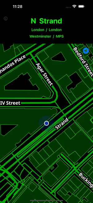
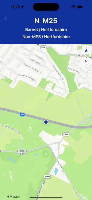
PatrolView - UK Police Information Display Heads-Up Display (HUD) and Map provide frontline officers with key information about their current location and travel. The screen displays live road names, heading, speed and information about your Town/City. It is particularly useful for Single-Crewed Officers, Pan-Force teams (Dogs, Traffic Firearms) who may cross divisional boundaries and operators delivering commentary during a pursuit. Knowing where you are, what sector you are in, and therefore what channel switch to, is key in ensuring operational safety for frontline officers by getting assistance quicker when needed. Helpfully highlights: - Vehicle Speed - Current Road Name & Heading - Police Force Area - Map overview with enlarged names - Multiple Map & Display Themes - Day/Night Usage PatrolView uses a custom GeoCoding service, to display which force area and division you are currently in. It is currently programmed for the following force areas: - Metropolitan Police - City of London Police To add additional force divisional areas, contact [email protected] to have these added to the benefit of all users. **PREMIUM VERSION** Pay a small monthly subscription to remove adverts and have access to additional premium day/night coloured themes. - No Adverts - Custom Map Themes All adverts and subscriptions assist in the running costs for PatrolView services. Premium Terms of Use: https://frontlinepolicing.com/patrolview/premium/
What’s new
Version 1.1 · Updated September 19, 2025
Added Premium Subscriptions
App privacy
The developer, Frontline Policing, reported these privacy practices to Apple.
Data Used to Track You
The following data may be used to track you across apps and websites owned by other companies:
- Location: Coarse Location
- Identifiers: Device ID
- Usage Data: Product Interaction, Advertising Data
- Diagnostics: Crash Data, Performance Data
Data Linked to You
The following data, which may be collected and linked to your identity, may be used for the following purposes:
- Location: Coarse Location
- Identifiers: Device ID
- Usage Data: Product Interaction, Advertising Data
- Diagnostics: Performance Data
Used for: Third-Party Advertising, Analytics
Data Not Linked to You
The following data, which may be collected but is not linked to your identity, may be used for the following purposes:
- Diagnostics: Crash Data
- Location: Precise Location
Used for: Third-Party Advertising, Analytics, App Functionality
Alternatives to PatrolView
Looking for apps like PatrolView? Here are 6 similar apps on the App Store. The highest rated is Blue Light Maps (5.0/5), and 5 of the 6 are free to download.
-
 Blue Light Maps
5.0
-
 What Road?
4.0
-
 Current Road
-
 SpotPilot
-
 Misper: Find people in crisis
-
 Network World Travel
| App | Rating | Price | Last updated | Compare |
|---|---|---|---|---|
| PatrolView | – | Free | September 19, 2025 | |
| Blue Light Maps | 5.0 / 5 (1) | Free | Oct 7, 2026 | Compare |
| What Road? | 4.0 / 5 (1) | Free | Mar 25, 2024 | Compare |
| Current Road | – | 1.99 USD | Nov 23, 2024 | Compare |
| SpotPilot | – | Free | Oct 9, 2026 | Compare |
| Misper: Find people in crisis | – | Free | Dec 22, 2025 | Compare |
| Network World Travel | – | Free | Nov 20, 2025 | Compare |
Compare PatrolView with the top alternatives: ratings, updates, ASO score and keyword gaps →