

Gargoyle Sentinel
Gargoyle Systems Utilities iPhoneiPadiPod touch
Gargoyle Sentinel is a free Utilities app for iPhone and iPad by Gargoyle Systems. Rated 5.0/5 from 1 ratings. Requires iOS 15.5. Updated October 22, 2026.
- Rating
- 5.0
- 1 ratings
- Price
- Free
- on the App Store
- Size
- 112 MB
- Age 4+
- Updated
- Oct 22
- 2026 · v1.3.1+20
Screenshots


About Gargoyle Sentinel
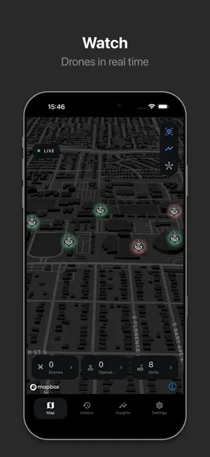
Sentinel by Gargoyle Systems is your window into the low-altitude skies. Built for homeowners, enterprises, and security providers, Sentinel connects to the Gargoyle rooftop node network to deliver real-time insights, alerts, and data on drone activity in your area. Features: • Live Drone Detection: See drone activity around your location in real time. • Smart Notifications: Get alerts when drones enter your monitored airspace. • Interactive Map: View coverage zones and nearby Gargoyle nodes. • Decentralized Network: Powered by Gargoyle’s rooftop hardware and blockchain incentives, providing privacy-first, community-driven coverage. • Secure Data Layer: Monitor not just threats, but also emerging aerial infrastructure like deliveries and autonomous flight paths. With Sentinel, you’re not just observing the skies you’re helping build the next layer of infrastructure for secure, scalable, and autonomous air travel.
What’s new
Version 1.3.1+20 · Updated October 22, 2026
What's New in 1.3.1 New: Insights A new tab shows what has been flying around your units, up to four months back. See which drones appeared most and where, busiest days and hours, flight time, new versus returning drones, and a heatmap of hot spots. Switch the map between where drones flew, how high, where pilots stood, and how busy each sensor was. 3D Map The New 3D map now places drones at the right height. Better flight replay A cleaner playback bar with the drone's model, height, speed, signal strength and pilot location for every moment of the flight. Clearer alerts Notifications now name the drone and show its height, the sensor that heard it, and whether the pilot's location is known. Tapping an alert opens the live map for a drone still in the air, or the replay of that flight once it has ended. Polish and speed A refreshed dark design, a roomier navigation bar, and faster History loading. Choose American or metric units in Settings. Security and sign-in protections have been strengthened.
App privacy
The developer, Gargoyle Systems, reported these privacy practices to Apple.
Data Linked to You
The following data, which may be collected and linked to your identity, may be used for the following purposes:
- Contact Info: Email Address, Physical Address, Name, Phone Number, Other User Contact Info
- Location: Precise Location, Coarse Location
- User Content: Photos or Videos
Used for: Developer’s Advertising or Marketing, Analytics, Product Personalization, App Functionality