

eOceanic
eOceanic Limited Navigation iPhoneiPadiPod touch
eOceanic is a free Navigation app for iPhone and iPad by eOceanic Limited. Requires iOS 13.0. Updated September 28, 2026.
- Price
- Free
- on the App Store
- Size
- 83 MB
- Age 4+
- Updated
- Sep 28
- 2026 · v1.2.1
Screenshots

About eOceanic
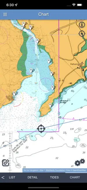
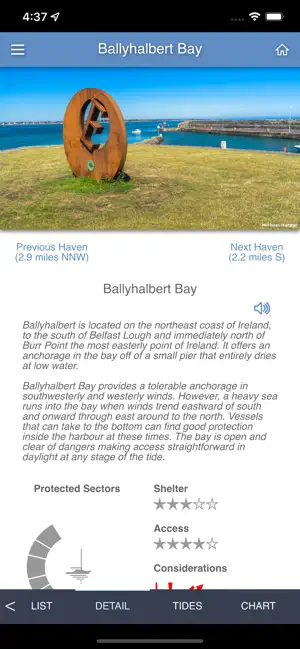
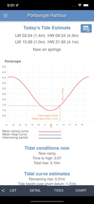
At eOceanic we are passionate about boating and it is our mission to provide empowerment at sea along the English and Irish coasts, as there has never been before. We fulfil this mission by creating two sister products: The web site, eOceanic.com, and the eOceanic application system. eOceanic.com is the finest seagoing intelligence platform for England and Ireland and is available to all, for free, for the common good. The eOceanic application system is a comprehensive seagoing application that allows all of the site information, as well as charting and tidal data, to be downloaded and used offline entirely independent of the site. There is no need for a network connection anymore, you have everything you need in the palm of your hand, on your smartphone, tablet or PC, or a range of all combined so that you have ample backup capabilities. eOceanic was built from the ground up just to serve you, right where you are, in real-time and to be so effective and efficient that it is a joy to use. With eOceanic, you will find the best decisions afloat are simple to see as all the options and data points are right at the tips of your fingers. * One swipe for tides * One swipe and touch to discover all the havens around you * One swipe and touch to see all the routes and coastal cuts immediately available to you * One swipe and a few more touches if you need to look for something specific. Then its extensive resource search feature will show you where you can get exactly what you want around you. When you know what you want to do, the application’s name says it all, just touch the ‘Go’ button or an object or waypoint and you are aided on your way by the finest raster charts available. Raster charts that feature, for the first time, a single plane view of the British Isles, with seamless scaling and full ‘touch to zoom’ functionality. When you are on your way, the application will be working behind the scenes to help you have a positive, enjoyable and safe experience. By maintaining a list of outlying hazards, such as rocks, shoals, and shallows, it will make you aware as you approach any of these listed dangers. Likewise, if there is something that concerns you in your area that we have not listed yet, just let us know and we will be delighted to add it to eOceanic.com for the benefit of all and synchronised to your device. Even with the utmost care, it is fair to say even the best of us slip up from time to time, and should that happen you have the assurance of a Man-Over-Board (MOB) function sitting centrally on the chart screen all the time. Once touched it immediately switches to guiding you back to the event location and automatically logs the key data points required by the rescue services should you require their assistance. eOceanic's logging capability is not just for a MOB situation, it provides a comprehensive means of keeping track of progress and events aboard. And, should you have the benefit of a network connection and wish to share your progress with friends or family, you can share your real-time track and logs on a personal eOceanic.com map page. Alternatively, if you want to fix something, find a better way of doing things or just make life a bit more comfortable aboard, you have an immediate repository of ‘Experience’ to call upon to handle situations with inspiration and confidence. All of this is just the start. It is because we are passionate about boating, the people who need to go to sea, the power of technological innovation and our mission to provide empowerment at sea, that ‘eOceanic will revolutionise your capability afloat. Welcome to the revolution, we know you are going to like it. Please note, that whilst we provide information for free via eOceanic.com, a subscription is required to make use of the eOceanic app and the advanced navigation tools it provides.
What’s new
Version 1.2.1 · Updated September 28, 2026
* Fixes freeze on charts for certain iOS devices
App privacy
The developer, eOceanic Limited, reported these privacy practices to Apple.
Data Linked to You
The following data, which may be collected and linked to your identity, may be used for the following purposes:
- Location: Precise Location, Coarse Location
- Contact Info: Email Address, Name
- Identifiers: User ID
Used for: App Functionality
Alternatives to eOceanic
Looking for apps like eOceanic? Here are 6 similar apps on the App Store. The highest rated is iStreams Lands End (2.0/5), and all 6 are free to download.
-
 iStreams Irish Sea
-
 iStreams Solent
-
 iStreams Lands End
2.0
-
 iStreams English Channel
-
 iStreams West Country
-
 iStreams Channel Islands
| App | Rating | Price | Last updated | Compare |
|---|---|---|---|---|
| eOceanic | – | Free | September 28, 2026 | |
| iStreams Irish Sea | – | Free | Aug 11, 2026 | Compare |
| iStreams Solent | – | Free | Aug 21, 2026 | Compare |
| iStreams Lands End | 2.0 / 5 (1) | Free | Jul 28, 2026 | Compare |
| iStreams English Channel | – | Free | Aug 17, 2026 | Compare |
| iStreams West Country | – | Free | Aug 6, 2026 | Compare |
| iStreams Channel Islands | – | Free | Jul 25, 2026 | Compare |
Compare eOceanic with the top alternatives: ratings, updates, ASO score and keyword gaps →